Directions
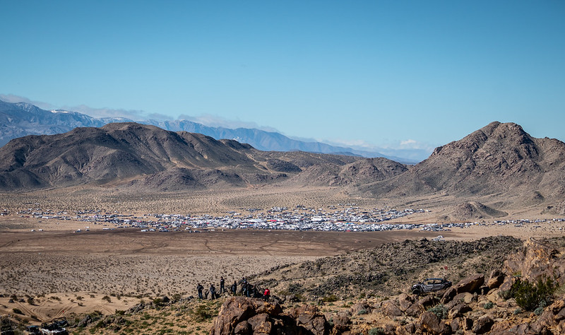
The riding area can be entered from Highway 247 at Old Woman Springs Road or Camp Rock Road, 55 miles southeast of Barstow. Most visitors access the area off Camp Rock Road by driving north off of Highway 247. Staging for many competitive events is at Anderson Dry Lake, 10 miles north of Highway 247 and east of Camp Rock Road. These are graded dirt roads.
Phone
760-252-6000
Activities
AUTO TOURING, BIKING, CAMPING, HIKING, HORSEBACK RIDING, HUNTING, RECREATIONAL VEHICLES, WILDLIFE VIEWING, PHOTOGRAPHY
Camping Reservations
Reserve your campsite at these camping areas:
Hiking Trails
Looking for nice hiking areas to take a hike? Choose from these scenic hiking trails:
Related Link(s)
More California Recreation Areas
Johnson Valley OHV area is temporarly closed for the 2020 King of the Hammers. See more details and a map here.
Overview

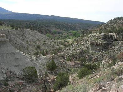
Vegetation consists of creosote scrub, annual grasses, wild flowers and Joshua Trees. Johnson Valley offers a riding opportunity for every skill level.
Know Before You Go
- Out of State Vehicles: OHV users must comply with all California rules and regulations governing Off-Highway vehicles. Please see below for a partial list of key regulation and visit the California OHV Page for more information.
- Weather: The area is hot and arid, with summer high temperatures ranging from 100 to 120 degrees F. Winter low temperatures may drop below freezing with highs in the 70’s. Typical of the desert, winds are frequent and strong, and humidity is generally low.
Off-Highway Vehicle Use
The southeast portion of the riding area offers a large mass of hills known to the rock crawler world wide as the Hammers. This area is for experts and has gained the attention of off-roaders in recent years through an event called King of the Hammers, experts only need apply. North of the Hammers offers a quality riding experience for novice and intermediate riders and some small dune riding experience.

The 96,000 acre off“highway vehicle riding area has something for every rider at every skill level. Approximately 53,000 acres of Johnson Valley is a shared-use area with the Marine Corps Air Ground Combat Center (MGAGCC) located in Twentynine Palms, CA.
The following partial list of regulations and tips should help OHV users and other recreationists appreciate and enjoy the use of these public lands.
- ATV riders must wear protective helmets.
- Observe posted signs. Fenced areas mark sensitive wildlife and plant habitat, and are “closed” to vehicle use. The “open” riding areas are also posted and those on foot should be aware of their locations.
- All vehicles must be registered or permitted to operate in the State of California and a green sticker or license plate clearly displayed.
- Maximum speed for OHVs is 15 MPH within 50 feet of a campsite (?), animal, or pedestrian.
- OHVs must be equipped with an approved muffler and spark arrester.
- Flags are required on all OHV’s in this recreation area for visibility and safety.
- Please respect private property.


