MOUNTAIN PARK, CO Campground Reservation, Info, Images, Map, Directions

MOUNTAIN PARK, Colorado Campground Images, Info & Reservations

Directions

From Fort Collins, travel west on Colorado Highway 14, to Ted’s Place, and continue up the Poudre Canyon to mile marker 98.8.

Phone

970-295-6700

Activities

BIKING, BOATING, CAMPING, FISHING, HIKING, WATER SPORTS, WILDLIFE VIEWING, BIRDING, RAFTING, WHITEWATER RAFTING

Keywords

MOUT,POUDRE RIVER,CACHE LA POUDRE RIVER,ARAPAHO AND ROOSEVELT NF – FS

Related Link(s)

Rec Area Info & Images

Colorado State Road Conditions

Colorado State Tourism

Forest Service Concessionaire

Overview

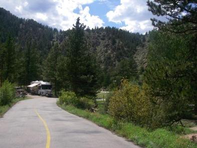
Mountain Park Campground is located on the Cache la Poudre River, 40 miles northwest of Fort Collins, Colo., along Highway 14. Visitors enjoy the area for its great rafting, fishing and hiking opportunities.

Recreation

The Cache La Poudre River offers whitewater rafting and fishing. Anglers cast for brown, cutthroat and rainbow trout.

Hiking, biking and horseback riding trails are in the surrounding area, including the Mt. McConnel Trail, William R. Kreutzer National Recreation Trail and Young Gulch Trail.

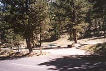
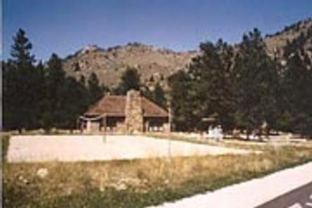
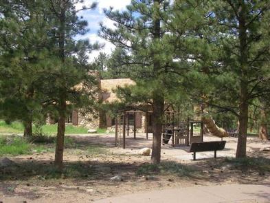
Volleyball and basketball courts, a playground and horseshoe pits are located in the campground. Other popular activities include birding and wildlife viewing.

Facilities

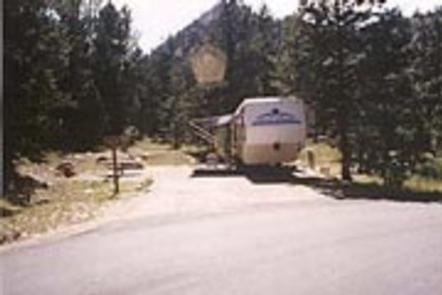
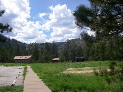
The campground offers accessible single- and double-family sites, and a group site that can accommodate up to 75 people. Sites 1 through 32 have electric hookups. Sites 33 through 54 do not have hookups.

Picnic tables, 12×15′ tent pads, campfire rings and grills are provided, as are vault toilets and drinking water. Coin showers are located on-site. Dead and downed firewood may be gathered in the forest or purchased from the host.

Natural Features

The canyon’s vegetation varies from dense forests to open meadows, surrounded by steep mountains. A forest of ponderosa pine trees covers the campground, which is situated on the banks of the Cache la Poudre River, Colorado’s first National Wild and Scenic River.

Reservation

More from CampingHiking.net:

ANTELOPE FLAT, Utah Campground Images, Info & Reservations

Directions From Vernal, Utah, take U.S. 191 north for 54 miles to Dutch John. Continue north for 8 miles, then turn west onto Forest Road 145 and travel 4 miles to the campground. From Manila, Utah, take Highway 44 for 28 miles. Turn left on U.S. 191 and go north

ALPINE RIDGE, Arkansas Campground Images, Info & Reservations

Directions From Interstate 30, take exit 73 and merge onto State Highway 8 west for 19 miles. Turn right on Fendley Road and continue 8.5 miles to the campground. Phone 870-246-5501 Activities BOATING, CAMPING, FISHING, SWIMMING SITE Keywords ALPR,DEGRAY LAKE,ALPINE,DEGRAY LAKE Related Link(s) Rec Area Info & Images Arkansas State

COVE CREEK, Oregon Campground Images, Info & Reservations

Directions From Detroit, Oregon, travel east on State Highway 22 for 2.7 miles to Blowout Road/Forest Service Road 10. From Idanha, Oregon, travel west on State Highway 22 for 0.7 miles to Blowout Road/Forest Service Road 10. Proceed on Blowout Road 3.6 miles to Cove Creek Campground on the right.

KAIBAB LAKE SITES AND GROUP AREAS, Arizona Campground Images, Info & Reservations

Directions From Williams, Arizona, take I-40 east to exit 165. Turn north onto State Highway 64 toward Grand Canyon and go a mile to the campground entrance on the left. Phone 928-699-1239 Activities BOATING, CAMPING, INTERPRETIVE PROGRAMS, FISHING, HIKING, HORSEBACK RIDING, WILDLIFE VIEWING, DAY USE AREA Keywords KAIB,Kaibab Picnic Area,Kaibab

FLETCHER VIEW, Nevada Campground Images, Info & Reservations

Directions From Las Vegas, Nevada, travel north on Highway 95 to the junction with Highway 157/Kyle Canyon. Turn left and travel approximately 18 miles; campground is on the left side of the highway. Phone 702-872-5486 Activities BIKING, CAMPING, HIKING, WILDLIFE VIEWING Keywords FLET,MOUNT CHARLESTON,LAS VEGAS,SRING MTNS NATIONAL REC AREA,HUMBOLDT-TOIYABE NF-FS