
Directions
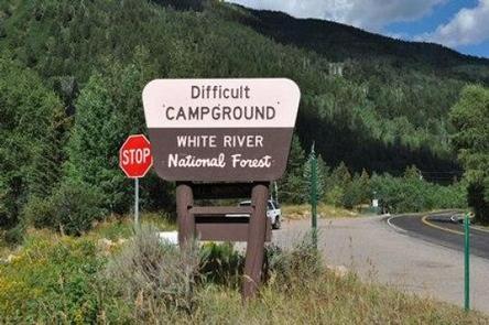
Take Highway 82 for 5 miles southeast of Aspen, Colorado. Look for USFS Difficult Campground sign on the right, past Mile Marker 45.
Phone
970-927-0107
Activities
CAMPING, FISHING, HIKING, WILDLIFE VIEWING
Keywords
DIFF,ASPEN COLORADO,INDEPENDENCE PASS,DIFFICULT CAMPGROUND GRP SIT,WHITE RIVER NF -FS
Related Link(s)
Colorado State Road Conditions
Overview
Located 5 miles southeast of Aspen, Colorado, Difficult Campground sits on the banks of the Roaring Fork River on the western slope of the Colorado Rockies.
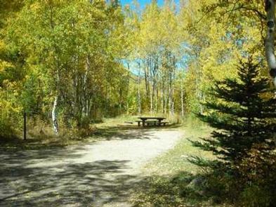
Campsites are nestled in a mixed forest of aspen, cottonwood, pine, fir, scrub oak, and spruce, and several are at the river’s edge, offering an ideal setting for guests seeking recreation and relaxation.
Recreation
Renowned for its fly fishing, the Roaring Fork River sustains populations of large rainbow, brown, cutthroat and brook trout. The nearby peaks and soothing sounds from the river offer anglers a perfect backdrop for an afternoon of fishing.
Whitewater adventure seekers may want to raft portions of the Roaring Fork, as it is navigable by small craft throughout most of its length to its confluence with the Colorado.
Hikers can access trails near the campground.
Facilities
Difficult Campground has 47 standard sites, including a group site.
It is important to note that vehicles over 35 feet in length are prohibited over Independence Pass but can access the campground via Aspen.
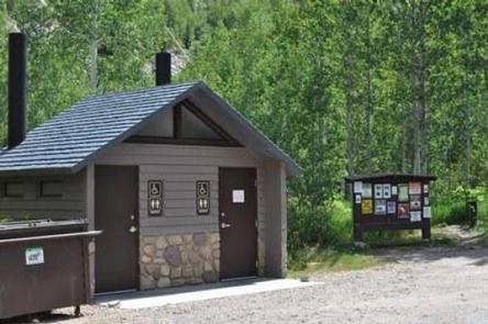
The campground is equipped with picnic tables, campfire rings, vault toilets, and drinking water. Electrical hook-ups are not available. Firewood is available for sale at the site.
Campground radius turns are tight for large RVs, and brush encroaches on roadways and spurs.
Natural Features
In the heart of the Rocky Mountains, the 2.3 million acre White River National Forest is a place of serenity and adventure, boasting 8 wilderness areas, 4 defined seasons, and 10 peaks surpassing 14,000 feet in elevation.
Wildlife in the area abounds. Bighorn sheep navigate rocky ridges and bull elk bugle at dusk. Scenic rivers sustain populations of cutthroat, rainbow, and brown trout. Alpine regions provide habitat for pika and ptarmigan. These species, along with many others, depend on surrounding undeveloped wilderness, clean streams, and diverse forests to live.
The Roaring Fork River flows by the campground, a tributary of the mighty Colorado. Deep, swift and clear, the Roaring Fork rises in the Sawatch Range on the west side of the Continental Divide and drains an area of the Colorado Western Slope called the Roaring Fork Valley.
Nearby Attractions
The nearby town of Aspen is a popular destination for visitors to the area. From downhill skiing and world-class fly fishing, to dining and resorts, there is a multitude of outdoor and indoor opportunites in this mountain town.