UPPER FIR GROUP AREA, NM Campground Reservation, Info, Images, Map, Directions

UPPER FIR GROUP AREA, New Mexico Campground Images, Info & Reservations

Directions

From Alamogordo, take US 82 east 17 miles through Cloudcroft. Turn left onto NM 244 towards Ruidoso and go 1/2 mile. Upper Fir Group Area is on Forest Road 422 at the end of the road.

Phone

575-682-7570

Activities

CAMPING

Keywords

FIRG,LINCOLN NF – FS

Related Link(s)

Rec Area Info & Images

Forest Service Concessionaire

New Mexico State Tourism

New Mexico State Road Conditions

Overview

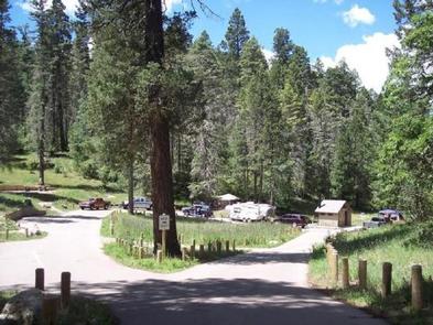
Upper Fir Group Area is one of the most popular campsites in the Sacramento Mountain area. Unique to its neighboring campgrounds, it’s set far back from public roads, allowing for true peace and quiet.

The campground is on the northwestern portion of the Lincoln National Forest, a protected area spanning an incredible 1.1 million acres of land. Spend your days exploring the mountains, or head west for a day trip to explore White Sands National Monument, the world’s largest dune field of pure, white gypsum sand.

Recreation

An open meadow, perfect for sports like ultimate Frisbee or horseshoes, is connected to the campground. The Rim Trail is a short hike or drive away, offering epic views, rocky inclines, and switchbacks for adventurous mountain bikers, hikers, and horse-back riders. Further down, the same trail opens up to motorcyclists as well.

Facilities

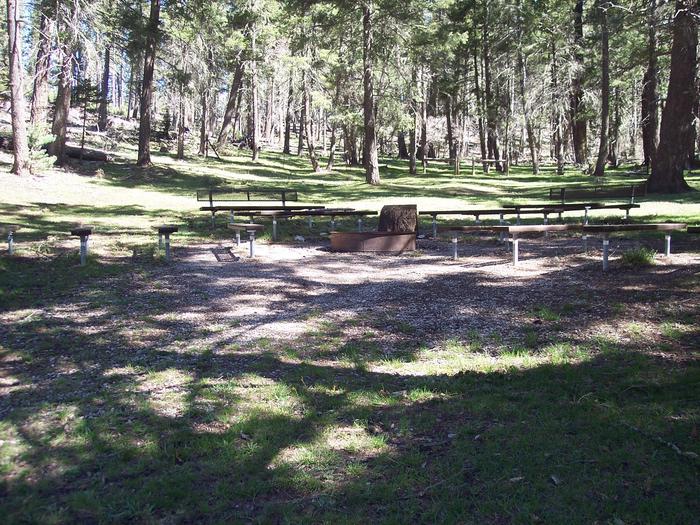
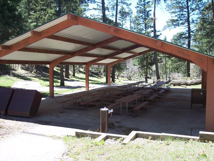
This is one of the only group sites with water access. Upper Fir comfortably fits groups as large as 120, and it’s connected to Lower Fir Group if your party has a need for an additional group of up to 70 campers.

Natural Features

Set 9,000 feet above sea level in the Sacramento Mountains, Upper Fir Group Area is close to breathtaking scenic overlooks, spanning the far-reaching desert valley of the Tularosa Basin. The high-elevation region offers a mixture of pine, fir, aspen, and oak trees, with high mountain meadows full of wildflowers and blossoming plants.

Nearby Attractions

The campground is a mile from the town of Cloudcroft, a quaint tourist village with New Mexico’s only standing railroad trestle.

Reservation

More from CampingHiking.net:

MEEKS BAY, California Campground Images, Info & Reservations

Directions Meeks Bay Campground is located 10 miles south of Tahoe City, on California Highway 89. Phone 530-525-4733 Activities BIKING, BOATING, CAMPING, INTERPRETIVE PROGRAMS, VISITOR CENTER, SWIMMING SITE Keywords MEEK,WEST SHORE,LAKE TAHOE,RUBICON,WEST SHORE LAKE TAHOE,LAKE TAHOE BASIN – FS Related Link(s) Rec Area Info & Images California State Road Conditions

COAL MINE, New Mexico Campground Images, Info & Reservations

Directions From Grants, take New Mexico State Highway 547 for 10 miles to the campground. Phone 505-287-8833 Activities CAMPING, HIKING, SCENIC DRIVE Keywords COAM,CIBOLA NF – FS Related Link(s) Rec Area Info & Images New Mexico State Tourism New Mexico State Road Conditions Overview Coal Mine Campground is situated in

CAMP HALE EAST FORK GROUP, Colorado Campground Images, Info & Reservations

Directions From I-70, take exit 171 toward Minturn. Turn south on Highway 24 and continue for approximately 19 miles, just beyond Camp Hale Memorial Site. Turn onto Old Highway East and follow for 2 miles to the campground. Phone 970-468-7681 Activities CAMPING, FISHING, HIKING, WILDLIFE VIEWING Keywords EAF1,WHITE RIVER NF

BEARD’S BLUFF PARK (AR), Arkansas Campground Images, Info & Reservations

Directions Beard’s Bluff Park is located 13 miles east of Ashdown on State Highway 32. When driving from Ashdown, cross Millwood Dam and take the second left. Phone 870-388-9556 Activities BOATING, CAMPING, FISHING, WILDLIFE VIEWING Keywords Related Link(s) Rec Area Info & Images Arkansas State Tourism Arkansas State Road Conditions

BAILEYS POINT, Kentucky Campground Images, Info & Reservations

Directions From Glasgow, KY: Take 31-E south for 15 mi to Hwy 252. Turn right, go 1.5 mi to Hwy 517, turn right and follow signs to entrance. Approximately 19 miles southwest of Glasgow, KY. Phone 270-622-6959 Activities CAMPING, HIKING, DAY USE AREA, SWIMMING SITE Keywords BAIP,BARREN RIVER LAKE Related

LAKELAND PAVILION, Texas Campground Images, Info & Reservations

Directions While traveling East on US Highway 380, turn right (South) on State Highway 78 at Farmersville. Go South about 4 miles to CR 550. Turn right on CR 550 and continue about 2 miles to the entrance of the park. The pavilion is inside Lakeland Park. Phone 972-442-3141 Activities