
Directions
From Pinedale, take U.S. Highway 191 northwest 6 miles. Turn north onto State Highway 352 and travel just over 14 miles. Turn east onto New Fork Lake Road, which is gravel, and travel almost 4 miles to the campground.
Phone
307-367-4326
Activities
BIKING, BOATING, CAMPING, FISHING, HIKING, WILDLIFE VIEWING, SWIMMING SITE
Keywords
NEWF,BRIDGER-TETON NF – FS
Related Link(s)
Overview
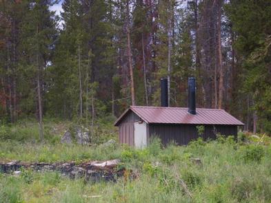
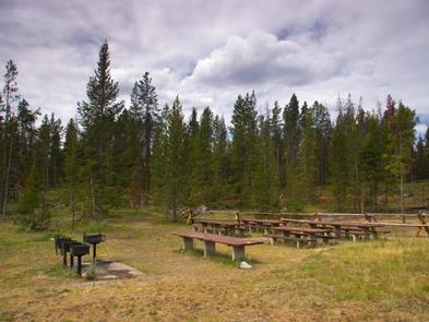
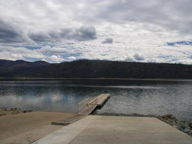
Located just 24 miles north of Pinedale, New Fork Group Campground includes large picnic tables, BBQ stands, a fire ring, and a double vault toilet for your large party needs. Just a short hike away is New Fork Lake, which offers great boating, canoeing and swimming. Anglers fish for kokanee salmon, brook, lake and rainbow trout. A boat ramp is located approximately one mile from the group site. There is no drinking water available and proper food storage is required.
Recreation
The 1,070-acre New Fork Lake offers great boating, canoeing and swimming. Anglers fish for kokanee salmon and brook, lake and rainbow trout. A large cement boat ramp is located a mile and a half from the campground, at the lake’s northwestern shore.
New Fork Trail, for hiking and horseback riding, begins at the entrance to the neighboring Narrows Campground (2.5 miles away). The trail provides back country access through New Fork Canyon into the Bridger Wilderness, and connects with several other trails. Horse corrals are located at the trailhead.
Facilities
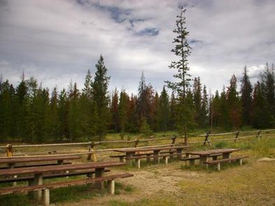
The campground’s large group site can accommodate up to 150 people, with picnic and serving tables, grills, two bear boxes for food storage, and a double vault toilet. Garbage service is located just outside of the group site on the main Forest Service road. Drinking water is not available.
Natural Features
The group site lies in a grassy meadow surrounded by lodgepole pine trees, which provide only very limited shade. As there is no traditional defined parking area, the group site allows for informal camping, gatherings and family affairs.
Nearby Attractions
Pinedale is 24 miles from the site and is the nearest full-service community.