
Directions
From Driggs, Idaho, travel 9 miles east. Turn east at the Key Bank on Little Avenue and follow the road to the forest boundary. Turn right on Forest Road 009 and continue 4 miles to the campground.
Phone
208-270-0150 OR 541-351-1182
Activities
CAMPING, FISHING, HIKING, WILDLIFE VIEWING
Keywords
TETO,CARIBOU-TARGHEE NF – FS
Related Link(s)
Overview
Teton Canyon Campground is located in beautiful Teton Canyon at an elevation of approximately 6,500 feet. Driggs, Idaho is just 11 miles away. Hiking, backpacking and horseback riding are popular activities in this scenic region.
Recreation
The towering Teton Range and Jedediah Smith Wilderness are adjacent to the canyon. Excellent hiking, backpacking and horseback riding opportunities abound, with trails leaving from the campground. A horse staging area is located at the trailhead parking area.
Teton Creek runs alongside the campground. Fly-fishermen love casting for brook and Yellowstone cutthroat trout.
Facilities
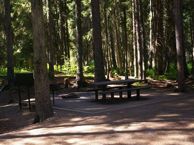
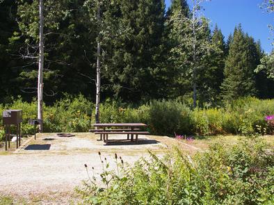
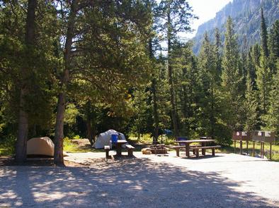
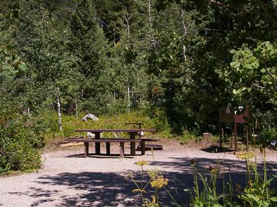
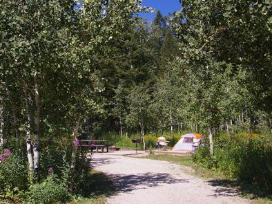
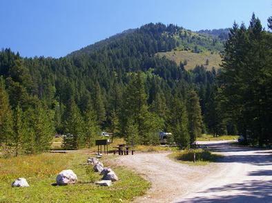
This newly-renovated campground contains several campsites, each equipped with a picnic table, campfire ring, grill and food storage locker. Two equestrian sites are available for those camping with horses.
Vault toilets, drinking water and trash collection are provided but there is no electricity. Some first come, first served sites may also be available. Firewood is available for purchase from the host. Roads and parking spurs are gravel.
Natural Features
The campground is situated along Teton Creek, with partial views of the nearby Teton Range. A dense forest of pine, spruce and fir covers half of the campground, providing nice shade. The other half of the campground is more open, with aspens and pines dotting the summer wildflower-filled meadows. A variety of wildlife makes its home in the area, including moose and deer.
Nearby Attractions
Popular activities in the area include the Teton Valley Summer Festival over the Fourth of July in Driggs, complete with a hot air balloon festival, parade, rodeo, bike races and antique and craft booths.
Grand Targhee Resort is nearby and hosts outstanding annual music festivals: Targhee Fest is in mid-July; Targhee Bluegrass Festival is in mid-August. The resort also offers lift-served hiking and mountain biking, scenic lift rides, guided horseback riding, a climbing wall and an 18-hole disc golf course. A disc golf tournament is held annually in late July.
Grand Teton and Yellowstone National Parks are both within a few hours drive.