
Directions
Coming from the south on Highway 101 to Greenfield, take the first exit (Arroyo Seco) into town. Turn left on Elm Street and go west to Arroyo Seco Road and turn left. Arroyo Seco Road dead-ends at the campground.
Coming from the north on Highway 101, just past Soledad, turn west onto Arroyo Seco Road and continue to the campground.
Phone
805-434-1996
Activities
BIKING, CAMPING, FISHING, HIKING, WILDLIFE VIEWING
Keywords
ARRS,LOS PADRES NF -FS
Related Link(s)
California State Road Conditions
Overview
Arroyo Seco Campground is a semi-rustic, but developed facility in California’s westernmost national forest. It offers a great escape from bustling city life, into the mountain air and provides access to a variety of outdoor recreation opportunities.
Recreation
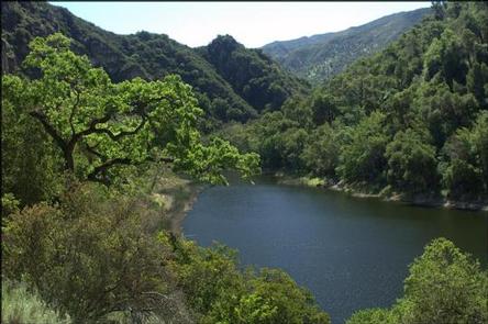
The small non-body contact lake near the group campsites gives campers an edge on mountain fishing and small non-motorized boating. Anglers will find mostly bass and catfish in the lakes, and other species on occasion. A fishing license is required for visitors over 16 years of age. The nearby river offers a small beach where campers and day use visitors may wade and swim. All nearby bodies of water are dependent upon seasonal rain for levels to rise.
The Ventana Wilderness, also known as "the gorge," provides ample opportunities for hiking, swimming, backpacking, hunting and horseback riding. No motorized vehicles are allowed (unless prior permission is granted by the Forest Service) beyond the gated road and parking lot. The 15.5-mile Santa Lucia Trail is available for hiking and horseback riding and provides access to the surrounding wilderness and a variety of other trails.
Facilities
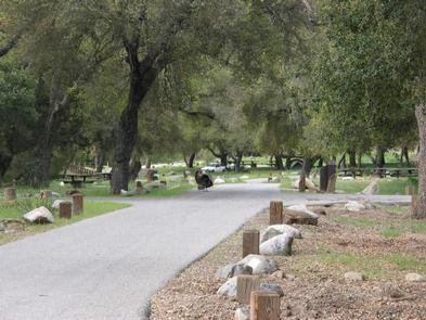
The campground offers sites that are both modern and more primitive, for single and double-family occupancy. Campsites are available for tent or RV camping, however utility hookups are not provided and there is no dump station. Some sites are level and large enough to accommodate most RVs. Roads are paved throughout the campground.
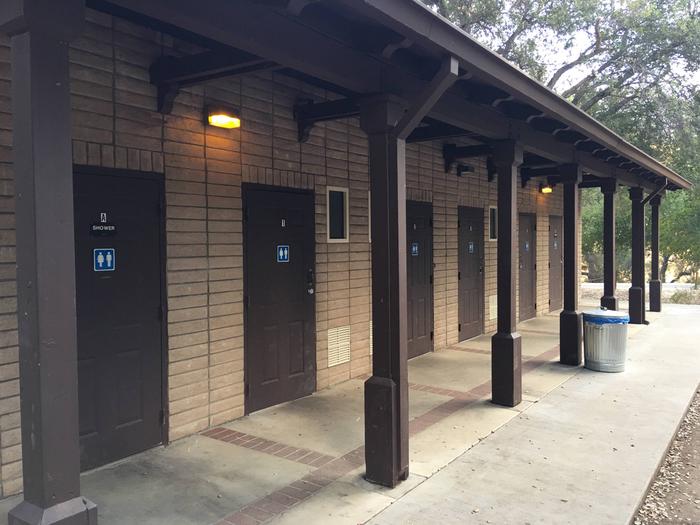
Each site is equipped with a table and campfire ring with grill. Campsites in the first loop offer accessible flush toilets, coin-operated showers and drinking water. In the more primitive area of the campground, vault toilets are provided, as well as drinking water. Some sites are fully accessible.
A group campsite is available for reservations and can accommodate up to 50 people and 10 vehicles. It provides tables and a campfire circle, as well as vault toilets and drinking water.
Natural Features
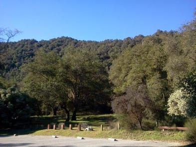
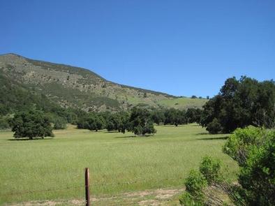
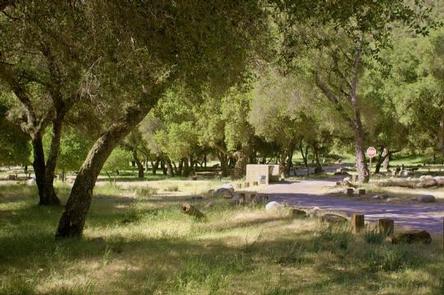
The campground offers views of the Ventana Wilderness mountain peaks and one small lake (water levels depend on the season). It is nestled into the hillside, surrounded by abundant shrubbery and large oak trees. It is situated next to the Arroyo Seco River at an elevation of about 1,200 feet. A variety of birds and wildlife make their home in the area.
A splash of color greets visitors at the entrance gate, where a variety of plants in bloom. In the spring and fall, the leaves on the trees change to beautiful shades of red, yellow and orange, creating a beautiful scenic landscape. In the springtime, lupines bloom all around.
Nearby Attractions
The city of Monterey provides a variety of tourism opportunities and is located about 50 miles from the campground.
The west side of the Pinnacles National Monument is about 30 miles from the campground. The monument and surrounding area is popular among rock climbers during the spring and fall.