BLUFF MESA GROUP CAMP, CA Campground Reservation, Info, Images, Map, Directions

BLUFF MESA GROUP CAMP, California Campground Images, Info & Reservations

Directions

Take I-10 east to Running Springs. Turn onto State Highway 18 and continue to Big Bear Lake Dam. Turn right and continue for 3 miles. Turn onto Tulip Lane and turn right on Mill Creek Road (Forest Road 2N10). Continue 4 miles and turn right on Forest Road 2N86 and continue to the campground.

Phone

909-866-8550

Activities

BIKING, BOATING, CLIMBING, CAMPING, FISHING, HIKING, WILDLIFE VIEWING, SWIMMING SITE

Keywords

BLUG,SAN BERNARDINO NF – FS

Related Link(s)

Rec Area Info & Images

California State Tourism

Forest Service Concessionaire

California State Road Conditions

Overview

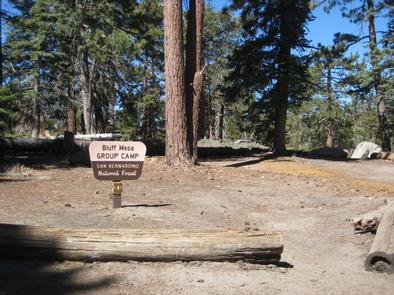
Bluff Mesa Group Campground is conveniently located for campers to enjoy all the beautiful Big Bear Lake area has to offer. A variety of trailheads are nearby, leading visitors through the scenic forest that surrounds the campground.

Recreation

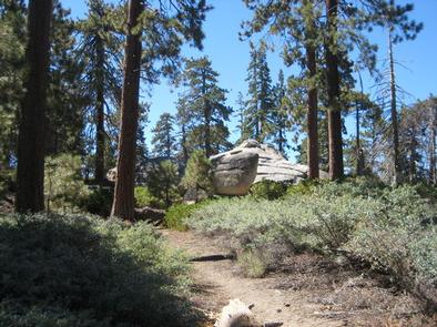
A variety of hiking and mountain biking trails can be accessed from the campground, and rock climbing routes can be found nearby.

Fishing, boating and swimming at Big Bear Lake are popular activities. Anglers can look forward to trout, bluegill, crappie, catfish and largemouth bass, among other fish. The lake is less than 10 miles from the campground.

Facilities

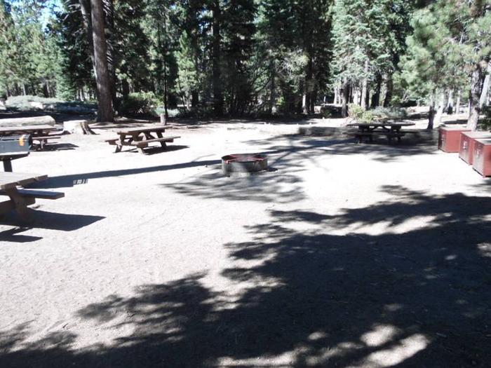
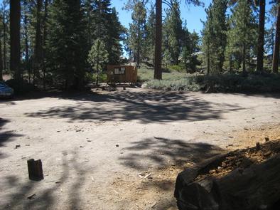
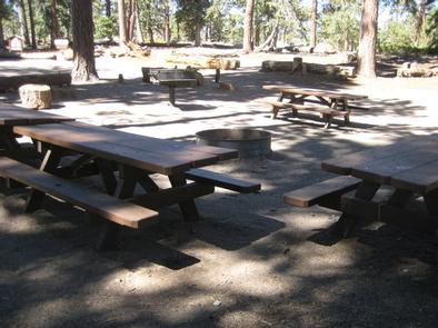
The campground offers one large group site for tents. It can accommodate up to 40 people and eight vehicles and is accessed by a dirt road. The site is equipped with picnic tables, grills and campfire circle.

Vault toilets are provided. Drinking water, utility hookups and trash collection are not available. Parking surfaces are gravel.

Natural Features

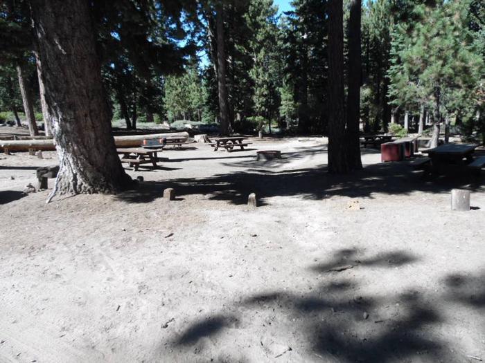
The campground is located 45 miles from San Bernardino at an elevation of 6,800 feet. It is accessed via a dirt road, and is nestled in a secluded, mixed conifer forest with a grassy understory. Mature trees provide much shade throughout the area, but open meadows are also available.

Nearby Attractions

The Big Bear Discovery Center is located about 10 miles from the campground, on the other side of Big Bear Lake. A visitor center, interpretive trails and educational programs are available, as well as accessible flush restroom facilities.

Reservation

More from CampingHiking.net:

CAMP CREEK, Oregon Campground Images, Info & Reservations

Directions From Portland, travel east on Highway 26 for approximately 32 miles. Camp Creek Campground is located on the south side of the highway, about 3 miles past the community of Rhododendron. Phone 503-630-5721 Activities BIKING, CAMPING, FISHING, HIKING, VISITOR CENTER Keywords CACR,MT. HOOD NF – FS Related Link(s) Rec

ARCH DAM CAMPGROUND, Utah Campground Images, Info & Reservations

Directions From Vernal, Utah, take U.S. 191 north for about 46 miles. From Manila, Utah, take Highway 44 for 28 miles. Turn left on U.S. 191 and go about 6 miles north. From Rock Springs, Wyoming, take I-80 west toward Green River about 6 miles to the junction with U.S.

SUNSET, Oregon Campground Images, Info & Reservations

Directions From Klamath Falls, go 32 miles northwest on Highway 140. Turn south on Dead Indian Memorial road and continue approximately 2.5 miles to the campground. Phone 866-201-4194 Activities BIKING, BOATING, CAMPING, FISHING, HIKING, SWIMMING SITE Keywords SUSE,LAKE OF THE WOODS,WINEMA NF – FS Related Link(s) Rec Area Info &

CANYON POINT, Arizona Campground Images, Info & Reservations

Directions Take Highway 260 east from Payson toward Heber. The campground is located at milepost 287 on State Highway 260 approximately 4.5 miles east of the Rim Visitor Information Station, and 20 miles west of Heber. Phone 928-535-9859 Activities BOATING, CAMPING, FISHING, HIKING, PICNICKING, DAY USE AREA Keywords CANY,APACHE-SITGREAVES NF-FS

JUMPUP CABIN, Arizona Campground Images, Info & Reservations

Directions From Fredonia, AZ: Travel on State Route 89a south 1 mile to Forest Road (FR) 22. Take a right onto FR22. Follow FR22 for approximately 30 miles (the pavement ends after approximately 19 miles). From FR22 take FR447 west (right turn) to the junction of the FR234 (4 miles),

BIG PINE CANYON, California Campground Images, Info & Reservations

Directions From Highway 395 in Big Pine, California, turn west at flashing yellow traffic light and continue on Crocker Street/Big Pine Road for 9 miles. The group campground is just above Upper Sage Flat Campground on the left. Phone 760-935-4339 Activities CAMPING Keywords BIGP,PALISADE GLACIER GROUP,PASISADE GLACIER,CLYDE GLACIER GROUP,CLYDE GLACIER,INYO