

Directions
From Roseburg, OR, turn left onto OR-138 East / NE Diamond Lake Boulevard for approximately 80 miles. Turn right onto Forest Road 4795 / Diamond Lake Loop at the north entrance to Diamond Lake Recreation Area. Continue 3.2 miles and turn right after the pizza parlor. Drive half a mile to the campground entrance on the left. Broken Arrow may also be accessed via OR-62 and OR-230 from Medford, OR, or US-97 from Klamath Falls, OR, and Bend, OR.
Phone
541-498-2531
Activities
BIKING, CAMPING, HIKING
Keywords
BROK,BROKEN ARROW GROUP,UMPQUA NF – FS
Related Link(s)
Overview
Set back in lodgepole pine forest at the south end of Diamond Lake, Broken Arrow Campground is a quiet retreat for family and large group camping excursions in Umpqua National Forest. This picturesque spot boasts spectacular views of both Mount Bailey and Mount Thielsen and offers visitors fantastic recreational opportunities.
Recreation
The area around Broken Arrow Campground offers outdoor enthusiasts the opportunity to hike, fish, swim, bike and enjoy a long list of outdoor recreational activities throughout the year. With a backdrop of forested shoreline and mountain peaks, anglers may cast a line from a boat or along the shore into nearby Diamond Lake to reel in rainbow trout. Swimming, kayaking, and picnicking along the shore are wonderful ways to spend a warm afternoon along the waterfront as well. Bicyclists will enjoy riding on the 11-mile paved trail around the lake, while hikers can head out for the day on one of many trails leaving from the area. Interpretive programs are offered on Saturday evenings at nearby Diamond Lake Campground. Trails for horseback riding are within 5 miles of the campground.
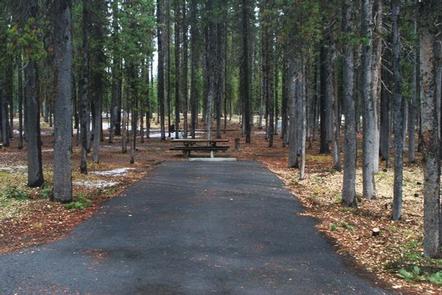
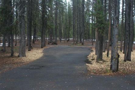
Facilities
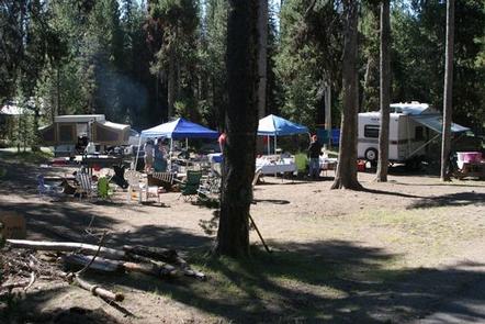
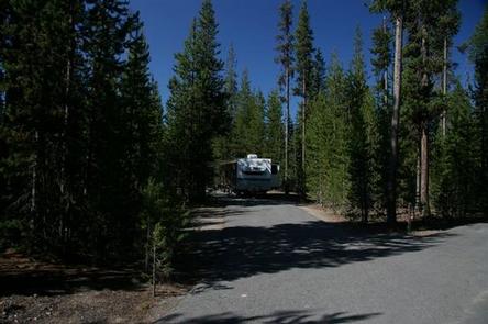
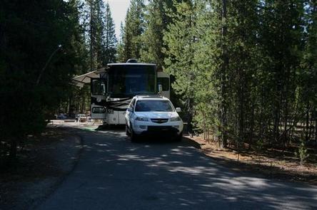
This large campground has 120 standard site and, 3 group sites, able to accommodate tents, RVs and trailers. The 3 group sites and 48 standard sites are reservable, the rest are available on a first-come first-serve basis. Sites are equipped with picnic tables, campfire rings, grills, drinking water and flush toilets. Several boat ramps provide access to the lake. Campground hosts are on site to answer questions.
Natural Features
Explosive geologic events have shaped the distinctive landscape on the 984,602-acre Umpqua National Forest, and the area provides spectacular scenery as well as an abundance of natural and cultural resources. The translation of the word, “Umpqua,” meaning “thundering waters,” defines the area. High mountain lakes, heart-stopping rapids, peaceful ponds and thundering waterfalls, including the 272-foot Watson Falls on the North Umpqua Highway, are available to visitors. Several designated wilderness areas provide undisturbed solitude. Encompassing 19,100 acres, Boulder Creek Wilderness is an incredible landscape, with dense old growth forests and steep terrain that tower above Boulder Creek. The most popular area in Boulder Creek is Pine Bench. This flat area overlooking Boulder Creek is home to a grove of old growth Ponderosa pines. Diverse ecosystems support a wide range of habitat for wildlife common to the area. From eagles and owls, to salamanders and salmon, these species, along with many others, depend on surrounding undeveloped wilderness, clean streams, and diverse forests to live.
Nearby Attractions
The nearby resort offers bicycle, boat, and horse rentals as well as lodging, a restaurant, grocery store, laundry facilities and fuel. Visitors also enjoy a trip to Crater Lake National Park, the only national park in Oregon. Interpretive programs and exhibits offer education about the natural and human history of the area. The Pacific Crest Trail (PCT), one of the world’s premier National Scenic Trails, showcases some of North America’s most fantastic scenery, winding its way its way from Mexico to Canada through California, Oregon and Washington, and is accessible near the campground.