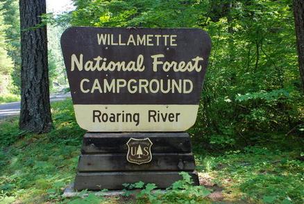
ROARING RIVER (GROUP), OR Campground Reservation, Info, Images, Map, Directions

ROARING RIVER (GROUP), Oregon Campground Images, Info & Reservations

Listen

Directions

From Eugene, Oregon, take I-105 east to McKenzie Highway 126 just past Milepost 45. Turn South on Aufderheide Drive/Forest Service Road 19 and travel for 22 miles to campground. Entry is through a locked gate with a combination.

Phone

541-822-3381

Activities

CAMPING, FISHING

Keywords

ROAR,WILLAMETTE NF -FS

Related Link(s)

Rec Area Info & Images

Oregon State Road Conditions

Oregon State Tourism

Overview

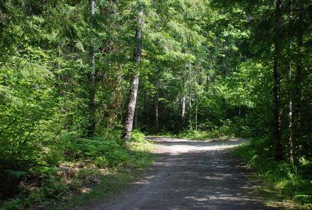
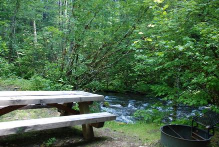
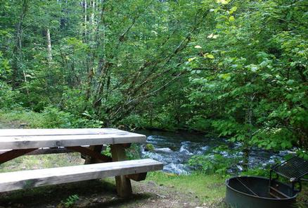
Campers at Roaring River Group Campground enjoy the soothing sounds of the aptly named Roaring River flowing past their campsites. The campground is tucked in a wooded setting in Willamette National Forest and can accommodate up to 50 overnight visitors.

Fishing and hiking are a few of the best ways to spend the day here. The nearby Three Sisters Wilderness offers plenty of trails to explore.

Recreation

The Box Canyon Trail area is nearby, providing excellent hiking routes like the McBee Trail and the Roaring Ridge Trail. The Roaring Ridge Trail passes through Douglas fir forests with views of the South Fork of the McKenzie River. Mountain biking, fishing and wildlife viewing are popular activities here. Bird sightings may include osprey, great blue herons and bald eagles.

Facilities

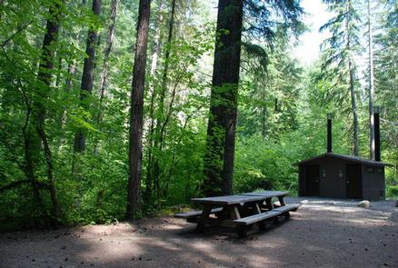
Roaring River provides picnic tables, dumpsters, vault toilets and campfire rings. No water is provided so campers are expected to bring their own. Parking fits up to 10 vehicles.

Natural Features

The group site is just a few feet from the river on the east bank, among Douglas fir, maple and alder. The Willamette National Forest stretches for 110 miles with varied landscapes of high mountains, narrow canyons, cascading streams and wooded slopes.

Nearby Attractions

The Three Sisters Wilderness Area offers 260 miles of hiking trail through 286,708 acres of wild, incredible mountains and meadows. There is also access to non-wilderness hiking and mountain bike trails within 10 miles.

Reservation

More from CampingHiking.net:

DIRT FLAT, California Campground Images, Info & Reservations

Listen Directions From Highway 140, turn on to Foresta Road. Landmarks include Red Bud Picnic Area and a National Park Service warehouse. After bridge, turn left onto the spur road. Immediately turn left onto Incline Road. Continue 1.5 miles to the facility. Phone 559-642-3212 Activities CAMPING Keywords DIRT,EL PORTAL,SIERRA NF

BERNERS BAY CABIN, Alaska Campground Images, Info & Reservations

Listen Directions Located 37 miles northwest of Juneau, the cabin is on shore of Berners Bay, 8 miles north from boat launch at Echo Cove at mile 40 Glacier Highway. Access is by boat, kayak and float plane only. Consult tide charts, as some parts of the bay become extremely

RAINBOW POINT, Idaho Campground Images, Info & Reservations

Listen Directions From Boise, Idaho, travel north on Highway 55 for 95 miles to Donnelly. Turn west on West Roseberry Road and go 1.5 miles to Norwood Road. Turn south and continue a mile to Tamarack Falls Road. Turn west and go just over a mile to West Mountain Road.

LOST LAKE CAMPGROUND, Wisconsin Campground Images, Info & Reservations

Listen Directions From Florence, travel west 17 miles on STH 70 to the intersection with FR2450 (Dream Lake Road). Turn left (south) on FR2450 and drive 1 mile to FR2156 (Chipmunk Rapids Road). Continue straight 2.9 miles on FR2156 to the campground. Phone (715) 479-2827 Activities BIKING, BOATING, CAMPING, FISHING,

GREENOUGH LAKE, Montana Campground Images, Info & Reservations

Listen Directions From U.S. Highway 212, turn off at Rock Creek Road (Forest Road 2421). Go 1 mile to campground entrance, which is on the left. Phone 406-587-9054 Activities BIKING, BOATING, CAMPING, FISHING, HIKING, OFF ROAD VEHICLE TRAILS, KAYAKING, CANOEING, SCENIC DRIVE Keywords GREH,CUSTER NF – FS Related Link(s) Rec