ANGEL CREEK, NV Campground Reservation, Info, Images, Map, Directions

ANGEL CREEK, Nevada Campground Images, Info & Reservations

Directions

Take Interstate 80 to the West Wells exit. Turn south on Angel Lake Road (State Route 231) and travel 8 miles to Angel Creek. Turn left and follow the road for one mile to the campground.

Phone

775-752-3357

Activities

BOATING, CAMPING, FISHING, HIKING, HORSEBACK RIDING, WILDLIFE VIEWING

Keywords

ANGC,RUBY MOUNTAINS,HUMBOLDT-TOIYABE NF-FS

Related Link(s)

Rec Area Info & Images

Nevada State Tourism

Forest Service Concessionaire

Nevada State Road Conditions

Overview

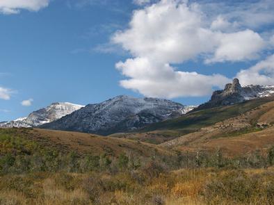
Angel Creek Campground is located on the grassy foothills of the East Humboldt Mountain Range, just eight miles southwest of Wells, Nev. It sits at an elevation of 6,200 feet. Visitors enjoy making the short drive to Angel Lake for canoeing and fishing.

Recreation

Beautiful Angel Lake is just four miles from the campground, offering great canoeing and fishing for rainbow and brook trout.

Greys Lake Trail, a 4.75-mile round-trip path to a hidden alpine lake, begins at Angel Lake.

A variety of wildlife, including bighorn sheep, mountain goats, deer and birds of prey, make its home around the lake, creating good viewing opportunities for visitors to the area.

Facilities

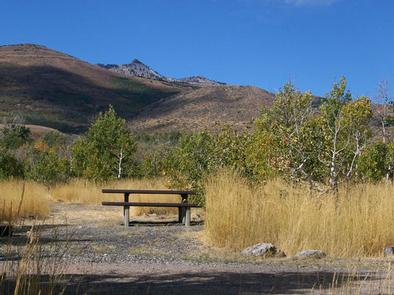
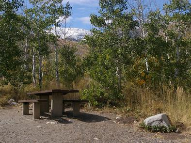
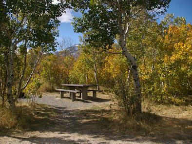
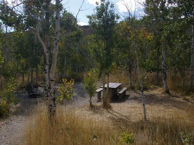
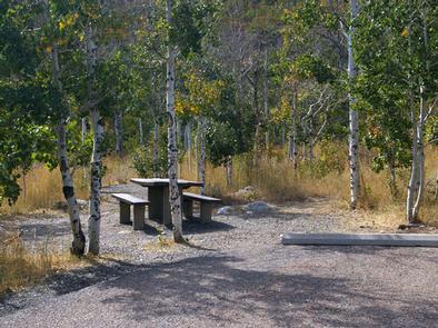
The campground provides vault toilets, drinking water and trash collection. Each campsite contains a picnic table and combination campfire ring with grill. Most sites have tent pads. Firewood is available for purchase from the host.

The tent only group camping area can accommodate up to 30 people and six tents. There is parking for six vehicles. The site contains picnic tables, a group fire ring and family grill. The site is handicap accessible. If not reserved, the site can be used on a first-come, first-served basis for group camping or day use picnics.

Natural Features

The campground is situated among mature aspens, which offer partial shade and beautiful fall color. Wildflowers dot the area during the summer months.

Reservation

More from CampingHiking.net:

FISH CREEK PAVILION, Idaho Campground Images, Info & Reservations

Directions From Grangeville, head south on Grangeville-Salmon Road for approximately 7 miles to the Fish Creek Meadows area. Turn right onto Forest Road 4600. The entrance to Fish Creek Pavilion is located 300 feet ahead on the left. Phone 208-983-1950 Activities CAMPING, HIKING, HORSEBACK RIDING Keywords None Related Link(s) Rec

JIMS LAKE CABIN, Alaska Campground Images, Info & Reservations

Directions Access to the cabin is by floatplane only. It is about a 50-minute flight from Juneau. This cabin is in a designated Wilderness area, and access by helicopter is illegal. In fall, winter and early spring, the cabin may be inaccessible due to frozen lake surface (floatplanes cannot land).

DEER CREEK CABIN (WY), Wyoming Campground Images, Info & Reservations

Directions From Afton, WY, take Highway 89 north about 31 miles to Alpine, Wyoming. At Alpine, turn right (south) onto Greys River Road (Forest Road 10138) and travel about 13 miles. The cabin is located on the left (east) side of the road, just past Murphy Creek Campground. Access is

CEDAR BLUFF, California Campground Images, Info & Reservations

Directions From Fresno, California: Take Highway 41 north through Oakhurst. Turn right onto Forest Road 222 (toward Bass Lake) and keep right for 3.5 miles to the Bass Lake Campground office. Continue southeast on Forest Road 222 for approximately 2.75 miles to Cedar Bluff Campground. Phone 559-642-3212 Activities BOATING, CAMPING,