EASLEY CAMPGROUND, ID Campground Reservation, Info, Images, Map, Directions

EASLEY CAMPGROUND, Idaho Campground Images, Info & Reservations

Listen

Directions

From Ketchum, take Highway 75 north for 14.1 miles. Turn onto Forest Road 160 at the sign for Easley Campground.

Phone

928-537-8888

Activities

BIKING, CAMPING, FISHING, HIKING, WILDLIFE VIEWING, SWIMMING SITE

Keywords

EASL,SAWTOOTH NF – FS

Related Link(s)

Rec Area Info & Images

Idaho State Road Conditions

Forest Service Concessionaire

Idaho State Tourism

Overview

Easley Campground is located along the beautiful Big Wood River at an elevation of 6800 feet, conveniently close to Ketchum, Idaho only 14 miles south. Visitors enjoy fishing, hiking and soaking at Easley Hot Springs.

Recreation

Easley is part of the Sawtooth National Recreation Area, where outdoor activities abound. Fly-fishing for rainbow, brown and brook trout is popular on the Big Wood River, as is float tubing.

The 20-mile Harriman Trail passes through the campground, offering excellent hiking and biking. Numerous trails spur off the Harriman Trail leading to deep canyons, sparkling lakes, swimming holes and more great high country fishing.

Facilities

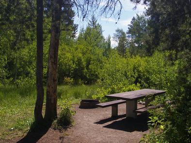
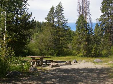
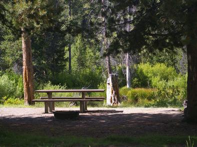
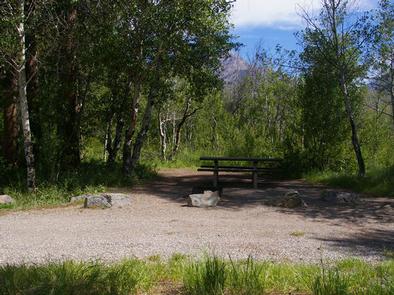
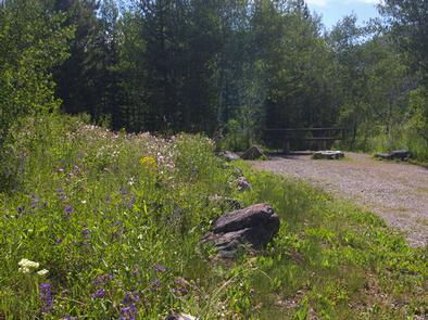
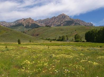
The campground offers several family campsites, most of which have scenic views of the Boulder Mountains to the east. Vault toilets and drinking water are provided, but there is no electricity. Roads and parking spurs are gravel.

Natural Features

A forest of Douglas fir, ponderosa pine, lodgepole pine and aspen offers plentiful shade in the campground. Colorful summer wildflowers are abundant and willows dot the banks of the river. Temperatures are cool with an average summer high of 78 and a low of 40.

Nearby Attractions

Easley Hot Springs is less than 1/4-mile away, just past the campground entrance. A swimming pool, hot tubs and showers are available for a small fee, and a small store is located on-site.

The Sawtooth National Recreation Area Visitor Center is 6.5 miles from the campground, with a small museum, bookstore and area information. A dump station and drinking water are located here as well.

Sun Valley Resort is 11 miles away, with hiking, biking, guided horseback riding and beautiful mountain scenery.

Popular area events include Wagon Days in Ketchum in September, and in Stanley an hour away, an Arts & Crafts Fair in July, and Salmon Festival, Quilt Fair and Fireman’s Ball in September.

Reservation

More from CampingHiking.net:

PLEASANT VALLEY CAMPGROUND, Washington Campground Images, Info & Reservations

Listen Directions From Naches, take Highway 410 northwest approximately 42 miles to milepost 80.2. Phone 541-338-7869 Activities BIKING, CAMPING, FISHING, HIKING, WATER SPORTS, SWIMMING SITE Keywords PLVA,OKANOGAN – WENATCHEE NF -FS,PLEASANT VALLEY,PLEASANT VALLEY CAMPGROUND Related Link(s) Rec Area Info & Images Washington State Road Conditions Washington State Tourism Forest Service

HOOVER CAMPGROUND, Oregon Campground Images, Info & Reservations

Listen Directions Drive 2.7 miles east of Detroit, OR on Highway 22. Turn onto Blowout Road/Forest Service Road 10, then go 0.75 miles west to the Hoover Group Site. Phone 801-226-3564 Activities CAMPING, FISHING, HIKING Keywords HOOG,DETROIT LAKE,WILLAMETTE NF -FS,Hoover Group Campground,Hoover Group Camp Related Link(s) Rec Area Info &

KIMBALL BEND PARK, Texas Campground Images, Info & Reservations

Listen Directions From Kopperl, TX, travel north on HWY 56 for approximately 2.5 miles. Turn right on HWY 174 and go approximately 2.3 miles. Turn left into the park, just before the HWY 174 bridge. From Cleburne, TX, travel south on HWY 174 for 22 miles. Turn right into the

ITALIO RIVER CABIN, Alaska Campground Images, Info & Reservations

Listen Directions Located 30 miles SE of Yakutat, the cabin is on the west bank of Hooligan Creek, a half-mile from the Old Italio River. Access is by wheeled plane on a tidal flat airstrip. The 1,600×100-ft. airstrip may flood at extreme high tides or after heavy rains. Please consult

PINEY POINT, Texas Campground Images, Info & Reservations

Listen Directions From Texarkana, take Highway 59 south to Wright Patman Lake. Just south of Sulphur River Dam, turn right into the park area, following signs. Proceed one mile to the park. Piney Point is just north of Rocky Point Park. Phone 903-796-0684 Activities BOATING, CAMPING, FISHING, HIKING, WATER SPORTS