SUNSET-UNION VALLEY, CA Campground Reservation, Info, Images, Map, Directions

SUNSET-UNION VALLEY, California Campground Images, Info & Reservations

Listen

Directions

On Highway 50, east of Placerville, travel for 21 miles to the Icehouse Road turnoff on your left. Continue north for 16 miles to the campground.

Phone

831-245-6891

Activities

BIKING, BOATING, CAMPING, FISHING, HIKING, SWIMMING SITE, SAILING

Keywords

SUNP,PENINSULA,SUNSET,UNION VALLEY,YELLOWJACKET,WOLF CREEK,LOON LAKE,SUNSET UNION VALLEY,ELDORADO NF – FS

Related Link(s)

Rec Area Info & Images

California State Road Conditions

Forest Service Concessionaire

California State Tourism

Overview

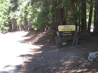
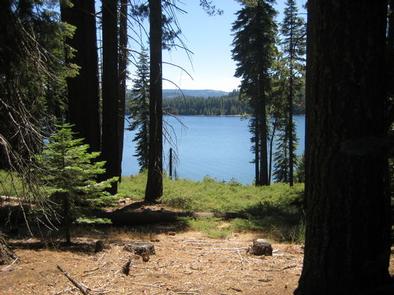
Sunset Campground is situated on the shores of Union Valley Reservoir, among the towering cedar and ponderosa pines of Eldorado National Forest. Aptly named, the campground is a fantastic destination for colorful sunset views over the lake. All water activities are popular here, but it’s also fun to bring a bike and explore the neighboring bike trail.

Eldorado includes the famed gold mining territory of the 1800s. Remnants of the days of the California Gold Rush can be found all around the region.

Recreation

On the water, sailing, boating and swimming are very popular. For hikers and bikers, the Union Valley Bike Trail and Bassi Falls Hiking Trail are great for exploring. Fishing in the lake includes rainbow, brown, mackinaw trout and kokanee salmon.

The bike trail connects with the campground, near the boat ramp, and stretches for 4.8 miles along the eastern shores of the lake.

Facilities

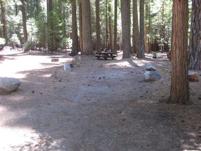
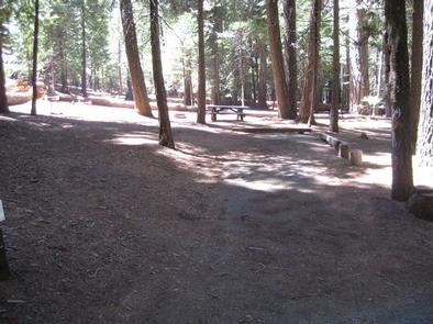
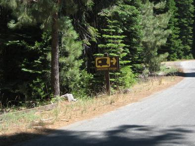
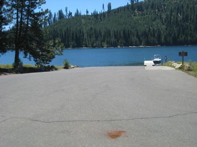
The large campground has 131 single-unit sites including 30 tent-only spots. Amenities include a boat ramp with an accessible boarding dock, a paved parking area, dump station, vault toilets and drinking water. A swimming beach is also located onsite.

Natural Features

Sunset Campground sits in the Crystal Basin at an elevation of 5,000 feet. Some sites are fully shaded while others sit in a meadow. The climate is similar to that of the Mediterranean with warm, dry summers and cold, wet winters.

Nearby Attractions

Venture to the nearby lake, Ice House Reservoir or hike up Twin Peaks to look down over Union Valley Reservoir.

A restaurant and general store are within 5 miles of the campground.

Reservation

More from CampingHiking.net:

MINERAL LAKE, Wisconsin Campground Images, Info & Reservations

Listen Directions From Mellen, Wisconsin, take County Highway GG west for about 9 miles to the campground sign. Turn right and drive less than a mile to the campground. From Clam Lake, Wisconsin, take County Highway GG north for about 9 miles to the campground sign and turn left. Phone

Sand Flats Recreation Area, Utah Campground Images, Info & Reservations

Listen Directions Directions from Your Location: The Entrance Station for the Sand Flats Recreation Area is located around 3000 Sand Flats Rd. We say “around” because there is no actual mailing address for the Entrance Station. Don’t worry though, we have detailed directions. From the South: If heading north on

MAGEE RANGERS CABIN, Idaho Campground Images, Info & Reservations

Listen Directions Access #1: From I-90, take Exit #43 (Kingston) and drive 24 miles north on Forest Highway 9 (two lane paved highway) to the Prichard Junction. Continue on Forest Road 208 for 28 miles to the end of the pavement and the start of Forest Road 6310 (a gravel

South Shore, Oregon Campground Images, Info & Reservations

Listen Directions From Sisters, Oregon, take Highway 20/126 northwest for about 12 miles. Turn left onto Forest Service Road 2070 toward Suttle Lake Campgrounds. Travel just less than a half-mile to the South Shore entrance on the right. Phone 541-323-1746 Activities BOATING, CAMPING, FISHING, HIKING, SWIMMING SITE Keywords SOUH,SUTTLE LAKE

SAVENAC WEST COTTAGE, Montana Campground Images, Info & Reservations

Listen Directions From Missoula, Montana, travel west on Interstate 90 for 90 miles to Exit 16 for Haugan. At the stop sign turn right. At the frontage road turn right and take the first left, crossing the cattle guard. Signs are onsite to follow. Maps are available online or for

DENBY POINT, Arkansas Campground Images, Info & Reservations

Listen Directions From Hot Springs, Arkansas, take US 270 west about 26.5 miles to Ouachita Shores Parkway. Turn right and follow access road one mile north to park. From Mount Ida, Arkansas, take US 270 east approximately 9.5 miles to Ouachita Shores Parkway. Turn left on access road one mile