ROBINSON CREEK NORTH, CA Campground Reservation, Info, Images, Map, Directions

ROBINSON CREEK NORTH, California Campground Images, Info & Reservations

Directions

Take U.S. Highway 395 through Bridgeport. Turn south on Twin Lakes Road at the Shell gas station. Travel 9.3 miles on Twin Lakes Road, then turn left into the campground.

Phone

760-932-7092

Activities

CAMPING, FISHING, HIKING, WILDLIFE VIEWING

Keywords

ROBI,HUMBOLDT-TOIYABE NF-FS

Related Link(s)

Rec Area Info & Images

California State Tourism

Forest Service Concessionaire

California State Road Conditions

Overview

Robinson Creek North Campground is located just 9 miles from Bridgeport, California, next to Robinson Creek at an elevation of 7,000 feet. The Twin Lakes area is close by, offering boating, fishing, hiking and horseback riding opportunities.

Recreation

Robinson Creek offers good rainbow trout fishing and can be easily accessed from within the campground. Numerous hiking trails are in the vicinity, including the popular Robinson Creek Trail.

Facilities

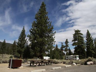
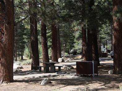
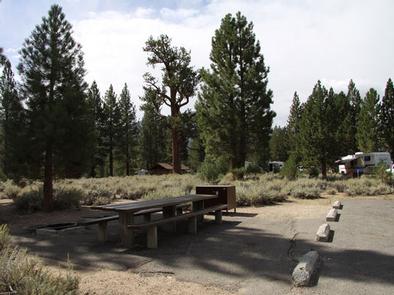
The campground contains single sites with picnic tables, food storage lockers and campfire rings with grills. Vault toilets, drinking water and trash collection are provided. Firewood is available for purchase from the host.

Educational programs are held next door at Robinson Creek South Campground’s amphitheater on weekends from July 4 through Labor Day.

Natural Features

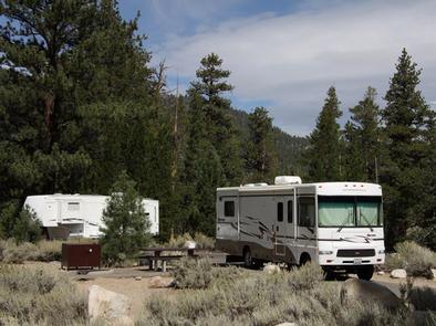
The campground is situated alongside its namesake creek, where a forest of massive Jeffrey pines towers over the site, offering partial shade. Lodgepole pines, sagebrush and summer wildflowers dot the landscape.

Nearby Attractions

Upper and Lower Twin Lakes are nearby, offering beautiful mountain scenery, boating, canoeing and fishing for Kokanee salmon and rainbow and brown trout. The rugged and scenic Hoover Wilderness Area can be accessed from the Twin Lakes area and offers additional trails for hiking and horseback riding.

Reservation

More from CampingHiking.net:

STAR MEADOWS GUARD STATION, Montana Campground Images, Info & Reservations

Directions STAR MEADOW GUARD STATION 5250 Star Meadows Road Whitefish, Montana 59937 Travel from Whitefish west on Highway 93 approximately 12 miles to mile marker 139, turn left onto Farm to Market Road. Continue 1.7 miles; turn right at the "Tally Lake Campground" sign onto the "Star Meadows Road". Continue

HERNANDO POINT, Mississippi Campground Images, Info & Reservations

Directions From I-55, take the Hernando, Mississippi exit and turn west. Continue to to HWY 51 and turn south. Turn west on Wheeler Road and follow signs into campground. Phone 662-562-6261 Activities BIKING, BOATING, CAMPING, FISHING, HIKING, HUNTING Keywords HERN,ARKABUTLA LAKE,ARKABUTLA LAKE Related Link(s) Rec Area Info & Images Mississippi

HORNET LOOKOUT, Montana Campground Images, Info & Reservations

Directions From Columbia Falls, take Nucleus Avenue north through Columbia Falls and turn east on Railroad Street. At the stop sign, the road becomes the North Fork Road. Continue on North Fork Road for about 45 miles and over the railroad overpass. Turn left (west) on Whale Creek Road 318

TANIS MESA SOUTH CABIN, Alaska Campground Images, Info & Reservations

Directions The cabin is located 50 miles southeast of Yakutat between Tanis Mesa and Brabazon Mountain Range. Access is by wheeled plane only via an 1,800-ft. airstrip at the cabin. Phone (907) 784-3359 Activities CAMPING, HIKING, HUNTING, WILDLIFE VIEWING Keywords TANS,TONGASS NF – FS Related Link(s) Rec Area Info &

HALF MOON RANCH, Arizona Campground Images, Info & Reservations

Directions From Tucson: Take I-10 east to Exit #318 (Dragoon Road). Turn right onto Dragoon Road and travel for approximately 10 miles through the village of Dragoon to the Cochise Stronghold Road. Turn right on Cochise Stronghold Road and travel for approximately 6 miles to Ironwood Road. The paved road