TERRACES CAMPGROUND - PICNIC AREA, NV Campground Reservation, Info, Images, Map, Directions

TERRACES CAMPGROUND – PICNIC AREA, Nevada Campground Images, Info & Reservations

Directions

Take Interstate 80 to any Elko exit and head south to Idaho Street. Turn south on 12th Street (from the east) or on 5th Street (from the west), to State Route 227. Travel 25 miles on SR 227 to Forest Road 660 (Lamoille Canyon Scenic Byway). Travel 10 miles on FR 660 to the picnic area.

Phone

775-752-3357

Activities

BIKING, CLIMBING, CAMPING, FISHING, HIKING, WILDLIFE VIEWING

Keywords

TERP,LAMOILLE CANYON,HUMBOLDT-TOIYABE NF-FS

Related Link(s)

Rec Area Info & Images

Nevada State Road Conditions

Forest Service Concessionaire

Nevada State Tourism

Overview

Terraces Overnight Group Area is a popular location for weddings, church activities, family reunions and company picnics. It is located in scenic Lamoille Canyon, 35 miles southeast of Elko, Nevada. Visitors enjoy fishing in Lamoille Creek and hiking on many local trails.

Recreation

Lamoille Creek runs just outside the picnic area and is a popular stream among fly-fishermen. The creek contains brook and wild rainbow trout.

Lamoille Canyon offers numerous hiking and horseback riding trails that lead to alpine lakes and vistas. The canyon road is popular for scenic driving and road biking. Many rock climbing routes can be found on the canyon walls.

Facilities

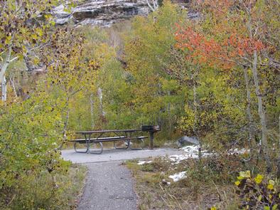
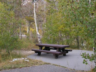
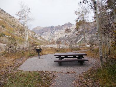
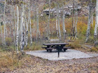
This site is a group overnight tent camping area that can accommodate up to 75 people throughout its nine individual family picnic sites or the facility can be reserved as a whole. If not reserved, the individual sites can be used on a first-come, first-serve basis for day use picnics.

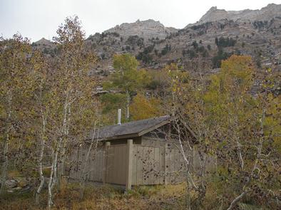
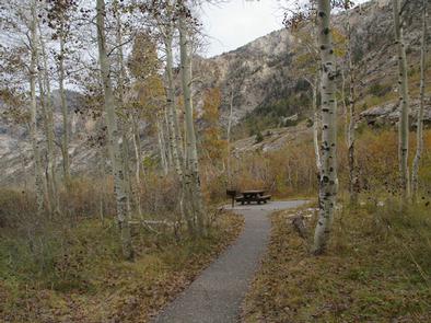
Sites are equipped with picnic tables and grills. Vault toilets, drinking water and trash collection are provided. A large paved parking area can accommodate up to 17 vehicles. Footpaths within the site are also paved.

Natural Features

The campground is situated at an elevation of 8,000 feet, high in Lamoille Canyon, within the beautiful Ruby Mountains. The area is a desert island brimming with wildlife, sparkling lakes and streams, wildflower-filled meadows and jagged peaks.

A dense stand of aspens covers the picnic area, offering partial shade and pretty fall colors. Most sites afford breathtaking views of the surrounding peaks and canyon walls.

Reservation

More from CampingHiking.net:

POSEY LAKE CAMPGROUND, Utah Campground Images, Info & Reservations

Directions From Highway 12 in Escalante, turn north at 300 East at the elementary school at the Posey Lake/Hell’s Backbone sign. Travel 14 miles to junction of Forest Roads 153 and 154, keep left and travel 2 miles to Posey Lake Campground. Site access can be difficult; about 14 miles

DEER LAKE, Minnesota Campground Images, Info & Reservations

Directions From Deer River, travel northwest on Highway 46. Turn on Eagle Nest Road and continue west for four miles, past East Seelye and West Seelye campgrounds. Deer Lake Campground is on the left. Take Highway 46 northwest from Deer River, MN. Turn on Eagle Nest Road (Old CR 33)

BLACK CANYON, New Mexico Campground Images, Info & Reservations

Directions From downtown Santa Fe, New Mexico, travel north on Washington Avenue to Artist Road (Hyde Park Road/State Route 475) and turn right. Continue for 7 miles to Black Canyon. Phone 505-753-7331 Activities BIKING, CAMPING, HIKING Keywords BOYD,SANTA FE NF – FS Related Link(s) Rec Area Info & Images New

BOGUS CREEK CAMPGROUND, Oregon Campground Images, Info & Reservations

Directions From Roseburg, OR, travel east on OR-138 East /NE Diamond Lake Boulevard for 35 miles, Bogus Creek Campground is on the left side of the highway – opposite of the campground entrance sign. Phone 541-496-3532 Activities FISHING, HIKING, WILDLIFE VIEWING Keywords Related Link(s) Rec Area Info & Images Oregon

FALL CREEK CAMPGROUND, Kentucky Campground Images, Info & Reservations

Directions From Monticello: KY 90, Turn onto KY 1275, light #1, Travel approximately 3.5 miles, Turn onto Hwy 2393, travel approximately 2 miles, Turn left at Fall Creek sign, Road ends at campground. Phone 606-348-6042 Activities BOATING, CAMPING, WILDLIFE VIEWING Keywords Fall Creek,Lake Cumberland,Wolf Creek Dam,FALL CREEK RECREATION AREA Related