


Directions
From Reno, Nevada, travel north on Highway 395. Merge onto Highway 70 west and travel 5 miles to Chilcoot. Turn north on Highway 284 and continue 8 miles to Frenchman Lake, turn right, cross the dam, and travel a mile to the campground.
Phone
530-836-2575
Activities
BOATING, CAMPING, FISHING, HIKING, HUNTING, WINTER SPORTS, WATER SPORTS, SWIMMING SITE
Keywords
FRMN,FRENCHMAN,CHILCOOT,BECKWOURTH,COTTONWOOD,SPRING CREEK,BIG COVE,PLUMAS NF – FS
Related Link(s)
California State Road Conditions
Overview
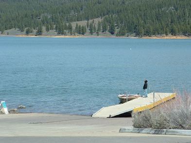
Frenchman Campground (5,700 feet) sites along the shores of its namesake lake, which boasts 21 miles of shoreline. The campground is situated at the southeastern peninsula of the lake. Situated on a pine covered hillside overlooking the lake, this is the place for campers to get in tune with their surroundings. The lake is at the interface between the mountains of the Sierra Nevada and high desert. Frenchman Lake and the surrounding Plumas National Forest together provide ample opportunity for recreation, relaxation and adventure.
Recreation
During peak camping season, the campground offers a variety of outdoor experiences including hiking, biking, picnicking and hunting. The nearby lake provides ample opportunities for swimming, boating, waterskiing, jet skiing and fishing. Frenchman Lake Boat Launching Facility and a day use area are near the campground. Winter activities range from ice fishing to snowmobiling.
Facilities
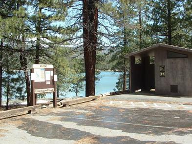
The campground offers single-family campsites for tent and RV camping. Twelve of the campgrounds 38 campsites can be reserved during peak camping season. All other campsites may be taken on a ‘First Come’ basis. The campground remains open throughout the years. However, most winters include enough snow to keep the road closed. Each site is equipped with tables and campfire rings with grills. Vault toilets and drinking water are also provided.
Natural Features
As part of California’s Plumas National Forest, the campground is located in northern California, between the rugged Sierra Nevada and the fringes of the Cascade ranges. The forest is home to hundreds of high alpine lakes and thousands of miles of clear-running streams.
Pine trees provide moderate to good shade in most sites. A variety of wildlife make its home in the area.
Nearby Attractions
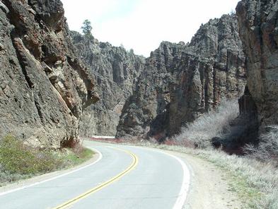
Little Last Chance Canyon Scenic Area
Sierra Valley – Largest valley in the Sierra nevada
Stores and services in the towns of Chilcoot and Loyalton
many forest roads to explore – take along a map, full tank and dependable vehicle