KYLE CANYON PICNIC AREA DAY USE, NV Campground Reservation, Info, Images, Map, Directions

KYLE CANYON PICNIC AREA DAY USE, Nevada Campground Images, Info & Reservations

Directions

From Las Vegas, Nevada, travel north on Highway 95 to the junction of Highway 157/Kyle Canyon. Turn left and travel approximately 18 miles. The picnic area is on the left side of the highway.

Phone

702-872-5486

Activities

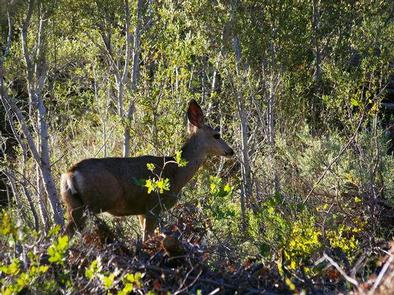
CAMPING, HIKING, WILDLIFE VIEWING

Keywords

KYLE CANYON PICNIC AREA,KYLE CANYON CAMPGROUND,KYLE,MOUNT CHARLESTON,LAS VEGAS,SPRING MNTS NAT REC AREA,HUMBOLDT-TOIYABE NF-FS

Related Link(s)

Rec Area Info & Images

Nevada State Tourism

Nevada State Road Conditions

Overview

Kyle Canyon Picnic Area is set in the beautiful Spring Mountains National Recreation Area, just 23 miles from Las Vegas. Visitors enjoy hiking, horseback riding and scenic driving in this forested desert oasis.

Recreation

The 1.6-mile Fletcher Canyon Trail begins nearby.
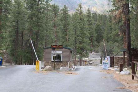
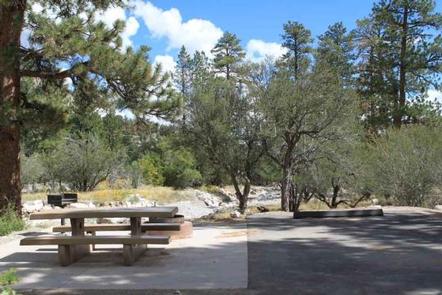
Facilities

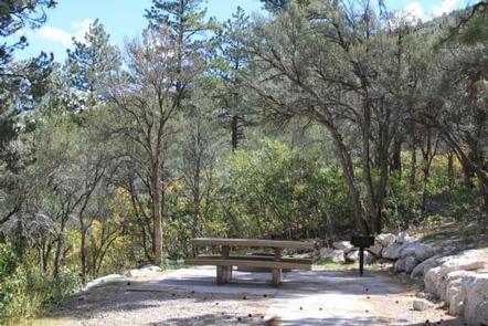
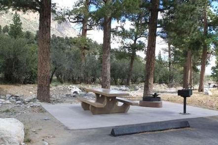
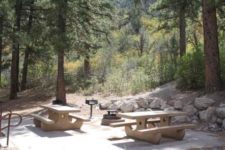
This year-round picnic area contains several single and double sites, four of which are accessible. Sites are equipped with a picnic table, campfire ring and grill. Flush toilets and drinking water are provided. Roads and parking spurs are paved.

Natural Features

The Spring Mountains National Recreation Area is a beautiful island in the desert, brimming with breathtaking scenery and diverse flora and fauna. The Bristlecone pine, the world’s oldest organism, and the rare Mount Charleston blue butterfly are both found within the Spring Mountains.

More than 100 springs create the namesake for the mountain range, making it an ideal place to escape the heat of the city.

The picnic area is set in an open forest of ponderosa pine, mountain mahogany and Gambel oak, which provides partial shade. Manzanita and wild roses dot the landscape. A seasonal stream and the highway parallels the area. Most sites have views of the surrounding towering canyon walls.

Nearby Attractions

More than 60 miles of hiking and horseback riding trails crisscross the area; two trails allow mountain biking. Rock climbing, picnicking and scenic driving are popular activities.

Reservation

More from CampingHiking.net:

LOST LAKE CABINS, Wisconsin Campground Images, Info & Reservations

Directions Lost Lake rustic cabins are located about 100 yards South of the Lost Lake Campground off of Forest Service Road 2156! From Florence, take Highway 70 for about 20 miles and take a righ onto Forest Service Road 2450, go about 1 mile and continue straight onto Forest Service

PASS CREEK CAMPGROUND, California Campground Images, Info & Reservations

Directions Take Interstate 80 to the Truckee/Highway 89 exit. Follow Highway 89 north for 17 miles to the Jackson Meadows turnoff. Travel west on Forest Road 07 for 18 miles to Jackson Meadows Reservoir. Turn at the Pass Creek Campground sign. Phone 530-265-8861 Activities BIKING, BOATING, CAMPING, FISHING, HIKING, HUNTING,

BEACH RIVER CABIN, Alaska Campground Images, Info & Reservations

Directions Beach River Cabin is only accessible by wheeled plane on the beach at low tide from Anchorage, Cordova or Seward. Travel time is 40 minutes southwest of Cordova, 45 minutes east of Seward. Click here for local tide information. Phone 1 (907) 424-7661 Activities BOATING, CAMPING, FISHING, HUNTING, WILDLIFE

KIOWA PARK I, Oklahoma Campground Images, Info & Reservations

Directions From Waurika, Oklahoma, take Highway 5 northwest for 8 miles. Turn right onto County Road 2750 N and proceed three miles to the park entrance. Phone 580-963-9031 Activities BOATING, CAMPING, FISHING, HUNTING, SWIMMING SITE Keywords KIOW,WAURIKA LAKE,WAURIKA LAKE Related Link(s) Rec Area Info & Images Oklahoma State Tourism Oklahoma

Blue Lake Creek Campground, Washington Campground Images, Info & Reservations

Directions Take State Highway 12 to Randle, Washington. Follow State Highway 131 to the fork and and stay left onto Forest Road 23. Follow Forest Road 23 beyond North Fork Campground to Blue Lake Creek. Phone 541-338-7869 Activities BIKING, CAMPING, FISHING, HIKING, HUNTING Keywords BCRE,GIFFORD PINCHOT NF – FS Related

LITTLE MILL, Utah Campground Images, Info & Reservations

Directions From Salt Lake City or Provo, take I-15 to the Alpine-Highland exit 284. Travel 8 miles east on Utah Highway 92 to the mouth of American Fork Canyon. Stay on 92 for 4 miles to the campground. Phone PLEASANT GROVE RANGER DISTRICT 801-785-3563 OR UTAH RECREATION COMPANY 385-273-1100 Activities