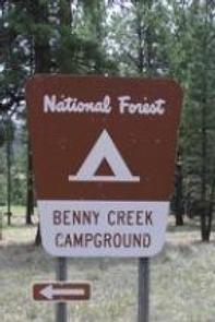
BENNY CREEK GROUP AREA, AZ Campground Reservation, Info, Images, Map, Directions

BENNY CREEK GROUP AREA, Arizona Campground Images, Info & Reservations

Listen

Directions

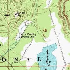
From Show Low, Arizona, take Highway 260 southeast 42 miles to Highway 373. Follow 373 south for 2.5 miles to the Benny Creek Campground entrance on the left.

Phone

928-735-7313

Activities

CAMPING, FISHING, HIKING

Keywords

BENN,APACHE-SITGREAVES NF-FS

Related Link(s)

Rec Area Info & Images

Arizona State Road Conditions

Arizona State Tourism

Forest Service Concessionaire

Overview

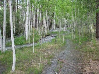
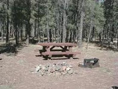
Benny Creek Campground offers group camping in the remote and scenic White Mountains of Arizona. A perfect outdoor retreat for small to medium group gatherings, the campground is situated in a pine forest above Benny Creek and within walking distance of Bunch Reservoir and Greer Lakes. Picnicking, fishing, hiking and boating are often enjoyed by campers.

Recreation

Excellent creek and lake fishing for trout draws anglers to the campground. Hikers can seek out the Squirrel Springs trail nearby.

Those wishing to relax on a scenic drive can explore the White Mountain and Coronado Trail Scenic Byways.

Facilities

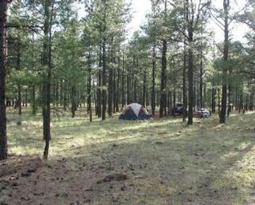
Three group camping areas are available for groups up to 24 or 32 guests. When not reserved, these sites may be available on a walk-in basis, and there are several individual sites that are also first-come, first-served.

The campground can accommodate tents, trailers and small motorhomes up to 24 feet. A dump station is available across the highway at Hoyer Campground.

Natural Features

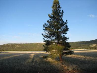
Benny Creek Campground sits in the White Mountains of eastern Arizona at an elevation of 8,250 feet. Campsites are fairly open under a canopy of ponderosa pine. Abert squirrels and chipmunks are common campground residents, and mule deer and elk inhabit the area as well. The nearby reservoir is one of three area lakes on the Little Colorado River.

Summer temperatures can be very pleasant due to the elevation. However, the rainy season often brings afternoon thunderstorms from late June through August. Visitors should come prepared for rain and cool nighttime temperatures.

Nearby Attractions

The nearby town of Greer offers gas, groceries, restaurants and equipment rentals.

Visitors can explore endless vistas and take part in many outdoor activities in the surrounding Apache-Sitgreaves National Forest, which encompasses 2 million acres of magnificent mountain country in east-central Arizona and New Mexico.

Reservation

More from CampingHiking.net:

BELLAH MINE, Arkansas Campground Images, Info & Reservations

Listen Directions From DeQueen, AR, take Highway 71 north for 7 miles. Turn west onto Bellah Mine Road and continue for 5 miles, following signs into the campground. Phone 870 386 7511 Activities BOATING, CAMPING, FISHING, HUNTING, WATER SPORTS Keywords BELL,DEQUEEN LAKE,DEQUEEN LAKE Related Link(s) Rec Area Info & Images

FERN BASIN, California Campground Images, Info & Reservations

Listen Directions From Idyllwild, travel north on State Route 243 about 4 miles. Turn right at the campground sign and continue to Forest Service Road 4S02. Turn left and proceed less than a mile to an intersection. Continue straight on the Forest Service Road and turn left into the campground.

ANDERSON COVE, Utah Campground Images, Info & Reservations

Listen Directions From Ogden, Utah, take 12th Street east through Ogden Canyon. Continue on Highway 39 north of Pineview Reservoir; campground is on the left side of highway. Phone OGDEN RANGER DISTRICT 801-625-5112 OR ANDERSON COVE 801-745-2265 OR UTAH RECREATION COMPANY 385-273-1100 Activities BOATING, CAMPING, FISHING, PICNICKING, WATER SPORTS, SWIMMING

SOUTH FORK (WYOMING), Wyoming Campground Images, Info & Reservations

Listen Directions From Buffalo, Wyoming, take U.S. Highway 16 west for 15 miles to Forest Service Road 337. Follow Forest Service Road 337 east for .25 miles to the campground. Phone 406-587-9054 Activities BIKING, BOATING, CAMPING, FISHING, HIKING, HORSEBACK RIDING, HOTEL/LODGE/RESORT PRIVATELY OWNED, OFF ROAD VEHICLE TRAILS Keywords SOU1,SOUTH FORK

DUCK HARBOR CAMPGROUND, Maine Campground Images, Info & Reservations

Listen Directions From the north, take I-95 to Bangor, then I-395 to Brewer, then take Rte. 15 south to Stonington. From the south, take I-95 or I-295 to Augusta, then Rte. 3 to Belfast, then Rte. 15 to Stonington. Phone 207-335-5551 Activities CAMPING Keywords None Related Link(s) Rec Area Info