BIG PINE CANYON, CA Campground Reservation, Info, Images, Map, Directions

BIG PINE CANYON, California Campground Images, Info & Reservations

Directions

From Highway 395 in Big Pine, California, turn west at flashing yellow traffic light and continue on Crocker Street/Big Pine Road for 9 miles. The group campground is just above Upper Sage Flat Campground on the left.

Phone

760-935-4339

Activities

CAMPING

Keywords

BIGP,PALISADE GLACIER GROUP,PASISADE GLACIER,CLYDE GLACIER GROUP,CLYDE GLACIER,INYO NF – FS

Related Link(s)

Rec Area Info & Images

California State Road Conditions

Forest Service Concessionaire

California State Tourism

Overview

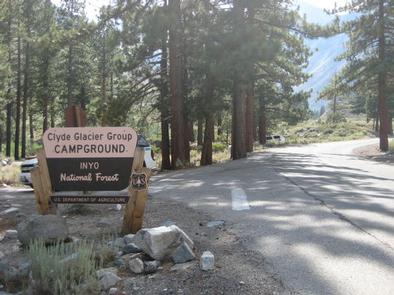
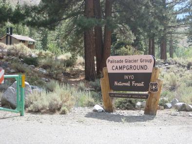
Big Pine Canyon Recreation Area includes two group campground sites. Named for glaciers that can be seen at the end of the valley, Clyde Glacier Group Site and Palisade Glacier Group Site sit along Big Pine Creek.

Recreation

Fishing is a popular activity in the creek and nearby lakes. Climbers make use of the steep, glacier-carved canyon walls for excellent climbing opportunities.

The North Fork Trail climbs past waterfalls and zigzags through Jeffrey pine, manzanita and sage before it reaches Big Pine Lakes with views of Palisade Glacier, the largest glacier.

The South Fork Trail climbs to small lakes fed by glacial waters from Norman Clyde and Middle Palisade Glaciers, the southernmost glaciers.

Facilities

The Clyde Glacier standard campsite fits up to 25 guests. Parking includes two 35-foot and six 20-foot paved spaces. Palisades Glacier campsite is also paved and can accommodate 25 people for tent camping only.

Campfire rings and grills are provided.

Natural Features

Big Pine Canyon is heralded for having both the largest and southern most glaciers in the Sierra Nevada mountains. Palisade Glacier, the largest, sits above Big Pine Lakes. These impressive glacial lakes at around 10,000 feet elevation are the source of the North Fork of Big Pine Creek. The South Fork is bordered by the Palisade Crest with peaks over 14,000 feet and Middle Palisade Glacier, the southernmost glacier.

Nearby Attractions

The glaciers in the nearby John Muir Wilderness provide an exciting hiking destination. A commercial pack station is within close proximity for horse enthusiasts looking for an outdoor adventure. A general store, pay showers and pond fishing can be found at a nearby resort.

Reservation

More from CampingHiking.net:

LEWIS CANYON, Arizona Campground Images, Info & Reservations

Directions Drive to Pinedale, Arizona, on State Highway 260, approximately 14 miles northwest of Show Low. Turn south on Forest Road 130 and continue approximately 2.3 miles to Junction 130A. Turn right to the group site, following the signs.  Phone 928-368-2100 Activities BIKING, CAMPING, HIKING Keywords LEWI,APACHE-SITGREAVES NF-FS Related Link(s)

KANGA BAY CABIN, Alaska Campground Images, Info & Reservations

Directions Accessible year round, weather permitting. Located 12 air miles south of Sitka on Baranof Island within Kanga Bay. From Sitka, floatplane access is 10 minutes, boat access is 40 minutes. For geographic features surrounding the cabin, refer to USGS topographicmaps Port Alexander D-5 and D-4. Please consult local tide

LOWER PINES, California Campground Images, Info & Reservations

Directions Take Highway 41 north from Fresno, Highway 140 east from Merced, or Highway 120 east from Manteca into Yosemite National Park. Follow signs to Yosemite Valley and the campgrounds. Phone (209) 372-8502 Activities CAMPING Keywords Yosemite National Park,The Valley Related Link(s) Rec Area Info & Images California State Road

BUCKBOARD, Utah Campground Images, Info & Reservations

Directions Located in Southeast Utah, six miles west of Monticello on paved Forest Road 105. Phone 435-587-2041 Activities AUTO TOURING, BIKING, CAMPING, FISHING, HIKING, HUNTING, PICNICKING, WILDLIFE VIEWING, PHOTOGRAPHY, MOUNTAIN BIKING, STAR GAZING, SCENIC DRIVE, OFF HIGHWAY VEHICLE TRAILS Keywords BUCB,BUCKBOARD,BLUE MTN. CAMPGROUND,MANTI-LASAL NF -FS Related Link(s) Rec Area Info

COSBY GROUP CAMP, Tennessee Campground Images, Info & Reservations

Directions From Cosby, TN, proceed south on TN 32 about 1.5 miles from junction with US 321. Turn right at Cosby sign. Group camp is another 2.2 miles. Phone 423-487-2683 Activities HISTORIC & CULTURAL SITE, CAMPING, FISHING, HIKING, WILDLIFE VIEWING, DAY USE AREA Keywords Great Smokey Mountains National Park,Great Smoky

COTTONWOOD (NE), South Dakota Campground Images, Info & Reservations

Directions From U.S. Hwy 81 in Yankton, South Dakota, drive four miles west on South Dakota Highway 52, then south on Dam Toe Road and follow signs. Phone 402-667-2546. FOR RESERVATIONS, CALL 877-444-6777. Activities BIKING, BOATING, CAMPING, FISHING, HIKING, PICNICKING, WILDLIFE VIEWING, DAY USE AREA, PLAYGROUND PARK SPECIALIZED SPORT SITE,