GROVE, KY Campground Reservation, Info, Images, Map, Directions

GROVE, Kentucky Campground Images, Info & Reservations

Directions

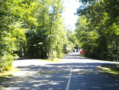
From Corbin, Kentucky, take Exit 25 from I-75, then take U.S. 25W west for 5 miles. Turn right on Kentucky 1193 and drive 2 miles. Turn right on Forest Road 558 and go 3 miles to the campground.

Phone

606-528-6156

Activities

BOATING, CAMPING, FISHING, HIKING

Keywords

GROV,LAUREL LAKE,LAUREL RIVER LAKE,GROVE RECREATION AREA,DANIEL BOONE NF-FS

Related Link(s)

Rec Area Info & Images

Forest Service Concessionaire

Kentucky State Road Conditions

Kentucky State Tourism

Overview

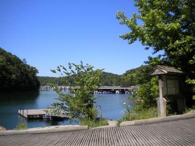
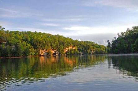
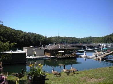
Grove Campground is perched on a forested ridge above Laurel River Lake in Kentucky’s Daniel Boone National Forest. The lake, fed by the Laurel River, is considered one of the most scenic lakes in the state. Boating, fishing, hiking and biking are greatly enjoyed by campers.

Recreation

Hikers, horseback riders and mountain bikers can trek more than 600 miles of road and trail in Daniel Boone National Forest. Duff Branch, Oak Branch, Fishing Point and Singing Hills Trails can all be accessed in the immediate area.

Anglers find prized catches of walleye, crappie, brown trout and rainbow trout at Laurel River Lake. Boating and swimming are also popular activities. A boat ramp is located nearby at Grove Marina.
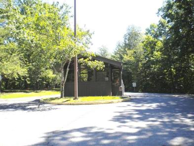
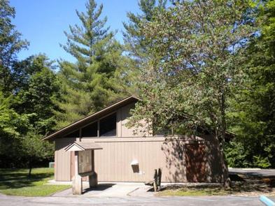
Facilities

The campground offers single and double family campsites, which have 20 and 30-amp electric hookups. Each site is equipped with a picnic table and campfire ring.

Flush toilets, drinking water and showers are provided. Ice and firewood are sold on-site. Limited groceries can be found at Grove Marina.

Natural Features

The campground overlooks the lake and is less than a mile from the shoreline. Laurel River Lake boasts 5,600 acres of deep, clear water and 192 miles of cliff-lined shores. Bountiful hills and valleys create a beautiful backdrop for the lake area.

The forest was named after Daniel Boone, a famous frontiersman and explorer who settled in Kentucky in the late 18th century.

Reservation

More from CampingHiking.net:

HUNGRY GULCH, California Campground Images, Info & Reservations

Directions From Bakersfield take Highway 178, to the town of Lake Isabella. From Lake Isabella, take Highway 155 North approximately four miles to the campground. Phone 760-376-1815 Activities CAMPING Keywords HUNG,LAKE ISABELLA,KERN VALLEY,SEQUOIA NF – FS Related Link(s) Rec Area Info & Images California State Road Conditions California State Tourism

BOULDER LAKE, Wisconsin Campground Images, Info & Reservations

Directions From Townshed, travel Highway T for about 17 miles to the intersection with Highway W. Turn onto Highway W and continue just over a mile to Forest Road 2116. Turn right and continue to the campground. Phone 715-276-6333 Activities BOATING, CAMPING, FISHING, WATER SPORTS, DAY USE AREA, SWIMMING SITE

MOOSE LAKE, Wisconsin Campground Images, Info & Reservations

Directions From Hayward, Wisconsin, drive east on State Highway 77 about 28 miles. Turn right onto Forest Service Road 174 and continue about a mile, then turn right onto Forest Service Road 176. After about 5 miles turn right again and drive less than 2 miles to the campground. Phone

MEADOW LAKE CAMPGROUND, Idaho Campground Images, Info & Reservations

Directions From Leadore drive 17 miles south on Highway 28 and turn right (west) on to Forest Service Road #002 at the old Gilmore Townsite. Follow the gravel road for 6 miles as it climbs 2,080 feet to the campground. Phone RECREATION PERSONNEL (208)756-5209 OR LEADORE OFFICE (208)768-2500 Activities CAMPING,

ANTELOPE, Idaho Campground Images, Info & Reservations

Directions From Horseshoe Bend, Idaho, take State Highway 52 for 9 miles, then turn right on Sweet/Ola Highway and travel 16 miles to Ola. From Ola, continue 10 miles northeast on FS Rd 618, then make a right on FS Rd 626 and follow it for 7 miles. Make a