JEMEZ FALLS (NM) PICNIC AREA, NM Campground Reservation, Info, Images, Map, Directions

JEMEZ FALLS (NM) PICNIC AREA, New Mexico Campground Images, Info & Reservations

Listen

Directions

From Jemez Springs, New Mexico, travel 15 miles northeast on State Road 4 to Forest Road 133 South. Continue approximately 1.5 miles to the day-use area.

Phone

(575) 829-3535

Activities

CAMPING, FISHING, HIKING

Keywords

JEME,PICNIC AREA JEMEZ FALLS,SANTA FE NF – FS

Related Link(s)

Rec Area Info & Images

New Mexico State Road Conditions

New Mexico State Tourism

Overview

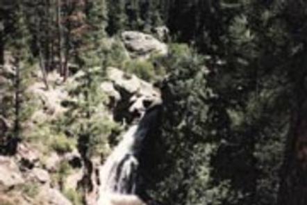
Jemez Falls Picnic Area is great place to spend the day, especially when planning a day hike to nearby Jemez Falls on the Jemez District of the Santa Fe National Forest. The lands are known for immense cultural heritage of the Jemez people, as well as a therapeutic natural warm springs.

Recreation

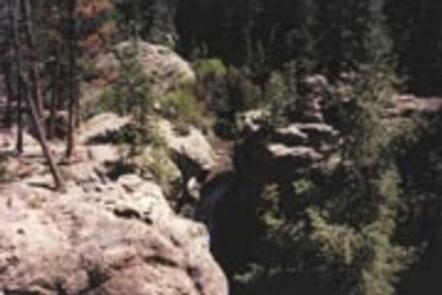
A trailhead to Jemez Falls is located within the day-use area. It leads to both Jemez Falls and McCauley Warm Springs. Visitors also enjoy fishing the Jemez River, a small trout stream stocked with catchable rainbow trout.

Facilities

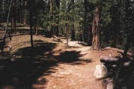
The accessible picnic area is equipped with a shelter, tables and large grills. Accessible vault toilets and trash collection are provided. The site can accommodate up to 100 people. A large parking area is on-site.

Drinking water is not provided in the day-use area, but is available at nearby campgrounds and facilities, including Battleship Rock, Vista Linda and the Jemez Ranger Station.

Natural Features

The picnic area is situated in a forested area at an elevation of 7,880 feet. Nearby Jemez Falls cascades 70 feet over a rocky cliff surrounded by boulders and pines.

Nearby Attractions

The picnic area is located 15 miles northeast of Jemez Springs, New Mexico.

Reservation

More from CampingHiking.net:

HEART BAR CAMPGROUND, California Campground Images, Info & Reservations

Listen Directions From I-10 in San Bernardino, take the Alabama exit in the city of Redlands to Lugonia Avenue (State Highway 38). Travel northeast on Highway 38 for approximately 30 mile,s to Forest Route IN02. Continue less than a mile to the campground. Phone 909-866-8550 Activities BIKING, CAMPING, FISHING, HIKING

STONY CREEK SEQUOIA, California Campground Images, Info & Reservations

Listen Directions From Fresno, California, go east on Highway 180 to the Kings Canyon National Park entrance. Take a right at the Generals Highway, traveling approximately 10 miles south to Stony Creek Campground. Phone 559-335-2232 Activities CAMPING, DAY USE AREA Keywords STCR,GIANT SEQUOIA NAT. MONUMENT,STONEY CREEK SEQUOIA,SEQUOIA NF – FS

DEMOTTE, Arizona Campground Images, Info & Reservations

Listen Directions From Kanab, UT the facility is 40 miles (35 miles from Fredonia, AZ) south on U.S. Route 89A to AZ State Route 67, at Jacob Lake. Then south 25 miles on AZ State Route 67 to DeMotte campground. From Bitter Springs intersection of U.S. 89 and 89A. Take

TREE OF HEAVEN CAMPGROUND, California Campground Images, Info & Reservations

Listen Directions Take I-5 to exit 786 for Highway 96 (Klamath River Highway). Follow Highway 96 for 4 miles until you see the sign for Tree of Heaven Campground. Turn left into the campground on road 46N90. Phone 530-493-2243 Activities CAMPING, FISHING, HIKING, WILDLIFE VIEWING, DAY USE AREA, SWIMMING, WHITEWATER