
Directions
From Enumclaw, Washington, drive approximately 33 miles southeast on State Highway 410 toward Mount Rainier National Park.
Phone
360-804-1103
Activities
BOATING, CAMPING, FISHING, HIKING
Keywords
SILS,MT. BAKER-SNOQU NF – FS
Related Link(s)
Washington State Road Conditions
Overview
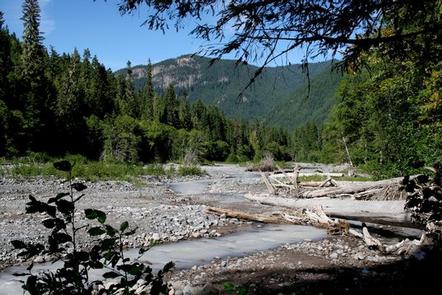
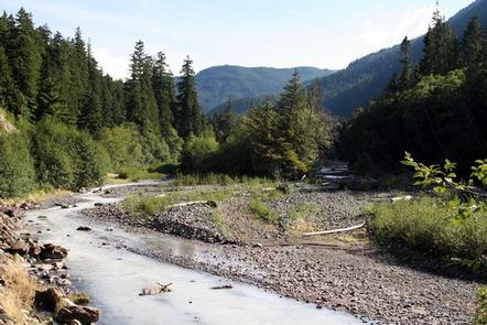
Silver Springs Campground is situated on the banks of the scenic White River in Mt. Baker-Snoqualmie National Forest, just outside Mt. Rainier National Park’s North Arch entrance. Silver Springs offers visitors stunning scenery and access to a multitude of recreational activities.
Recreation
The White River sustains populations of salmon and trout, making it a great spot for fishing. A natural spring flows through the campground as well.
Hiking and climbing top the list of recreational activities in the surrounding area. The 0.5-mile, accessible John Muir Nature Trail begins at nearby Dalles Campground. Visitors enjoy gazing up the "Big Tree," at an old-growth Douglas fir tree inside Dalles. This giant measures 9.5 feet in diameter and is over 700 years old. The tree stands at the beginning of the Dalles River View Trail, originating at the west end of the campground loop.
Local Crystal Mountain Trail begins about five miles southwest of the campground. It climbs 1,600 feet in elevation through clear-cut areas and second-growth forest before breaking out to expansive views of the White River Valley and Mt. Rainier. The trail continues to climb along the ridge, showcasing wildflowers in early June and huckleberries in early August.
Facilities
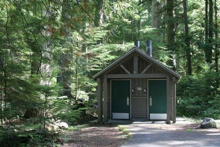
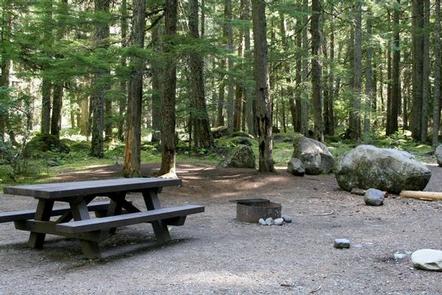
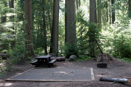
Silver Springs Campground offers both standard and accessible sites and accommodates tents or RVs. A group picnic shelter is also available. Picnic tables and campfire rings with grills are provided, as are flush and vault toilets and drinking water. No electrical hookups are available.
Natural Features
The campground’s widely-spaced sites are scattered in a beautiful section of old-growth forest, where many sit on the banks of the White River, which is sourced by flowing water from ice caves at the base of Emmons Glacier on Mt. Rainier.
The Mt. Baker-Snoqualmie National Forest showcases rugged peaks, sparkling alpine lakes and old-growth forests. Several designated wilderness areas surround the forest.
Mt. Rainier, the highest peak in Washington and the Cascades Range, dominates the landscape on clear days. The volcano rises to an elevation of 14,411 feet and is perpetually snow-capped, boasting a total of 36-square miles of snowfields and glaciers.
Wildlife in the area ranges from mountain goats in the higher elevations to porcupines and pine martens in the forests. Migratory birds and native fish find ample habitat in the varied ecosystems.
Nearby Attractions
Mount Rainier National Park offers fantastic glimpses of glaciers, subalpine ecology and volcanic landscapes. Hiking trails and scenic drives crisscross the park.
Visit or stay in one of the historic lookouts in the area. Lookouts are tangible symbols of Forest Service heritage, perched on high peaks with unobstructed views where they have been used throughout the years to detect fires in remote forest lands.