GREEN SPOT EQUESTRIAN GROUP CAMP, CA Campground Reservation, Info, Images, Map, Directions

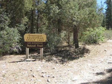
GREEN SPOT EQUESTRIAN GROUP CAMP, California Campground Images, Info & Reservations

Directions

From the Big Bear Ranger Station, turn left on Highway 38 and proceed 3 miles east to Greenway. Turn right and continue past the airport to the signal at Big Bear Boulevard. Turn right and continue on Highway 38 for almost 4 miles to Forest Route 2N93. Turn right on Forest Route 2N93 and continue a half-mile to the second dirt road on the left (not marked). Proceed up the road about 50 yards to the campground.

Phone

909-866-8550

Activities

BOATING, CAMPING, FISHING, HIKING, SWIMMING SITE

Keywords

GRES,SAN BERNARDINO NF – FS

Related Link(s)

Rec Area Info & Images

California State Tourism

California State Road Conditions

Overview

Green Spot Equestrian Group Campground provides access to a number of recreational activities in the area, namely horseback riding trails. The large campground gives campers and horses ample space to move around and enjoy the scenic surroundings.

Recreation

Visitors enjoy a variety of recreational opportunities, including fishing, boating and swimming at the nearby Big Bear Lake. Access to the Sugarloaf National Recreation Trail is also available near the campground. It is a fairly difficult trek to the highest point in Big Bear Valley, and a climb to an altitude of 9,952 feet.

Facilities

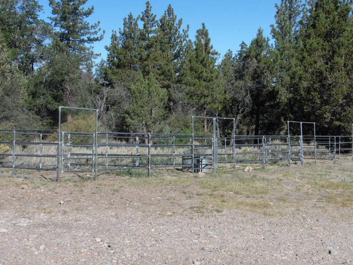
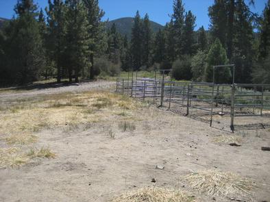
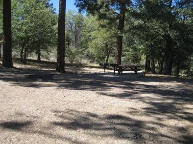
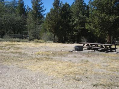
The campground offers just one large group campsite that can accommodate up to 25 people and eight vehicles. The site is equipped with tables and campfire rings with grills. Vault toilets are provided, but drinking water and trash collection are not available. The campground offers five horse corrals that can hold up to 10 horses. Non-potable water is available for livestock.

Natural Features

The campground is located in the San Bernardino Mountains at an elevation of 7,224 feet. It is situated in a pinyon pine and juniper forest carpeted with grassy meadows. The road to the campground is rough and rocky, suitable for four-wheel drive vehicles.

Nearby Attractions

The campground is approximately 45 minutes from San Bernardino.

Reservation

More from CampingHiking.net:

MUD LAKE CAMPGROUND, Oregon Campground Images, Info & Reservations

Directions From Baker City, Oregon, head north on Highway 30 toward Haines for approximately 10 miles. In Haines, turn left and follow the Anthony Lake Highway signs (turns into Forest Road 73 and Elkhorn Scenic Byway) for 25 miles to the Anthony Lake Recreation Area. Turn right into the campground

ISLAND PARK, California Campground Images, Info & Reservations

Directions From Fresno, California, travel east on Highway 180/Kings Canyon Highway to Academy Avenue. Turn left onto Academy Avenue, and then turn right on Belmont Avenue. Continue traveling for approximately 20 miles; the entrance to Island Park Recreation Area is on the right. NOTE: Belmont Avenue becomes East Trimmer Springs

NANCYTOWN GROUP CAMPGROUND, Georgia Campground Images, Info & Reservations

Directions From Interstate 85 in Georgia, merge onto Interstate 985 via exit 113. Interstate 985 will eventually become State Highways 441/365. Continue north for about 5 miles to Cornelia, then take the Clarkesville/Highway 197 exit and turn right. Turn right again at Dick’s Hill Parkway. Continue approximately a mile and

EUREKA, Kentucky Campground Images, Info & Reservations

Directions From Nashville, Tennessee take I-24 West to Exit 40. Turn left onto Highway 62 West for 2.9 miles then turn left onto Highway 810. Go 0.7 miles then turn right onto State Route 1271. Continue onto 1271 for 1.8 miles. The road leads directly into the campground. Phone 270-388-9459

ELK CREEK CAMPGROUND, Colorado Campground Images, Info & Reservations

Directions Elk Creek is located off of US Hwy 50 between Gunnison and Montrose, along Blue Mesa reservoir. Phone 970-641-2337 Activities BIKING, BOATING, CAMPING, INTERPRETIVE PROGRAMS, FISHING, HIKING, HUNTING, VISITOR CENTER, WATER SPORTS, WILDLIFE VIEWING, DAY USE AREA, SWIMMING SITE Keywords ELKC,CURECANTI NATIONAL RECREATION,ELK CREEK CURECANTI NRA,CURECANTI Related Link(s) Rec

Fish Dam Creek Park, North Carolina Campground Images, Info & Reservations

Directions From Charlotte, North Carolina , take I-77 North (approximately 60 miles) before merging onto Highway 421 North towards Wilkesboro/Boone. Continue to Exit 286B (approximately 20 miles), turn left onto Highway 268 and continue for approximately 3.5 miles. Turn right onto Reservoir Road. Continue on Reservoir Road across the dam