


Directions
From Seattle, Washington, go north on I-5 to Everett. Take Exit 194 onto Hwy 2. At Hwy 204, go north to Lake Steven. Turn north on Hwy 9. Turn east on Hwy 92 to Granite Falls on Hwy 7 Scenic Byway.
Phone
360-804-1103
Activities
CAMPING
Keywords
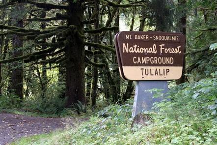
TULA,MT. BAKER-SNOQU NF – FS
Related Link(s)
Washington State Road Conditions
Overview
Situated a short distance from the banks of the Stillaguamish River and in close proximity to several wilderness areas, Tulalip Group Campground offers visitors the opportunity to experience both the serene and wild aspects of the Cascade region in Mt. Baker-Snoqualmie National Forest.
Surrounded by stands of diverse forest and located in an open, flat area along the scenic Mountain Loop Road, this site is ideal for small group camping excursions.
Recreation
In addition to being a prime location for hiking, fishing, picnicking, and horseback riding in summer and early fall, visitors can take advantage of skiing and snowshoeing in the winter months.
Anglers will enjoy fishing from the gently-flowing Stillaguamish River or neighboring Old Mill Pond. The Stillaguamish sustains a large salmon and trout population including chinook, coho, chum, pink, and sockeye salmon, steelhead trout, sea-run cutthroat and bull trout.
Fishing is best in the summer months, though crisp, autumn evenings provide a delightful backdrop for those looking to cast a line in greater solitude.
Facilities
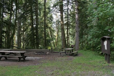
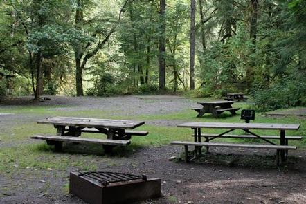
There is only one site at the campground, making it a perfect setting for groups and family gatherings.
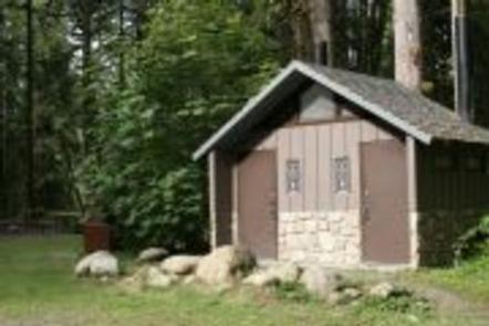
The site is equipped with tables and campfire rings with grills. Vault toilets are available, but there is no drinking water. Visitors must bring their own water.
River access is available via a short trail from the campground.
Natural Features
The Mt. Baker-Snoqualmie National Forest offers visitors the chance to explore the region’s rugged peaks, scenic rivers, and exciting wildlife in the forest and surrounding designated wilderness areas.
On banks of the Stillaguamish River, visitors can explore portions of the unique ecosystems typical of the area. Old-growth forests of cedar, fir, and hemlock line the wide, gently-flowing river and tower over trails of underbrush and spring flowers.
On a clear day visitors will see Mt. Baker, the most prominent feature of the Mt. Baker Wilderness Area. Rising to an elevation of 10,781 feet, the active volcano from which the forest takes its name is perpetually snow-capped and mantled with an extensive network of creeping glaciers. Mt. Baker’s summit, Grant Peak, is actually a 1,300-foot-deep mound of ice, which hides a massive volcanic crater.
Undeveloped wilderness, clean streams and diverse forests provide important habitat for wildlife to thrive in this region, including lynx, moose, wolves and wolverine.
Nearby Attractions
Visit or stay in one of the historic lookouts in the area. Lookouts are tangible symbols of Forest Service heritage, perched on high peaks with unobstructed views, where they have been used throughout the years to detect and control fires in remote wildlands.
Take some time to visit North Cascades National Park or Mt. Rainer National Park to learn about the diverse landscape and history of the area through interpretive programs and exhibits.
Traverse at least a portion of the spectacular Pacific Crest Trail (PCT), one of the world’s premier National Scenic Trails. This trail showcases some of North America’s most fantastic scenery, winding its way its way from Mexico to Canada through California, Oregon and Washington.