NORTH MILLS RIVER, NC Campground Reservation, Info, Images, Map, Directions

NORTH MILLS RIVER, North Carolina Campground Images, Info & Reservations

Directions

From Asheville, take U.S. Highway 280 west to North Mills River Road. Follow North Mills River Road to the campground.

Phone

(828) 552-8040

Activities

CAMPING, INTERPRETIVE PROGRAMS, FISHING, HIKING, WATER SPORTS, SWIMMING SITE

Keywords

NOMR,NFs IN NORTH CAROLINA – FS

Related Link(s)

Rec Area Info & Images

North Carolina State Road Conditions

North Carolina State Tourism

Overview

North Mills River Campground is a rustic mountain getaway in Pisgah National Forest in western North Carolina. Located just outside the popular city of Asheville, the campground provides access to a variety of cultural and natural attractions, including an arboretum, the scenic Blue Ridge Parkway and numerous hiking, fishing and mountain biking opportunities.

Recreation

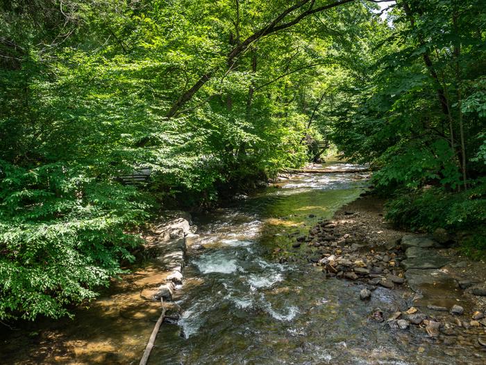
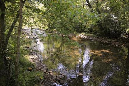
The forest is known for its hiking and mountain biking trails, several of which are near the campground. Mills River offers excellent trout fishing, as well as tubing and swimming, which are kid-friendly favorite activities. Visitors wishing to learn more about the area can attend educational programs during the summer.

Facilities

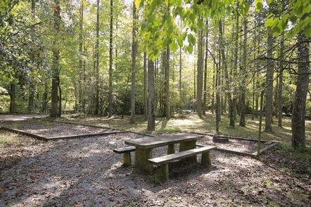
This is a relatively small facility with campsites organized into two loops on opposite sides of the river. Sites are mostly shaded and lie within a short distance of the water.

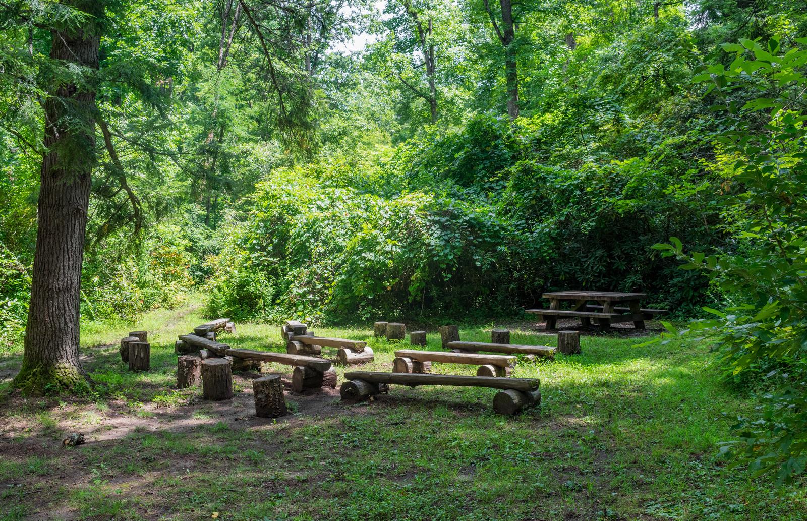
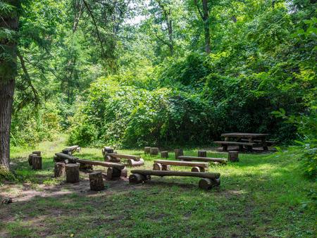
The facility provides picnic tables, tent pads, lantern posts and campfire rings with grills, in addition to restrooms with hot showers and flush toilets. Campers can purchase firewood and fire starter on-site.

Natural Features

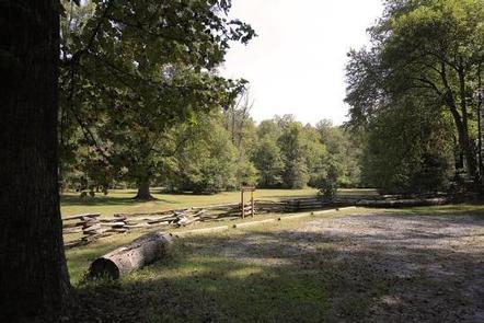
The campground is situated in the Appalachian Mountains at an elevation of 2,200 feet. The surrounding land boasts mile-high peaks, cascading waterfalls and slopes densely forested with hardwoods. The group camping area is adjacent to the beautiful, shallow waters of the Mills River.

Nearby Attractions

Several natural and cultural attractions are within close proximity to the campground. Sliding Rock, Looking Glass Falls and the scenic Blue Ridge Parkway are among the most popular sites. The small town of Brevard offers various amenities and services, and visitors can take a trip to Asheville to visit art galleries, music venues, shops and restaurants.

Reservation

More from CampingHiking.net:

PYBUS BAY CABIN, Alaska Campground Images, Info & Reservations

Directions Access to the cabin is by float plane or boat with anchor at high tide. Flight time is approximately one hour and 15 minutes from Juneau or 30 minutes from Petersburg. Access by boat via Stephens Passage or Fredrick Sound is approximately 100 miles from Juneau. Float plane or

TWIN LAKE CAMPGROUND, Utah Campground Images, Info & Reservations

Directions Travel east out of Mayfield, UT on "Canyon Road" to the Forest Service boundary of Twelve Mile Canyon. Stay on Forest Development Road 22, approximately 7.5 miles from Mayfield. Phone 435-283-4151 Activities CAMPING Keywords None Related Link(s) Rec Area Info & Images Utah State Tourism Utah State Road Conditions

COUGAR ROCK CAMPGROUND, Washington Campground Images, Info & Reservations

Directions Cougar Rock Campground is located 14 miles east of Ashford, Washington, on State Route 706/Paradise Road. Phone 360-569-6626 Activities CAMPING, INTERPRETIVE PROGRAMS Keywords CG44,Mount Rainier National Park Related Link(s) Rec Area Info & Images Washington State Tourism Washington State Road Conditions Overview Cougar Rock Campground, on the southwest side

SOUTH FORK (UT), Utah Campground Images, Info & Reservations

Directions South Fork is located approximately 7 miles east of Huntsville, Utah, on Highway 39. From I-15, take the 12th Street exit and continue through Ogden Canyon. Continue on Highway 39 toward Monte Cristo. Phone OGDEN RANGER DISTRICT 801-625-5112 OR UTAH RECREATION COMPANY 385-273-1100 OR SOUTH FORK 801-745-4446 Activities BIKING,

INDIAN RIDGE LOOKOUT, Oregon Campground Images, Info & Reservations

Directions From Blue River, OR, travel 4 miles east on Highway 126 to Aufderheide Drive/Forest Service Road (FSR) 19. Continue south on Aufderheide Drive, taking a right at the Y and climbing to the top of Cougar Reservoir. Continue south on Aufderheide Drive past Cougar Reservoir 7 miles to FSR