STATION CREEK CAMPGROUND, WY Campground Reservation, Info, Images, Map, Directions

STATION CREEK CAMPGROUND, Wyoming Campground Images, Info & Reservations

Directions

From Jackson, travel south on Highway 191/89/26 for about 13 miles, to Hoback Junction. Turn right onto Highway 26/89 and continue along the Snake River Canyon for 14 miles. The campground is on the north side of the road.

Phone

541-351-1182

Activities

BOATING, CAMPING, FISHING, HIKING, WATER SPORTS

Keywords

STCC,STATION CREEK OVERFLOW,BRIDGER-TETON NF – FS

Related Link(s)

Rec Area Info & Images

Overview

Station Creek Campground is located in beautiful Snake River Canyon, just 27 miles southwest of Jackson, in western Wyoming. It sits at an elevation of 5,800 feet. Visitors enjoy fishing and whitewater rafting on the Snake River.

Recreation

Fly-fishing for cutthroat, rainbow and brown trout is a popular activity on the Snake, as is whitewater rafting and kayaking. A boat ramp is nearby.

Facilities

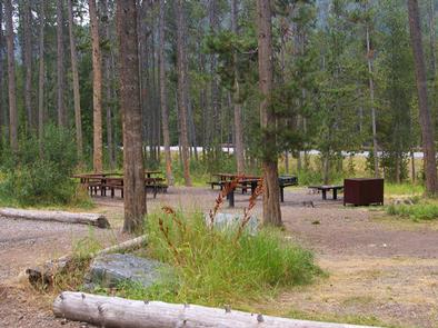
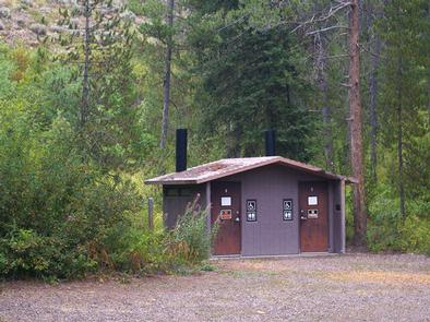
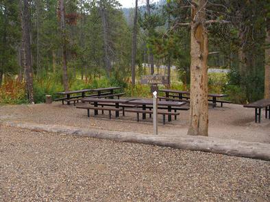
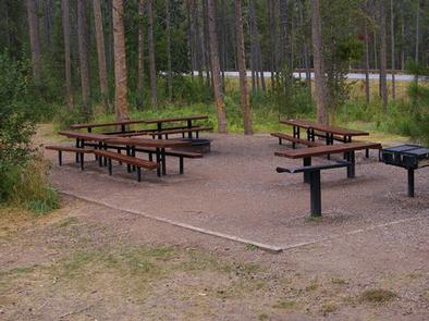
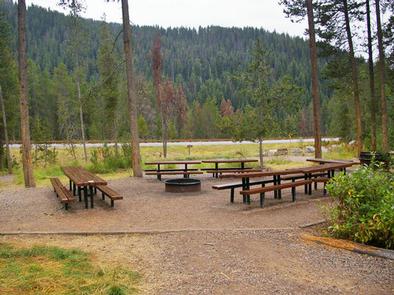
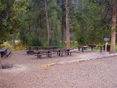
The campground offers two group campsites that can accommodate up to 40 people each. The sites are equipped with picnic and serving tables, campfire circles, grills and food storage lockers. Vault toilets and drinking water are provided, but there is no electricity. Firewood can be purchased at the campground. Large parking areas within the facility are dirt.

Natural Features

The campground is situated in a forest of lodgepole pines, which provide partial shade throughout the campground. Summer wildflowers are abundant in the area. The Snake River can be accessed across the road and down an embankment.

Nearby Attractions

The city of Jackson is 25 miles north of the campground, offering restaurants, groceries, shops, galleries and ski resorts with summer activities.

Grand Teton National Park is approximately 40 miles north, providing opportunities for boating, fishing, hiking, canoeing and outstanding mountain scenery.

Reservation

More from CampingHiking.net:

AUNTS CREEK, Missouri Campground Images, Info & Reservations

Directions From Branson, Missouri, take Highway 13 south for about 4 miles. Turn west onto Highway 00 and continue for nearly 3 miles to the campground. Phone 417-739-2792 Activities BIKING, BOATING, CAMPING, FISHING, HIKING, PICNICKING, WATER SPORTS, WILDLIFE VIEWING, DAY USE AREA, SWIMMING SITE, PHOTOGRAPHY, SWIMMING, RANGER STATION, WATER ACCESS

ANTELOPE FLAT, Utah Campground Images, Info & Reservations

Directions From Vernal, Utah, take U.S. 191 north for 54 miles to Dutch John. Continue north for 8 miles, then turn west onto Forest Road 145 and travel 4 miles to the campground. From Manila, Utah, take Highway 44 for 28 miles. Turn left on U.S. 191 and go north

La Wis Wis Campground, Washington Campground Images, Info & Reservations

Directions From Packwood, Washington, go 5 miles east on State Route 12 to Campground. Phone 541-338-7869 Activities BIKING, CAMPING, INTERPRETIVE PROGRAMS, FISHING, HIKING, WILDLIFE VIEWING, DAY USE AREA Keywords LAWI,WHITE PASS,PACKWOOD,MT RANIER,GIFFORD PINCHOT NF – FS,COHO Related Link(s) Rec Area Info & Images Washington State Tourism Forest Service Concessionaire Washington

JACK BAY CABIN, Alaska Campground Images, Info & Reservations

Directions Access to the site is by float plane or boat only. The flight is typically 15 minutes from Valdez or a 30 minutes from Cordova. To travel by boat is 20 miles from Valdez and 70 miles from Cordova. Tides influence travel to the cabin. Click here for local

LOST CREEK GROUP, California Campground Images, Info & Reservations

Directions From Redding, California drive 48 miles east on State Highway 44 to State Highway 89. Turn right into Lassen Volcanic National Park and continue five miles south to Lost Creek Group Campground. It is 1/8-mile south of Crags Campground. Phone 530 595-6121 Activities BOATING, HISTORIC & CULTURAL SITE, CAMPING,