WARM LAKE, ID Campground Reservation, Info, Images, Map, Directions

WARM LAKE, Idaho Campground Images, Info & Reservations

Directions

From Boise, Idaho, travel 85 miles north on Highway 55 to Cascade. Turn east on Warm Lake Highway and travel 25 miles to Forest Road 579KA. Turn south and travel a short distance to the campground.

Phone

208-382-7400

Activities

BIKING, BOATING, CAMPING, FISHING, HIKING, WILDLIFE VIEWING, SWIMMING SITE

Keywords

WARM,FOREST SERVICE CASCADE RGR DIS,IDAHO CASCADE WARM LAKE,WARM LAKE LODGE,BOISE NF – FS

Related Link(s)

Rec Area Info & Images

Idaho State Road Conditions

Idaho State Tourism

Overview

Warm Lake Campground is near the eastern shore of beautiful Warm Lake, at an elevation of 5,300 feet. Visitors enjoy boating, fishing, swimming, hiking and viewing local wildlife.

Recreation

Warm Lake offers great fishing opportunities for cutthroat, rainbow, lake and bull trout. Boating, canoeing and swimming are popular activities. A developed swim beach is available less than a quarter-mile away, at Warm Lake Lodge.

Billy Rice Swim Beach is just over a mile from the campground, on the north side of the lake. The area offers a day-use site for picnicking and swimming. A boat ramp is located at nearby Shoreline Campground.

The surrounding area offers great hiking, mountain biking, horseback and off-road vehicle riding, and hunting. The WeWuKiye (Wa Wu Kia) Trail No. 252 was recently built and can be accessed at Shoreline Campground. It is popular for hiking and mountain biking.

For off-road vehicle enthusiasts, Telephone Ridge Trail No. 112 offers 20 miles of trails for all riding levels, with staging areas within the campground and up the road at Shoreline Campground.

Facilities

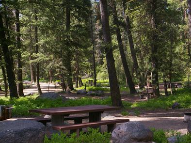
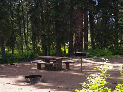
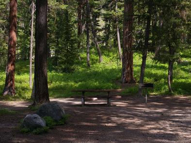
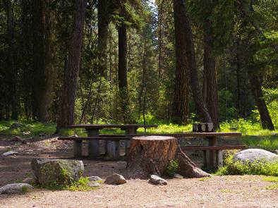
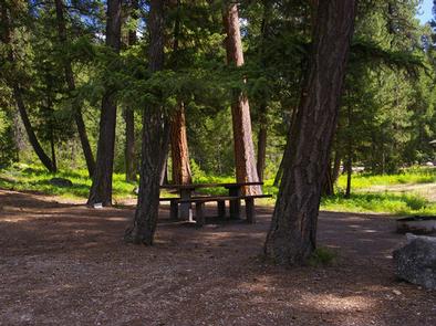
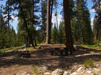
This small campground provides campsites equipped with a picnic table, campfire ring and grill. Vault toilets, drinking water and trash collection are provided at the campground, but electricity is not available.

Roads and parking spurs within the facility are gravel. The lake is not visible from the campground.

Natural Features

The campground is situated in a scenic forest of towering, old-growth ponderosa pine, which provides partial shade in the campground. Chipmunk Creek runs alongside the campground. Summer wildflowers are abundant.

A variety of wildlife including bears, deer, elk, fox, grouse, eagles, osprey, grosbeaks, whooping cranes and otters, lives around the lake.

Nearby Attractions

Warm Lake Lodge is located across the road from the campground and has a restaurant and small store with camping and fishing essentials.

Reservation

More from CampingHiking.net:

BIG HART (DAY-USE SHELTER), Georgia Campground Images, Info & Reservations

Directions From Thomson, Ga, travel 10 miles west on US-78, then 6 miles north on park access road. Park is located in McDuffie, GA. Phone 800-533-3478 Activities BOATING, FISHING, PICNICKING, DAY USE AREA, SWIMMING SITE, WATER ACCESS Keywords BHAT,J STROM THURMOND LAKE Related Link(s) Rec Area Info & Images Georgia

DUCK CREEK, Utah Campground Images, Info & Reservations

Directions Take Highway 14 from Cedar City, Utah, 28 miles east to Duck Creek campground. Campground turnoff will be on the left hand side of the highway, before you reach Duck Creek Village. Phone 801-226-3564 Activities BIKING, BOATING, CAMPING, FISHING, HIKING, HUNTING, VISITOR CENTER, WILDLIFE VIEWING, PHOTOGRAPHY, MOUNTAIN BIKING, CANOEING,

KADAKE BAY CABIN, Alaska Campground Images, Info & Reservations

Directions Access is by boat (13 miles from Kake), or float plane (39 miles from Petersburg). Float planes generally land near the mouth of the bay and require up to a 2-mile hike across the tide flat. An 18-foot or higher tide is required for direct boat or float plane

NORTH DICKEY LAKE, Montana Campground Images, Info & Reservations

Directions From Eureka, travel south on Highway 93 for approximately 13 miles to Fortine. Continue south on Highway 93 for over a mile to the campground. Phone 406-296-2536 Activities BIKING, BOATING, CAMPING, FISHING, HIKING, WATER SPORTS, SWIMMING SITE Keywords NODI,DICKEY LAKE,KOOTENAI NF – FS Related Link(s) Rec Area Info &

PORUM LANDING, Oklahoma Campground Images, Info & Reservations

Directions From Porum, Oklahoma, take Texanna Road west for 7 miles, then follow signs to the campground. Phone 918-799-5843 Activities BOATING, CAMPING, FISHING, HIKING, SWIMMING SITE Keywords PORU,EUFAULA LAKE,EUFAULA LAKE Related Link(s) Rec Area Info & Images Oklahoma State Road Conditions Oklahoma State Tourism Overview Porum Landing Campground sits along

PALISADES RANGER RESIDENCE CABIN, Arizona Campground Images, Info & Reservations

Directions Driving Directions: From northeast Tucson, take East Tanque Verde Road to East Catalina Highway. Turn left (north) on East Catalina Highway, which becomes the General Hitchcock Highway, for approximately 23 miles to Organization Ridge Road and turn left (just before Palisades Visitor Center). The cabin is located approximately 100