
Directions
Boat transportation can be arranged with Island Packers from Ventura Harbor. To park headquarters in Ventura, Ca: exit Highway 101, at Victoria or Seaward to Ventura Harbor.
Phone
805-658-5730
Activities
BOATING, HISTORIC & CULTURAL SITE, CAMPING, INTERPRETIVE PROGRAMS, FISHING, HIKING, PICNICKING, VISITOR CENTER, WATER SPORTS, WILDLIFE VIEWING, WILDERNESS, INFORMATION SITE, PHOTOGRAPHY, SWIMMING, SNORKELING, BEACHCOMBING, SEA KAYAKING, BIRDING, WATER ACCESS, EVENING PROGRAMS, GUIDED INTERPRETIVE WALKS, SAILING, SCUBA DIVING, WHALE WATCHING
Keywords
CG10,SANTA CRUZ ISLAND SCORPION,SANTA CRUZ,CHANNEL ISLANDS,CHANNEL ISLAND,SCORPION,Channel Islands National Park
Related Link(s)
California State Road Conditions
National Park Services Concessionaire
Overview
Fantastic ocean views and relaxing beach time is practically guaranteed at Scorpion Canyon Campground, the most family-friendly campsite on Santa Cruz Island. Set on the eastern part of the island, the campground is a short hike from the pier and is sheltered from harsh ocean winds. The largest of California’s Channel Islands, Santa Cruz Island is one of the five islands that make up the Channel Islands National Park. The island is rich in cultural history, magnificent landscapes, and unique flora and fauna. Native American Indians inhabited the island for over 10,000 years and Europeans explored and ranched on the island for over 150 years. Over 600 plant species, 140 land birds, 11 land mammals and a handful of amphibians and reptiles call the island their home. The island fox and island scrub-jay are exciting finds, as they’re unique to the island, found nowhere else in the world. For more information about Santa Cruz Island visit: https://www.nps.gov/chis/planyourvisit/santa-cruz-island.htm .
Recreation
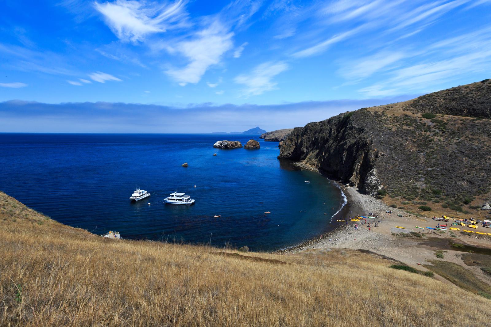
With its easy beach access and generally good weather, this area offers the most recreational activities in the park, including hiking, swimming, snorkeling, diving, kayaking and wildlife/wildflower viewing. There are no services on the island, so all gear has to be brought to the island. Guided kayak trips and kayak rentals must be arranged before arriving on the island. For more information about recreational activities in the park, visit https://www.nps.gov/chis/planyourvisit/index.htm.
Facilities
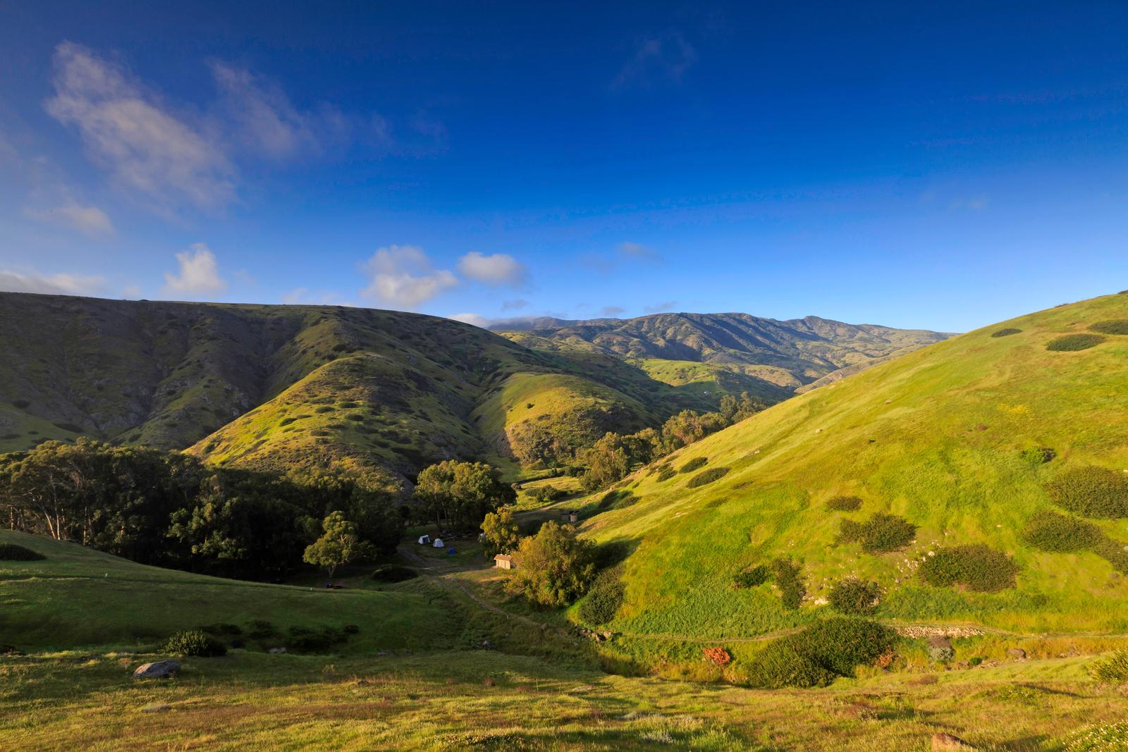
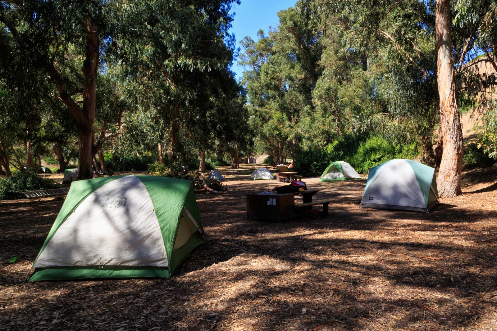
Primitive camping is available at Scorpion Canyon Campground with 25 individual sites which accommodate up to six persons per site; and six group sites with up to 15 persons per site. Picnic table, food storage box, pit toilet, and water are provided. The campground is a flat 1/2 mile to 1 mile hike from the pier. Access to the island is by Island Packers Cruises or by private boat.
Natural Features
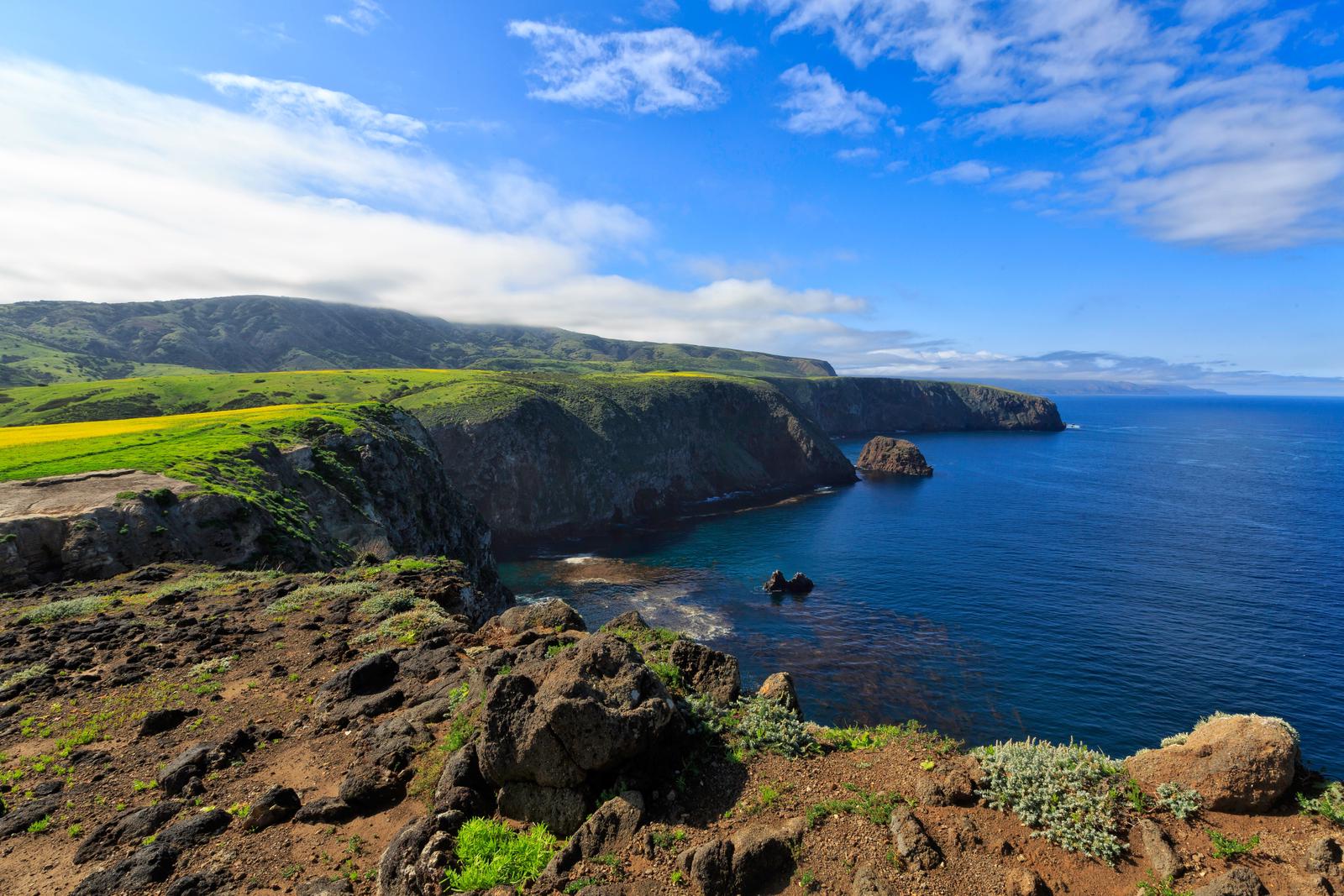
The beach near the campground is a mix of sand and rocks, and faces the Santa Barbara Channel. The campground is located in a valley with a mixture of trees and shrubs. Rugged mountain peaks rise above the campground to 1,808 feet.
Nearby Attractions
Hiking options are unlimited and offer spectacular coastal views. Try the 2 mile round-trip Cavern Point Loop hike for views of the island’s mountain peaks, and the southern California coastline. This popular hike takes you past antique ranching equipment and historic buildings for a taste of island ranch history. For more advanced hikers, tackle the 7.5-mile round-trip hike from the campground to Smugglers Cove.