OCRACOKE CAMPGROUND, NC Campground Reservation, Info, Images, Map, Directions

OCRACOKE CAMPGROUND, North Carolina Campground Images, Info & Reservations

Directions

The campground is located off North Carolina Route 12, three miles east of Ocracoke Village and ten miles west of Hatteras inlet ferry terminal.

Phone

252-928-6671

Activities

BOATING, CAMPING, FISHING, VISITOR CENTER, SWIMMING SITE

Keywords

CG04,OCRACOKE Campground,Cape Hatteras National Campgrounds,OCRACOKE,OCRACOKE

Related Link(s)

Rec Area Info & Images

North Carolina State Road Conditions

North Carolina State Tourism

Overview

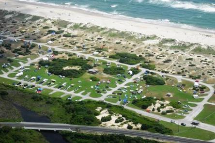
Located in the famous Outer Banks area of the stunning North Carolina coast, this campground is perfect for a beach getaway trip.

Recreation

The seashore provides a place for active recreation or for quiet reflection. Campers can visit a lighthouse, look for seashells, go fishing and clamming or just sit back and enjoy the peace and beauty of the white sandy beaches.

More active recreational activities include swimming, kayaking and windsurfing.

Bird and wildlife viewing is also a popular pastime for campers. The seashore provides a home and habitat for creatures large and small, on land and in the water.

Facilities

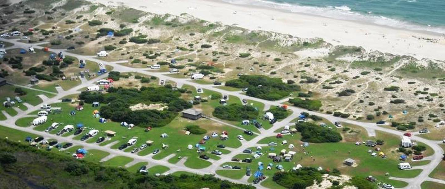
Ocracoke Campground is only accessible by ferry or aircraft. Campsites are located on sandy soil, so campers are encouraged to bring extra long tent stakes. Flush toilets, drinking water, cold showers and grills are all provided for a more comfortable beach camping experience.

The campground is conveniently located on the ocean side, separated from the beach by barrier dunes.

Natural Features

Ocracoke Campground sits on a barrier island along the Cape Hatteras National Seashore. The shore a recreational oasis for beach lovers. This ribbon of sand provides some of the most dazzling scenery that the Atlantic coast has to offer.

Nearby Attractions

Nearby Ocracoke Village offers restaurants, gift shops, grocery stores, a gas station and tackle shop.

Reservation

More from CampingHiking.net:

FROG LAKE, Oregon Campground Images, Info & Reservations

Directions From Sandy, travel 62 miles east on Highway 26, then continue 1 mile west through the Sno-Park on Forest Road 2610. Phone 503-630-5721 Activities BIKING, BOATING, CAMPING, FISHING, HIKING, WILDLIFE VIEWING, SWIMMING SITE Keywords FROG,MT. HOOD NF – FS Related Link(s) Rec Area Info & Images Forest Service Concessionaire

ONEGUME, Minnesota Campground Images, Info & Reservations

Directions Onegume is located on State Highway 46, approximately 18 miles northwest of Deer River, Minn. Phone 218-246-2123 Activities BIKING, BOATING, CAMPING, INTERPRETIVE PROGRAMS, FISHING, HIKING, WATER SPORTS Keywords ONEG,CHIPPEWA NF – FS Related Link(s) Rec Area Info & Images Minnesota State Tourism Minnesota State Road Conditions Overview Onegume Campground

PETERSBURG, Georgia Campground Images, Info & Reservations

Directions From I-20, take Exit 183 (Appling). Go north on HWY 221 approximately 6 miles. At the 4-way stop, go straight (HWY 221) another 2 miles. Campground road is on the left. Follow signs. Phone 706-541-9464 Activities CAMPING Keywords PETB,J STROM THURMOND LAKE Related Link(s) Rec Area Info & Images

ROCK CREEK – SIUSLAW, Oregon Campground Images, Info & Reservations

Directions From Yachats, Oregon, take Highway 101 south about 10 miles. Look for campground sign and turn left. Phone 541-547-5219 Activities CAMPING, FISHING, HIKING, WILDLIFE VIEWING, BERRY PICKING, BIRDING Keywords ROOR,ROCK CREEK SIUSLAW,SIUSLAW NF – FS,ROCK CREEK CAMPGROUND Related Link(s) Rec Area Info & Images Oregon State Tourism Forest Service