COSSATOT REEFS, AR Campground Reservation, Info, Images, Map, Directions

COSSATOT REEFS, Arkansas Campground Images, Info & Reservations

Directions

From De Queen, Arkansas, head north on US-59/US-71. Continue for nearly 10 miles and turn Right at Gillham EZ-Mart. Turn right on Tower Road; go 1.3 miles turn left onto Gillham Lake road; go 4.3 miles turn right and follow signs into the campground.

Phone

870-386-7261

Activities

BOATING, CAMPING, FISHING, HUNTING, WATER SPORTS

Keywords

COSS,GILLHAM LAKE,GILLHAM LAKE

Related Link(s)

Rec Area Info & Images

Arkansas State Tourism

Arkansas State Road Conditions

Overview

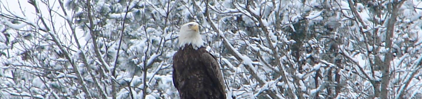
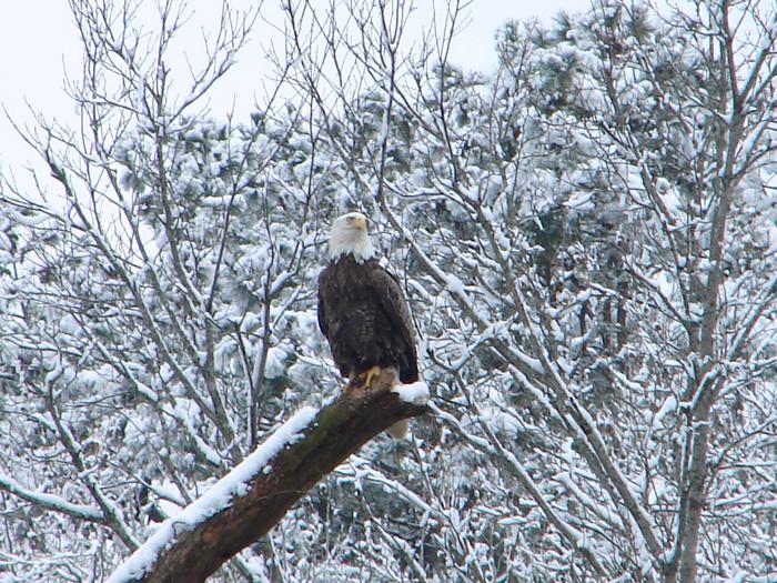
Cossatot Reefs Campground sits along the lush banks of Gillham Lake in southwest Arkansas.

Nicknamed the "Bright Spot on the Cossatot," Gillham Lake is a recreational oasis for outdoor enthusiasts.

Recreation

Visitors enjoy the lake for its vast boating opportunities, and a boat ramp is provided for easy water access. The river can be canoed from a point below the dam to U.S. Highway 71 South, a distance of about 16 miles. For shorter canoe trips, there are access roads to the river at Mize Crossing and Ladd Bridge.

Anglers will find smallmouth, largemouth, and spotted bass, crappie, channel and flathead catfish and various species of sunfish in the river. Fly fishing is also a popular pastime.

A short nature trail within the campground weaves through a quaint wooded section. In spring, the trail is painted with colorful redbud and dogwood blossoms.

Facilities

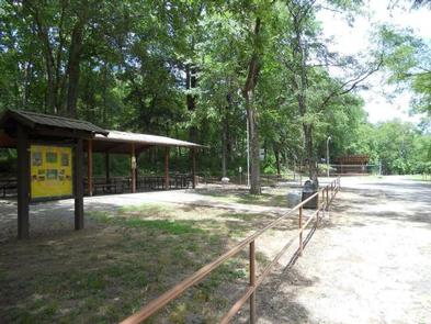
Cossatot Reefs offers 31 shady campsites, including a large group shelter. Hot showers, drinking water and flush toilets help create a comfortable camping experience.

Natural Features

Gillham Lake spans 1,370 surface acres and boasts 36 miles of shoreline. The lake stems from the Cossatot River, designated as a National Wild and Scenic River.

Reservation

More from CampingHiking.net:

WISH POOSH CAMPGROUND, Washington Campground Images, Info & Reservations

Directions From Seattle, take I-90 East to exit 80, then take a left on Bullfrog Road, then head north on County Road 903. The campground is on the left after approximately 8 miles. Phone 509-852-1100 Activities BIKING, BOATING, FISHING, PICNICKING, SWIMMING, KAYAKING Keywords WISH POOSH CAMPGROUND (IL) Related Link(s) Rec

OAK GROVE PICNIC AREA, Iowa Campground Images, Info & Reservations

Directions Physical Address: 4801 NW 98th Ave, Polk City, IA 50226 From Ankeny, travel 3.4 miles west on 1st Street. Turn right onto HWY 415 for 0.9 miles, then left onto NW 44th street, which turns slightly right and becomes NW 98th Ave. Picnic area is on the right. Phone

BASIN STATION CABIN, Montana Campground Images, Info & Reservations

Directions Summer directions from West Yellowstone: Proceed west on U.S. Highway 20 for approximately 6.5 miles. Turn right on Denny Creek Road and continue approximately two miles north. The cabin is located on the right side of the road. Winter directions from West Yellowstone: Proceed west on U.S. Highway 20

Marble Creek Campground, Washington Campground Images, Info & Reservations

Directions From Seattle, take I-5 north for about 42 miles. Exit onto WA-530 East, then continue east on Highway 20 for about 40 miles. At the town of Marblemount, cross the bridge over the Skagit River and continue east approximately 8 miles to the Marble Creek Campground. Phone 360-804-1103 Activities