JOHN F KENNEDY, AR Campground Reservation, Info, Images, Map, Directions

JOHN F KENNEDY, Arkansas Campground Images, Info & Reservations

Directions

From Heber Springs, AR, take SR-25 north 4 miles, cross the dam, and turn right on the second road.

Phone

501-250-0481

Activities

CAMPING, WILDLIFE VIEWING

Keywords

JOHN,JFK,GREERS FERRY LAKE,GREERS FERRY LAKE

Related Link(s)

Rec Area Info & Images

Arkansas State Tourism

Arkansas State Road Conditions

Overview

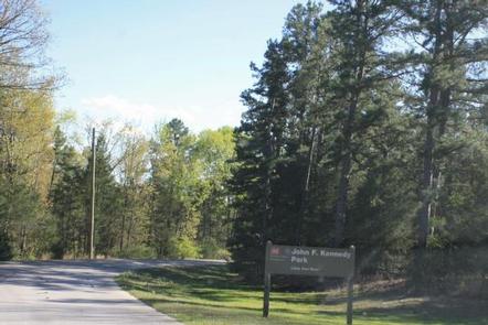
John F. Kennedy Campground is located on the Little Red River just downstream of Greers Ferry Dam in the beautiful Ozark Mountains of north-central Arkansas.

In his last major appearance before his death, President John F. Kennedy stood on a flag-draped platform overlooking the just-completed Greers Ferry Dam and spoke of the prosperity the lake would bring to the region.

Today, a million visitors flock yearly to the scenic waters for family camping, fishing, boating and hiking.

Recreation

Greers Ferry Lake is an outdoor enthusiasts’ dream, with boating, sailing, water skiing, swimming, scuba diving and fishing opportunities. Hikers enjoy the area’s three National Nature Trails and one multi-purpose, fitness trail.

The William Carl Gardner Visitor Center is just west of the dam, with exhibits, a children’s touch table, and a replica of the world record 40 lb. 4 oz. brown trout caught in the Little Red River downstream of the center.

Facilities

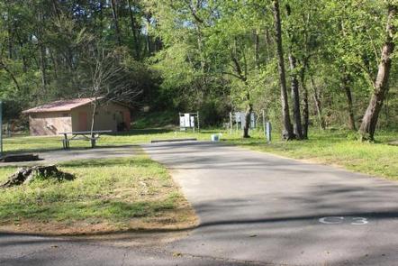
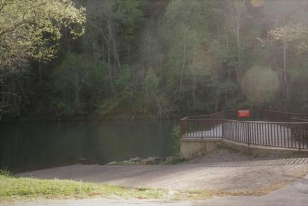
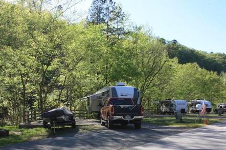
This campground offers 73 sites with electrical hookups, 13 of which also have water hookups. Additional amenities include flush toilets, showers, a dump station, picnic shelter and a boat ramp.

Natural Features

A dense mix of red cedar, black gum, red oak, elm, pecan and sweet gum trees forest the area, providing shade in the summer months and beautiful fall colors in autumn.

Wildlife is plentiful around Greers Ferry Lake. Visitors commonly see white-tailed deer, wild turkeys, rabbits, squirrels and a wide variety of birds.

Nearby Attractions

With over 30,000 acres of water surface, the lake serves as a playground for all kinds of water sports. Eighteen parks around the shoreline provide modern campgrounds, boat ramps, swim areas and marinas.

Reservation

More from CampingHiking.net:

MOOSE MANOR, Colorado Campground Images, Info & Reservations

Directions From Grand Junction, CO, take I-70 east for 13 miles. Take exit 49 to Highway 65 South toward Grand Mesa. Continue for 25 miles and turn right into Mesa Lakes Recreation Area. Take the second right toward Day Use Parking, and look for Mesa Lakes Ranger Station on the

Chief Paulina Horse Camp, Oregon Campground Images, Info & Reservations

Directions From Bend go south 23.5 miles on Hwy 97, then 13.9 miles east on Rd. 21 From La Pine go north 5 miles on Hwy 97, then 13.9 miles east on Rd. 21 Phone 541-383-5300 Activities HIKING, HORSEBACK RIDING, HORSE CAMPING Keywords CHIF,Chief Paulina,Paulina Horse,Chief,Newberry Horse,Chief Paulina Horse Campground,Chief

FLEECER STATION, Montana Campground Images, Info & Reservations

Directions From Butte, travel south on Interstate 15 for 15 miles. Take the Feely exit (no. 111) and turn west on Forest Road 96. Continue about 3 miles to Forest Road 447, turn left and travel about 2 miles to the cabin. The access road is on private land and

VIGILANTE CABIN, Montana Campground Images, Info & Reservations

Directions From Sheridan, travel south on Highway 287 for about 10 miles to Alder. Turn south on Ruby River Road and continue about 22 miles to Vigilante Station. The last 20 miles are on a gravel road, which can be slippery when wet or snow-covered. The gate lock code is

HURRICANE CAMPGROUND, Virginia Campground Images, Info & Reservations

Directions From I-81: Take Marion exit 45 onto Virginia State Route 16 South. Follow SR 16 for 15 miles to SR 650 (5 miles south of Sugar Grove). Turn right on gravel SR 650, and follow for 2 miles to the paved campground entrance road. Phone 276-783-5196 Activities BIKING, CAMPING,

MONTPELIER CANYON CAMPGROUND, Idaho Campground Images, Info & Reservations

Directions The campground is located three miles east of Montpelier, Idaho, on U.S. Highway 89. Phone 541-351-1182 Activities BIKING, BOATING, CAMPING, FISHING, HIKING, HORSEBACK RIDING, WILDLIFE VIEWING Keywords MTPC,MONTPELIER CAMPGROUND,CARIBOU-TARGHEE NF – FS Related Link(s) Rec Area Info & Images Idaho State Road Conditions Idaho State Tourism Overview Montpelier Canyon