
Directions
From Interstate 35, take Farm-to-Market Road 2305 (West Adams Ave.) west. Drive for nine miles and turn left on Farm-to-Market Road 2271 (Morgan’s Point Road). Go two miles to the park entrance. The campground is adjacent to the Belton Dam and spillway.
Phone
254-780-1738
Activities
BOATING, CAMPING, HIKING, CANOEING, BIRDING
Keywords
LIVE OAK,BELTON LAKE,LAKE BELTON,LIVE OAK,BELTON LAKE
Related Link(s)
Overview
Live Oak Ridge Campground is located at Belton Lake, which provides some of the best fishing, camping and boating in Central Texas.
This year-round campground accommodates both tents and RVs and has many amenities, such as a playground, showers, drinking water, laundry facilities, a group meeting area and free wireless internet.
Belton Lake was created by the U.S. Army Corps of Engineers with the construction of Belton Dam in 1954. The 12,300-acre lake is located on the Leon River, just upstream of the confluence of the Leon River and the Little River.
Recreation
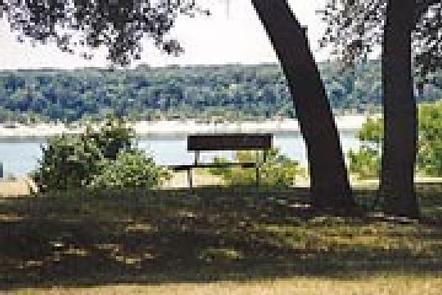
With 136 miles of shoreline, Belton Lake offers a wide variety of recreation activities, including camping, water recreation, picnicking and nature trails. The facility has a multi-lane boat ramp, and hiking trails are available adjacent to the park at Miller Springs Nature Area.
Hawks, great blue herons, ducks, geese, many species of songbirds, bobwhite quail, Rio Grande turkey and even an occasional bald eagle visit the lake area, offering year-round opportunities for birders.
Facilities
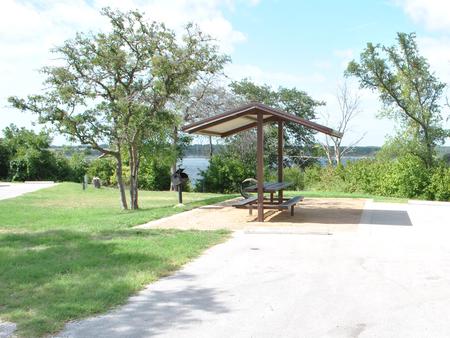
This park offers 48 sites that range from wooded to open sun. All campsites have water and electric hookups, plus a covered table and grill. Campers have access to restrooms with flush toilets and hot showers, a two-lane boat ramp and a dump station.
The park is staffed with full-time gate attendants. Free wireless internet is available for registered guests, and a camper service center can be used for group parties, meetings and laundry facilities.
Natural Features
Live Oak Ridge lives up to its name, with many large oak trees, a pleasant atmosphere and plenty of shade. The campsites are flat and grassy, and several overlook the lake (others are only a short walk away). Springtime brings an abundance of wildflowers that blanket areas of the park.
There is a man-made wetland on the lake between White Flint and Winkler Parks, providing an additional 25 acres of wildlife habitat to the lake area.
Nearby Attractions
Belton Lake is located adjacent to the Fort Hood Army Base, which has several points of interest for the military buff. The mural painted on the spillway wall of Belton Dam depicts the history of the Bell County area.