RISING STAR, AR Campground Reservation, Info, Images, Map, Directions

RISING STAR, Arkansas Campground Images, Info & Reservations

Directions

From Pine Bluff, Arkansas, take U.S. Highway 65 south for 7.8 miles to Linwood. Turn left on Blankinship Road, drive 3.5 miles and follow the signs for Rising Star Campground.

Phone

870-479-3292

Activities

BOATING, CAMPING, FISHING, HUNTING, WILDLIFE VIEWING

Keywords

RISI,POOL 3 LOCK AND DAMR – ARK.RIV,POOL 3 LOCK & DAM

Related Link(s)

Rec Area Info & Images

Arkansas State Tourism

Arkansas State Road Conditions

Overview

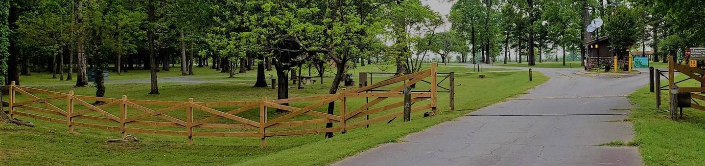
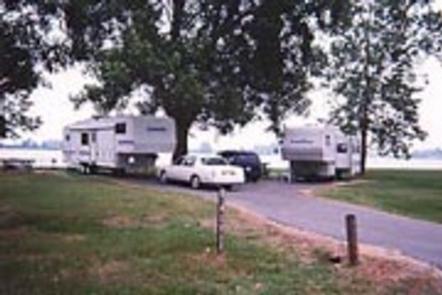
Rising Star Campground is located on the Arkansas River by Pool 3 Lock and Dam. Whether camping, fishing, boating or just relaxing in the sun, this area provides something for everyone.

Recreation

The campground is popular among fishermen. There is excellent catfish fishing in the tail-waters of Joe Hardin Lock and Dam as well as Emmitt Sanders Lock and Dam at the upstream end of Pool 3. Anglers often catch bass, crappie and bream.

Hunting is available in nearby forests, and there is duck hunting on the waterways.

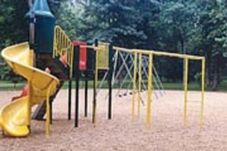
On shore, families enjoy picnicking and using the playground.

Facilities

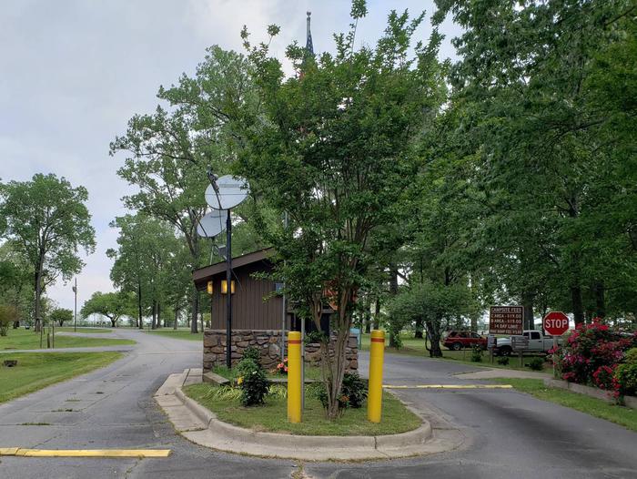
Rising Star Campground offers 25 sites with electric and water hookups. Additional amenities include hot showers, a dump station and a playground.

There is one accessible group shelter that can accommodate up to 60 people; it is for day-use only and must be reserved.

Natural Features

The park is in a forested area along the riverfront, close to the rolling fields of cotton farms. It is 193 feet above sea level; winters are generally mild and summer temperatures reach the upper 90s with high humidity.

Red fox are frequently seen in the park, and numerous species of waterfowl live in the water and along the shores.

Nearby Attractions

Rising Star Park is located 12 miles from Pine Bluff, the home for the Arkansas Railroad Museum, Pine Bluff Regional Park, the Martha Mitchell Home and other points of interest, as well as shopping and groceries.

Reservation

More from CampingHiking.net:

HICKORY CREEK PARK, Arkansas Campground Images, Info & Reservations

Directions From Rogers, AR, take Highway 264 east for 4.5 miles. Turn right on Cow Face Road. After a mile, turn left on Hickory Creek Road. The park entrance sign is on the right after about a mile. Phone 479-750-2943 Activities BOATING, CAMPING, FISHING, HIKING, SWIMMING SITE Keywords HIC2,BEAVER LAKE,HICKORY

GLACIER VIEW CAMPGROUND, Idaho Campground Images, Info & Reservations

Directions From Stanley, Idaho, take State Highway 75 south approximately 4 miles. Go west onto Forest Road 214. Turn left at Glacier View Campground entrance sign. Phone 928-537-8888 Activities BIKING, BOATING, CAMPING, FISHING, HIKING, HORSEBACK RIDING, WILDLIFE VIEWING, SWIMMING SITE Keywords GLAC,SAWTOOTH NF – FS Related Link(s) Rec Area Info

QUAKING ASPEN CABIN, California Campground Images, Info & Reservations

Directions From Porterville, California, take Highway 190 east. Continue through Springville for approximately 28 miles to the Quaking Aspen Campground. From Bakersfield, California, take Highway 65 North to Highway 190 east. Continue for approximately 28 miles to the campground. Phone 559-539-5230 Activities BIKING, CAMPING, FISHING, HIKING, HORSEBACK RIDING, HUNTING, WILDLIFE

HAWTHORN BLUFF, Oklahoma Campground Images, Info & Reservations

Directions From Tulsa, Oklahoma, take U.S. Highway 169 north for 27 miles to Highway 88. The campground is 2 miles east of the town of Oologah on Highway 88. Phone 918-443-2319 Activities BOATING, CAMPING, FISHING, HIKING, VISITOR CENTER, WATER SPORTS, DAY USE AREA, SWIMMING SITE Keywords HAWT,OOLOGAH LAKE,OOLOGAH LAKE Related

BUNCOMBE CREEK, Oklahoma Campground Images, Info & Reservations

Directions From Madill, OK, travel south on Highway 99 for 17 miles to Willis, OK, then east for one mile on paved access road. Physical address: 1010 West Buncombe Creek Road, Willis, OK 75020. Phone 580-564-2901 Activities BOATING, CAMPING Keywords BUNC,TEXOMA LAKE,TEXOMA LAKE Related Link(s) Rec Area Info & Images

RIBBONWOOD EQUESTRIAN CG, California Campground Images, Info & Reservations

Directions From Palm Desert, California, take the Palms to Pines Highway/Highway 74 south for approximately 16 miles to the community of Pinyon. Turn left onto South Pinyon Drive and the entrance to the campground is on the right. Phone (760) 862-9984 Activities CAMPING, FISHING, HORSEBACK RIDING, HORSE CAMPING, MOUNTAIN BIKING