SIX MILE CREEK, AL Campground Reservation, Info, Images, Map, Directions

SIX MILE CREEK, Alabama Campground Images, Info & Reservations

Directions

From Selma, Alabama, follow US-41 south for 9 miles. Turn right on County Road 139 and follow the signs into the campground.

Phone

334-872-9554

Activities

BOATING, CAMPING, FISHING, HUNTING

Keywords

SIXM,ALABAMA RIVERS,ROBERT F. HENRY,MILLERS FERRY LAKE,WILLIAM DANNELLY,ALABAMA RIV. – DAN

Related Link(s)

Rec Area Info & Images

Alabama State Tourism

Alabama State Road Conditions

Overview

Six Mile Creek Campground is located on its namesake at scenic Dannelly Reservoir in Alabama’s Black Prairie Belt. The reservoir sits on the Alabama River and covers roughly 27 square miles, boasting more than 500 miles of shoreline.

Boating, fishing, hunting and hiking are popular activities.

Recreation

The creek offers excellent fishing for bass, crappie, bluegill and catfish, and numerous fishing tournaments and annual festivals are held in the immediate area.

Whitetail deer and wild turkeys roam the park, creating excellent bow-hunting opportunities.

Facilities

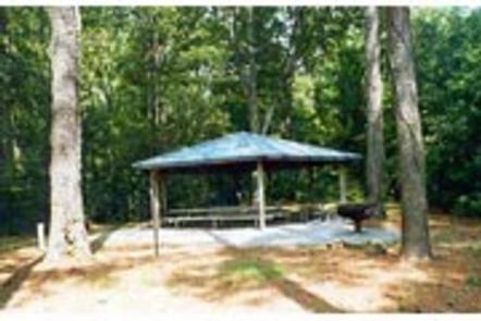
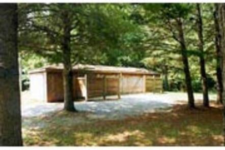
This peaceful waterfront campground is open from April – Labor Day and offers 31 family sites with electric hookups. Amenities include flush toilets, showers, drinking water, a dump station and boat dock.

Natural Features

The Black Prairie Belt is characterized by rich, dark soils and a mosaic of rolling grasslands and dense hardwood and pine forests.

Reservation

More from CampingHiking.net:

WISH POOSH CAMPGROUND, Washington Campground Images, Info & Reservations

Directions From Seattle, take I-90 East to exit 80, then take a left on Bullfrog Road, then head north on County Road 903. The campground is on the left after approximately 8 miles. Phone 509-852-1100 Activities BIKING, BOATING, FISHING, PICNICKING, SWIMMING, KAYAKING Keywords WISH POOSH CAMPGROUND (IL) Related Link(s) Rec

CUMMINGS CABIN, Montana Campground Images, Info & Reservations

Directions The cabin is located 8.5 miles east of Lincoln, Montana and can be reached via Hogum Creek Road, which is approximately 6 miles east of Lincoln on Highway 200. Follow Hogum Creek Road to the junction of Black Diamond Road and Lower Hogum Creek Road. Lower Hogum Creek Road

AIRPORT PARK, Texas Campground Images, Info & Reservations

Directions From I-35, take the Lake Shore Drive exit (Exit 339) and drive west to Steinbeck Bend Road. Turn right and proceed to second stop light. At the intersection with FM 1637 (China Spring Highway) turn right. Go to next stop light (Flat Rock Road). Turn left and drive approximately

DALE HOLLOW LAKE – PRIMITIVE CAMPING, Tennessee Campground Images, Info & Reservations

Directions Camping locations are dispersed throughout Dale Hollow Lake. Reference primitive camping map or site details for information on how to get to the specific site. Mailing and contact information is for the Resource Manager’s Office. Phone DALE HOLLOW LAKE RESOURCE MANAGERS OFFICE-931-243-3136. SHERIFF’S DEPARTMENT EMERGENCY CONTACTS: CLAY COUNTY 931-243-3266