
Directions
From Clemson, South Carolina, take Highway 133 north for almost two miles. Twelve Mile will be on the left. 113 TWELVE MILE PARK, Clemson, SC 29631
Phone
888-893-0678 HARTWELL PROJECT OFFICE
Activities
BOATING, FISHING, PICNICKING, DAY USE AREA, SWIMMING SITE, WATER ACCESS
Keywords
TWEL,HARTWELL LAKE PROJECT
Related Link(s)
South Carolina State Road Conditions
Overview
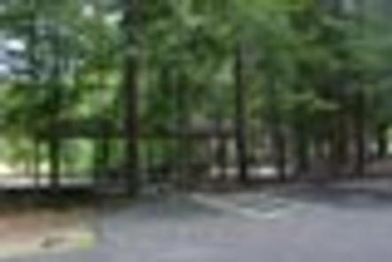
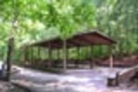
Twelve Mile Recreation Area consists of 26 acres of pine and mixed hardwood. The interior portion of Twelve Mile is moderately sloping although the picnic area itself is quite gentle. The site presently offers day use and boat launching facilities including 1 gatehouse/entrance, 49 picnic sites, 2 standard picnic shelters with water and electric service, 1 two lane boat ramp, 1 courtesy dock, 2 comfort stations, 2 playgrounds, 1 designated swim area/beach with 60 iron framed footbridge for access, and associated paved roads and parking areas throughout. The area experiences extremely high levels of intense public use during peak recreation season.
Recreation
Boating and water sports top the list of popular activities. A boat ramp is provided for easy lake access.
Facilities
The site presently offers day use and boat launching facilities including 1 gatehouse/entrance, 49 picnic sites, 2 standard picnic shelters with water and electric service, 1 two lane boat ramp, 1 courtesy dock, 2 comfort stations, 2 playgrounds, 1 designated swim area/beach with 60 iron framed footbridge for access, and associated paved roads and parking areas throughout.
Natural Features
Hartwell Lake is a man-made lake bordering Georgia and South Carolina on the Savannah, Tugaloo and Seneca Rivers. The dam and lake area boasts 8 campgrounds and 11 day-use facilities that are operated by the US Army Corps of Engineers. The Hartwell Project was originally authorized for hydro-power, flood control, and navigation. Later, recreation, water quality, water supply and fish and wildlife management were added. Surrounding vegetation allows for plenty of shade, and the 962 miles of shoreline provide numerous swimming beaches, picnic areas and boat ramps.
Nearby Attractions
Twelve Mile is located just minutes from Clemson, South Carolina, which offers historical attractions, restaurants, grocery stores, fuel and more.
Charges & Cancellations
A $10 service fee will apply if you change or cancel your reservation more than 14 days in advance of the arrival date. If you cancel a reservation within 14 days of your scheduled arrival date, you will forfeit the reservation fee.