South Shore, OR Campground Reservation, Info, Images, Map, Directions

South Shore, Oregon Campground Images, Info & Reservations

Directions

From Sisters, Oregon, take Highway 20/126 northwest for about 12 miles. Turn left onto Forest Service Road 2070 toward Suttle Lake Campgrounds. Travel just less than a half-mile to the South Shore entrance on the right.

Phone

541-323-1746

Activities

BOATING, CAMPING, FISHING, HIKING, SWIMMING SITE

Keywords

SOUH,SUTTLE LAKE CAMPGROUND,DESCHUTES NF – FS

Related Link(s)

Rec Area Info & Images

Oregon State Tourism

Oregon State Road Conditions

Forest Service Concessionaire

Overview

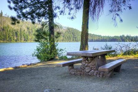
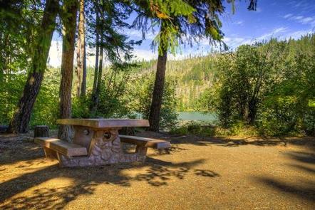
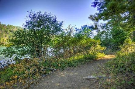
South Shore Campground is located along Suttle Lake, shaded by Douglas fir and Ponderosa pine. One section of the camp sits on the shoreline, while the other is nestled on a hillside.

Most sites have lake views. The 3,400-foot elevation and the lake breezes make South Shore Campground a comfortable summertime destination.

Recreation

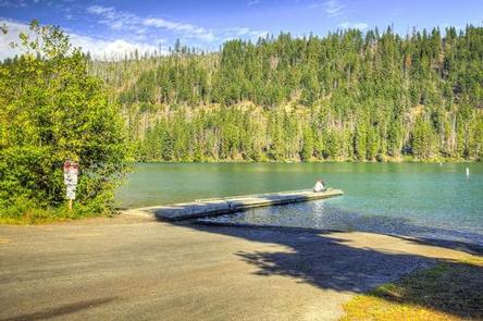
There is a boat launch available at this camp. Popular activities include power and non-motorized boating, sailing, water skiing and wind surfing.

Anglers can fish for rainbow trout, kokanee salmon and brown trout, and there is a fish cleaning station on-site. Hikers and mountain bikers have access to the 3.2-mile Suttle Lake Shoreline Trail.

Facilities

Each site has a gravel parking spur, picnic table and campfire ring. Dump stations are dispersed through the campground.

Drinking water and vault toilets are provided.

Natural Features

Nestled along the Cascade Mountains, the Deschutes National Forest is one of the most popular recreation forests in the Pacific Northwest. It offers a variety of landscapes, from fields of sagebrush and hay to old-growth forests and glacier-carved volcanic peaks.

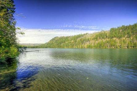
Suttle Lake is a natural lake formed by glaciers. It has a forested shoreline and offers views of nearby Mt. Washington.

Nearby Attractions

The town of Sisters is about 15 miles away, offering shopping and restaurants.

Reservation

More from CampingHiking.net:

GREEN RIVER LAKES, Wyoming Campground Images, Info & Reservations

Directions From Pinedale, drive 7 miles west on U.S. Highway 191. Turn north onto Wyoming Highway 352 and continue 25 miles to the forest boundary, where the pavement ends. Continue on the dirt road for 18 miles to the campground. While the dirt road to the campground is suitable for

Sentinel Campground, California Campground Images, Info & Reservations

Directions From Fresno, CA, follow California State Highway 180 East to Cedar Grove. Sentinel Campground is located on the left (north) side of the road in the village. Phone (559) 565-3341 Activities CAMPING, INTERPRETIVE PROGRAMS, HIKING, HORSEBACK RIDING, VISITOR CENTER, DAY USE AREA Keywords Related Link(s) Rec Area Info &

MOGOTE, Colorado Campground Images, Info & Reservations

Directions From Antonito, Colorado, go west on Highway 17 about 15 miles to the campground access road. Turn right and travel 1/4 mile to the Upper Loop Road. Phone 719-376-2535 Activities CAMPING Keywords MOGO,CONEJOS PEAK RD,15571 COUNTY RD T-5,LA JARA,COLORADO 81140,magotie,magoaty,mogoaty,RIO GRANDE NF- FS Related Link(s) Rec Area Info &

SITKOH LAKE (WEST) CABIN, Alaska Campground Images, Info & Reservations

Directions Accessible generally mid-April through October. Located 35 air miles northeast of Sitka, on the southeast side of Chichagof Island, about 30 minutes by floatplane. Access is also possible by boat to Peril Strait, then hiking about 3 miles on logging road system. This mode of access is recommended only

ROCKLAND RECREATION AREA, Tennessee Campground Images, Info & Reservations

Directions From Nashville, TN, take I-65 North to TN-386/Vietnam Veterans Blvd. Continue East on TN-386/Vietnam Veterans Blvd. to exit 3 for US-31E toward Hendersonville. Turn right onto Rockland Road (1st red light you come to), travel approximately 0.6 miles. Turn right onto Power Plant Road. Turn left onto Overlook Circle.