JACKASS MEADOW, CA Campground Reservation, Info, Images, Map, Directions

JACKASS MEADOW, California Campground Images, Info & Reservations

Directions

From Clovis, California: Take Hwy 168 north for 70 miles to Huntington Lake Campground office at Eastwood. Turn right and follow Kaiser Pass Road approximately 21 miles to Jackass Meadow campground.

Phone

559-893-2111

Activities

BOATING, HISTORIC & CULTURAL SITE, CAMPING, FISHING, HIKING, HORSEBACK RIDING, DAY USE AREA

Keywords

JAAS,FLORENCE LAKE,HIGH SIERRA,SIERRA NF – FS

Related Link(s)

Rec Area Info & Images

Forest Service Concessionaire

California State Road Conditions

California State Tourism

Overview

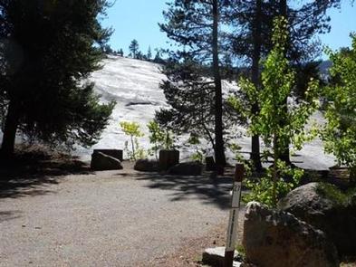
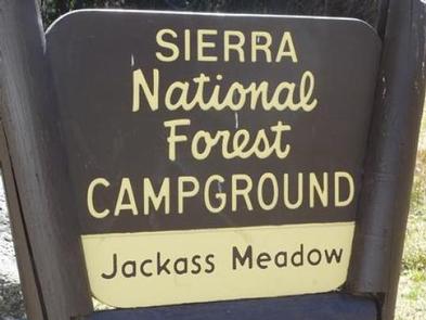
Jackass Meadow Campground is situated below Florence Lake on the San Joaquin River, surrounded by the craggy peaks of the John Muir Wilderness.

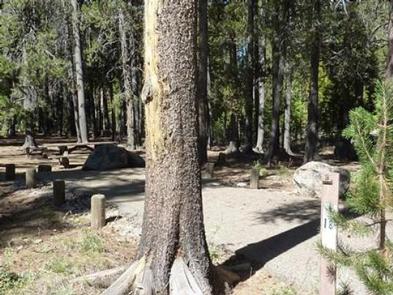
Jackass Meadow is shaded by a stand of Aspen and Lodgepole Pine, and the South Fork of the San Joaquin runs through the campground. This camp is located near several Native American archaeological sites.

Recreation

There is a .7 mile accessible hiking trail near the campground. Nature walks are held every Saturday during the summer.

Most of the recreation opportunities here can be found in and around Florence Lake. There is a boat ramp and boat rentals at the Florence Lake Store.

Facilities

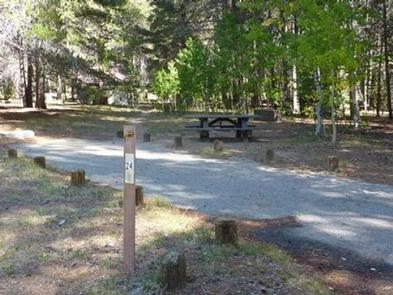
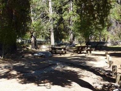
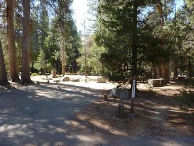
Each campsite has a table, fire ring and grill. Bear-proof food lockers, water and accessible vault toilets are provided.

Supplies and groceries can be purchased half a mile from the campground at the Florence Lake Store.

Natural Features

The Sierra National Forest, located on the western slope of the central Sierra Nevada, is known for its spectacular mountain scenery and abundant natural resources.

The terrain includes rolling, oak-covered foothills, heavily forested middle elevation slopes and the starkly beautiful alpine landscape of the High Sierra.

The John Muir Wilderness stretches for 100 miles along the crest of the Sierra. It is a land of lofty snow-capped mountains, deep canyons and vast expanses of glacially carved terrain.

Nearby Attractions

A popular activity is to take a ferry from Florence Lake to the John Muir Trail, which is part of the Pacific Crest Trail, which stretches from Mexico to Canada. Ferry tickets can be purchased at the Florence Lake Store.

Reservation

More from CampingHiking.net:

HORSETHIEF CABIN, Arizona Campground Images, Info & Reservations

Directions From Phoenix, Arizona: When traveling Northbound on I-17 take the Bumble Bee Exit 248 and continue North on the dirt road, taking Forest Road (FR) 259 to Crown King. From Crown King, take (FR) 259A south for 0.5 mile to the junction of 52. Take FR 52 southeast for

SOUTH RUBY CAMPGROUND, Nevada Campground Images, Info & Reservations

Directions Take Interstate 80 to Highway 93. Exit at Wells and follow Highway 93 south for 30 miles to State Route 229. Follow State Route 229 for 15 miles, then head south on State Route 767 and County Road 788 for 30 miles, to the campground. Phone 775-752-3357 Activities BOATING,

BLOODY DICK CABIN, Montana Campground Images, Info & Reservations

Directions From Dillon, travel south on I-15 for about 19 miles and exit at Clark Canyon Reservoir (Hwy 324). Travel 17 miles west on Highway 324 through Grant, MT. Proceed west and turn north onto Bloody Dick Road/Forest Road 181. Continue about 18 miles following road signs. The Bloody Dick

PINE CREEK COVE, Oklahoma Campground Images, Info & Reservations

Directions From Valliant, OK, travel Pine Creek Road 7 miles north to the access road. Follow signs into the campground. Phone 580-933-4215 Activities BOATING, CAMPING, FISHING, PICNICKING, DAY USE AREA, SWIMMING SITE, SWIMMING, WATER ACCESS Keywords PICR,PINE CREEK LAKE,PINE CREEK LAKE Related Link(s) Rec Area Info & Images Oklahoma State

BLUEBILL CAMPGROUND, Oregon Campground Images, Info & Reservations

Directions From Reedsport, Oregon, take Highway 101 south for 22 miles to the Horsfall Dunes and Beach road sign; turn right and follow signs. From Coos Bay/North Bend, Oregon, take Highway 101 north for about 2 miles to the Horsfall Dunes and Beach road sign, turn left and follow signs.