MONO CREEK, CA Campground Reservation, Info, Images, Map, Directions

MONO CREEK, California Campground Images, Info & Reservations

Directions

From Clovis, California, take Highway 168 north 70 miles to Huntington Lake Campground office at Eastwood. Take Kaiser Pass Road to Mono Creek Campground.

Phone

559-893-2111

Activities

BOATING, CAMPING, INTERPRETIVE PROGRAMS, FISHING, HIKING, HORSEBACK RIDING

Keywords

MONO,SIERRA NF – FS

Related Link(s)

Rec Area Info & Images

California State Road Conditions

Forest Service Concessionaire

California State Tourism

Overview

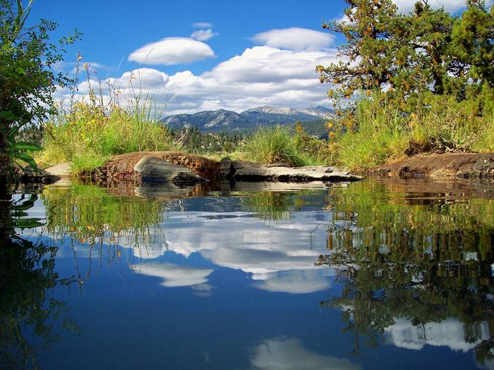
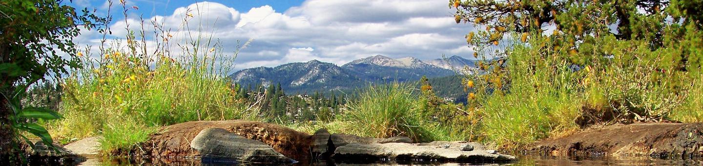
Mono Creek Campground is located in the High Sierras above Kaiser Pass. This quiet, remote campground is situated in a peaceful meadow near Mono Hot Springs at an elevation of 7,500 feet. Visitors enjoy hiking, fishing, boating and horseback riding.

Recreation

Most recreational activities are centered around nearby Edison Lake and Mono Hot Springs. Interpretive programs, hiking, trout fishing, boating and horseback riding are popular pastimes. Hot mineral baths can be enjoyed at Mono Hot Springs.

Facilities

Each campsite has a picnic table, grill and bear-proof food storage locker. No water source is available on-site, but potable water is available at the High Sierra Ranger Station. Accessible vault toilets are provided.

Natural Features

Campsites are spacious, private and shaded by mature Ponderosa pines within the Sierra National Forest on the western slope of the central Sierra Nevada. The forest is known for its spectacular mountain scenery and abundant natural resources.

The terrain includes rolling, oak-covered foothills, heavily forested middle elevation slopes and the starkly beautiful alpine landscape of the High Sierra.

Nearby Attractions

The Mono Creek Trail, which can be accessed at Edison Lake, leads hikers and horseback riders to the network of trails within the John Muir Wilderness. This includes the scenic Pacific Crest Trail, which spans from Mexico to Canada.

Reservation

More from CampingHiking.net:

TURKEY CREEK, Oklahoma Campground Images, Info & Reservations

Directions From Broken Bow, OK, travel Highway 3 west for 28 miles to the entrance sign. Follow access road north 5 miles to the campground. Phone 580-876-3720 Activities BOATING, CAMPING, FISHING Keywords TURK,PINE CREEK LAKE,PINE CREEK LAKE Related Link(s) Rec Area Info & Images Oklahoma State Road Conditions Oklahoma State

RIVERSIDE (KS), Kansas Campground Images, Info & Reservations

Directions From Salina, KS: Take HWY 140 19 miles west to HWY 141. Travel 14 miles south on 141, then 1/2 mile east on Riverside Drive. Look for signs to the park. From Ellsworth, KS: Take HWY 140 15 miles east to HWY 141. Travel 14 miles South on Hwy

Bumping Lake Campground, Washington Campground Images, Info & Reservations

Directions From Yakima, Washington, travel 25 miles on Highway 12 to the junction with Highway 410. Travel 29 miles on Highway 410 (Chinook Pass Highway) to milepost 88.4. Take Forest Road 18 (Bumping River Road) for 11.7 miles to campground. Phone 541-338-7869 Activities BIKING, BOATING, CAMPING, FISHING, HIKING, WATER SPORTS

COTTONWOOD CREEK, California Campground Images, Info & Reservations

Directions From Truckee, travel north on Highway 80 to Highway 89 approximately 20 miles to the campground. From Sierraville, travel approximately 5 miles south on Hwy 89, the campground will be on the left side of the highway. Phone 530-994-3401 Activities BIKING, CAMPING, HIKING, HUNTING, WILDLIFE VIEWING Keywords COTC,TAHOE NF

LOS PRIETOS, California Campground Images, Info & Reservations

Directions From Highway 101 in Santa Barbara, turn east onto Highway 154 and continue about 11 miles. Turn onto Paradise Road and travel about 3 miles to the campground. Phone 805-434-1996 Activities BIKING, CAMPING, FISHING, SWIMMING SITE Keywords LOSP,Santa Ynez Recreation Area,Los Padres National Forest,LOS PADRES NF -FS Related Link(s)