


Directions
From Estacada, travel east on Highway 224 for 14 miles to Armstrong Campground, on the right.
Phone
503-630-5721
Activities
BIKING, BOATING, CAMPING, FISHING, HIKING, WATER SPORTS, WILDLIFE VIEWING
Keywords
ARMS,MT. HOOD NF – FS
Related Link(s)
Overview
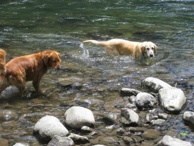
Armstrong Campground is a small but beautiful place to camp, right on the edge of the Clackamas Wild and Scenic River. The river flows right by spacious, lush, family-friendly campsites, giving visitors plenty of access to the river, as well as to the surrounding forest.
Recreation
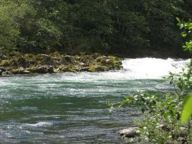
Fishing is very popular in the Clackamas River and anglers can expect a catch of winter steelhead, spring chinook and late summer coho salmon, as well as other species of freshwater fish. The Clackamas contains miles of wild water as it bends and drops through the scenic Cascade Range, creating prime whitewater rafting opportunities.
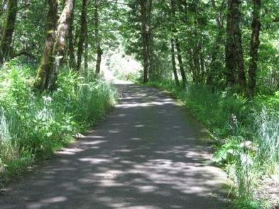
A hiking trail follows the river north and south and begins about a mile away at Fish Creek Campground.
Facilities
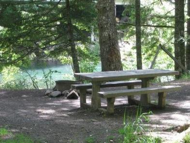
The campground offers single-family sites available mostly for tent camping, but a few sites having space for RVs. Larger RVs may have trouble navigating the roads within the facility. An overflow parking area is available.
Each site is equipped with a table and campfire ring with grill. Accessible vault toilets and drinking water are provided. No hookups are available. Parking surfaces are gravel and dirt.
Natural Features
The campground is located in Mt. Hood National Forest at an elevation of about 870 feet. A variety of ferns, shrubs and grasses cover the forest floor and provide some privacy between sites. While the campground is close to the road, the sound of the river blocks most of the noise.
The forest provides habitat for the federally protected bald eagle and northern spotted owl, as well as an occasional peregrine falcon. A variety of wildlife makes its home in the area.
Nearby Attractions
A boat ramp is available at Fish Creek Campground, which is less than half a mile south of the campground. It is a convenient place to launch kayaks, canoes or other boats on the river.
Just below Indian Henry Campground, the Clackamas River offers 12.5 miles of class III-IV whitewater. The Upper Clackamas Whitewater Festival is hosted annually on the river, attracting rafters from all over the country.