SUNSTRIP, OR Campground Reservation, Info, Images, Map, Directions

SUNSTRIP, Oregon Campground Images, Info & Reservations

Directions

From Estacada, travel east on Highway 224 for about 21 miles to the campground.

Phone

503-630-5721

Activities

CAMPING, FISHING, HIKING, WATER SPORTS, WILDLIFE VIEWING

Keywords

SUN1,MT. HOOD NF – FS

Related Link(s)

Rec Area Info & Images

Oregon State Tourism

Forest Service Concessionaire

Oregon State Road Conditions

Overview

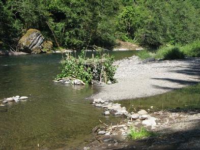
Sunstrip Campground is a primitive campground on the banks of the Clackamas Wild and Scenic River. It provides access to a variety of outdoor activities, but retains the look and feel of true nature, with only a few amenities.

Recreation

Fishing is very popular in the Clackamas and anglers can expect winter Steelhead, spring Chinook and late summer Kokanee salmon, as well as other species of freshwater fish.

Whitewater rafting is also a favorite activity among visitors. The Clackamas River provides miles of wild water as it snakes through the scenic Cascade range.

A hiking trail meanders along the riverbank, north and south of the campground. Scenic driving is available on the nearby West Cascades National Scenic Byway, which follows the river.

Facilities

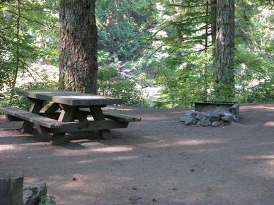
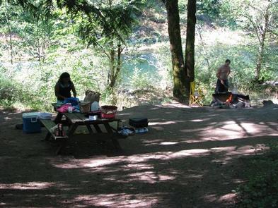
The campground offers about eight tent-only campsites, half of which are on the waterfront. Each site is equipped with a table and campfire ring with grill. Accessible vault toilets are provided. Drinking water is not available at the campground.

Natural Features

The campground is nestled in a wooded area of the Mt. Hood National Forest, thick with moss and greenery, at an elevation of about 1,000 feet.

The river provides habitat for the federally protected bald eagle and northern spotted owl, as well as the occasional peregrine falcon. A variety of wildlife make its home in the area.

Nearby Attractions

The Clackamas River, just below nearby Indian Henry Campground to the North Fork Reservoir, provides 12.5 miles of class III-IV whitewater. Outfitters are located in the town of Estacada.

Reservation

More from CampingHiking.net:

CAPE FAIR, Missouri Campground Images, Info & Reservations

Directions From Reeds Spring, Missouri, head south on Highway 13 for 1.4 miles. Turn West onto Highway 76 and continue for 8 miles to Cape Fair. Turn southwest onto Lake Road 76-82 and follow signs to the campground. Phone 417-538-2220 Activities BIKING, BOATING, CAMPING, FISHING, HIKING, PICNICKING, WATER SPORTS, WILDLIFE

RIVER ROAD PARK, Missouri Campground Images, Info & Reservations

Directions From Piedmont, MO, follow state highway HH for 6 miles. Campground will be located just below Clearwater Lake Dam. Follow signs into campground. Phone 573-223-7777 (CLEARWATER LAKE PROJECT OFFICE) RIVER ROAD PARK GATE HOUSE(573-223-4424 Activities BOATING, CAMPING, FISHING, HIKING, HUNTING, WATER SPORTS, SWIMMING SITE Keywords RILB,CLEARWATER LAKE,RIVER VIEW,BELOW THE

PINECREST, California Campground Images, Info & Reservations

Directions From Sonora, take Highway 108 east for 30 miles, take the Pinecrest exit onto Pinecrest Lake Road and continue to the campground. Phone 209-965-3116 Activities BIKING, BOATING, CAMPING, FISHING, HIKING, HORSEBACK RIDING, DAY USE AREA, SWIMMING SITE Keywords PINC,PINECREST CAMPGROUND,STRAWBERRY CAMPGROUND,STANISLAUS NF -FS Related Link(s) Rec Area Info &

HOT SPRINGS, Idaho Campground Images, Info & Reservations

Directions From Boise, Idaho, take State Highway 55 north 35 miles to Banks. Turn east onto the Banks-Lowman Highway and go 17 miles to the campground, which is on the lefthand side of the highway. Phone 541-351-1182 Activities BOATING, CAMPING, FISHING Keywords HOT1,BOISE NF – FS Related Link(s) Rec Area

WILBORN CREEK (GROUP CAMP), Illinois Campground Images, Info & Reservations

Directions From Sullivan, Illinois, go west on State Route 121 for 5 miles. Turn left on County Road 5 and drive 3.5 miles, then make a right on County Road 18 and drive 0.75 miles to the campground. Phone 217-774-3951 Activities BOATING, CAMPING, FISHING, SWIMMING SITE Keywords WCGC,LAKE SHELBYVILLE,WILBORN CREEK

SANTA BARBARA CAMPGROUND, New Mexico Campground Images, Info & Reservations

Directions From the junction with State Road 75, follow SR 73 1.4 miles to the Santa Barbara Road. Turn left onto the Santa Barbara Road. Then travel 6.2 miles to the campground. Santa Barbara Road becomes Forest System Road 116 when the pavement ends. Phone 435-245-6521 Activities CAMPING, HIKING, HORSEBACK