

Directions
From Estacada, travel east on Highway 224 for 20 miles to the campground.
Phone
503-630-5721
Activities
CAMPING, FISHING, HIKING, WATER SPORTS, WILDLIFE VIEWING
Keywords
ROA1,MT. HOOD NF – FS
Related Link(s)
Overview
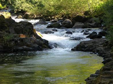
Roaring River Campground is located across from the Wild and Scenic Clackamas River in the beautiful Cascade Range of northern Oregon. The small, rustic campground has some charm and provides visitors with access to a variety of outdoor recreation opportunities, including world-famous whitewater rafting.
Recreation
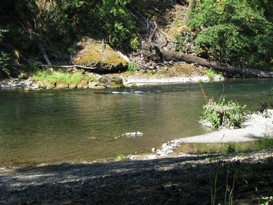
Fishing is very popular in the Clackamas River and anglers can expect a catch of winter steelhead, spring Chinook and late summer Coho salmon, as well as other species of freshwater fish. The Clackamas River provides miles of wild water as it bends through the scenic Cascade Range, making whitewater rafting a very popular activity.
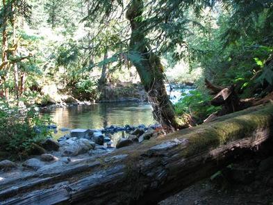
A hiking trail follows the river north and south. Scenic driving is also available on the nearby West Cascades Scenic Byway, which follows the river.
Facilities
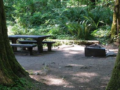
The campground offers just over a dozen single-family sites, the majority of which are designated for tent camping only. RVs larger than 16 feet are not recommended in the campground. Utility hookups are not available and parking surfaces are gravel.
Each site is equipped with a table and campfire ring with grill. Accessible vault toilets and drinking water are provided. Firewood is available for purchase within the campground.
Natural Features
The campground is nestled in a wooded area thick with moss and greenery, at an elevation of about 1,000 feet. The river is across the highway and is not visible from the campground, but can sometimes be heard.
The river provides habitat for the federally protected bald eagle and northern spotted owl, as well as an occasional peregrine falcon. A variety of wildlife makes its home in the area.
Nearby Attractions
Just below nearby Indian Henry Campground, the Clackamas River provides 12.5 miles of class III-IV whitewater as it works its way toward North Fork Reservoir.