
Directions
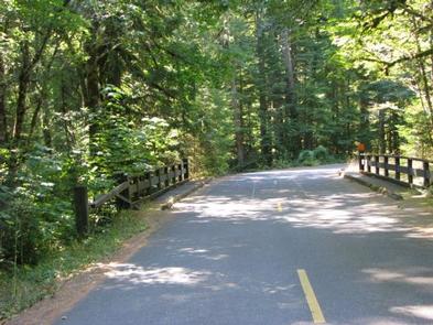
From Estacada, Oregon, travel east on Highway 224 for 24 miles to the campground.
Phone
503-630-5721
Activities
CAMPING, FISHING, HIKING, WATER SPORTS, DAY USE AREA
Keywords
INDH,MT. HOOD NF – FS
Related Link(s)
Overview
Indian Henry Campground is located in the Mount Hood National Forest, along the scenic Clackamas River. The campground is a great location for relaxation and a spectacular outdoor experience, providing ample access to the river and the surrounding wilderness, as well as other scenic spots in the area.
Recreation
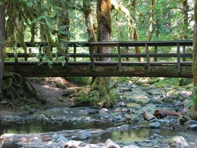
The family-friendly Clackamas River Trail is popular for hiking and mountain biking and begins at the upper end of the campground. It extends about 8 miles and climbs about 450 feet in elevation along the way. It is available year-round, but may be covered in snow during winter months. The Indian Henry Trail, which trolls through the forest, is also located near the campground.
Fishing is very popular in the nearby river and anglers can expect a catch of winter steelhead, spring chinook and late summer kokanee salmon, as well as other species of freshwater fish. Whitewater rafting is also enjoyed by visitors to the area. The Clackamas River provides miles of wild water as it bends through the scenic Cascade range.
Facilities
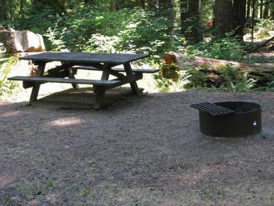
The large campground offers dozens of single-family campsites for tent and RV camping. Tent-only sites are available for reservation, while the rest of the sites are available on a first-come, first-served basis.
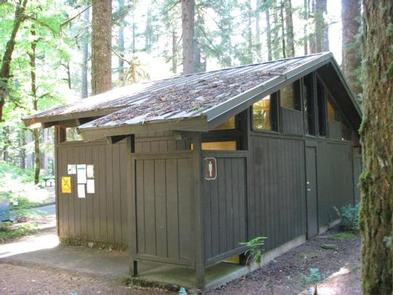
Each site is equipped with tables and campfire rings with grills. A dump station is located within the campground. Parking surfaces are mostly paved. Accessible flush toilets and drinking water are also provided.
Natural Features
The campground is situated at an elevation of 1,249 feet, in Oregon’s Cascade Mountains, nestled in a mixed forest of conifers and hardwoods, including grand old Douglas firs and a variety of evergreens. A thick gathering of ferns and ivy increase privacy between campsites. Some sites overlook the river and others neighbor a mountain creek.
Nearby Attractions
The picturesque, blue-green Surprise Lake is located not far from the campground, up a steep climb. It is most popular for fishing, as the lake isn’t large enough for motorized boats.
The Bagby Hot Springs are located about 20 miles southwest of the campground. A popular site for soaking and relaxation, the springs are in a heavily wooded forest in the scenic Cascade Mountains of Oregon. A historic guard station was built there in 1913 and the available bathhouses are fed by three major hot water springs and several minor outlets in the area.