

Directions
Take I-5 to State Highway 12 and exit at Randle, Washington. Follow State Highway 131 for 1 mile, staying left at the fork, and continuing on Forest Service Road 23. Stay left at next fork for Forest Service Road 21 to Forest Service Road 56 to arrive at the campground.
Phone
541-338-7869
Activities
BIKING, CAMPING, FISHING, HIKING, HORSEBACK RIDING, HUNTING
Keywords
ADFO,GIFFORD PINCHOT NF – FS
Related Link(s)
Washington State Road Conditions
Overview
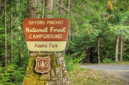
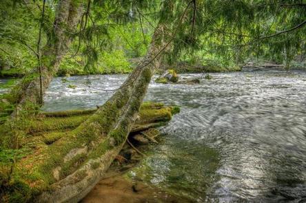
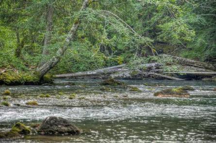
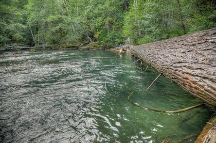
Nestled among tall conifers on the Adams Creek Fork of the Cispus River, Adams Fork Campground offers single sites for tent and RV camping, as well as one group site, with several of the sites sitting along the banks of the river.
Adams Fork Campground makes an excellent base from which to explore Mount St. Helens and the surrounding area. Nearby multi-use trails offer a myriad of recreational activities, in addition to trout fishing in the Cispus River.
Recreation
Part of the Randle Recreation Area, Adams Fork Campground is an ideal location for many recreational activities. The Valley Trail network, popular with dirt bikes and ATVs, offers 50 miles of multi-use trails close to this campground.
Hikers, horseback riders and mountain bikers can also use the Valley Trail, which offers views of the Cispus River Valley and Tongue Mountain and anglers can fish for brook trout in the Cispus River.
Facilities
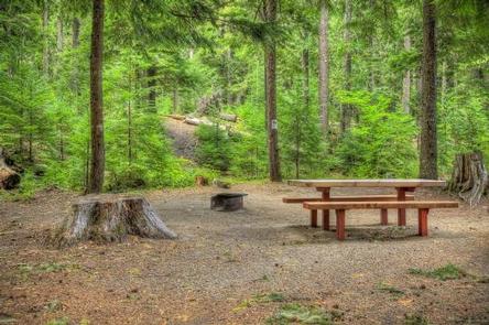
This campground consists of 24 paved back in sites, including one group site that can accommodate 20 to 50 campers. Many of the sites are small but still usable by RVs, with a maximum parking spur length of 30 feet.
There are no water or electric hook-ups, but drinking water and vault toilets are provided. Picnic tables are available in camp sites for a fee. Fire rings are provided.
Nearby ORV trails, the campground is popular with ORV riders. Campers should expect riders coming and going from the campground.
Natural Features
Located in southwest Washington State, the Gifford Pinchot National Forest encompasses over 1.3 million acres, including the 110,000-acre Mount St. Helens National Volcanic Monument established by Congress in 1982.
Adams Fork is part of the Cowlitz Valley Ranger District, which is located in the northernmost portion of the Gifford Pinchot National Forest in southwest Washington.
This Ranger District manages four Wilderness Areas including the Goat Rocks Wilderness, Glacier View Wilderness, Tatoosh Wilderness and William O Douglass Wilderness.
The Cispus River originates in a high glacial valley in the Goat Rocks Wilderness, and flows through heavily forested areas before before meeting the North Fork and flowing westerly past many trails and campgrounds.
Nearby Attractions
The nearby town of Randle offers an access point to the Windy Ridge viewpoint at Mount St. Helens.