
Directions
Take Highway 14 to Carson. From Carson, travel about 19 miles northwest on Wind River Highway. The campground is between mile post 20 and 21.
Phone
541-338-7869
Activities
CAMPING, FISHING, HIKING, HUNTING
Keywords
PACR,GIFFORD PINCHOT NF – FS
Related Link(s)
Washington State Road Conditions
Overview
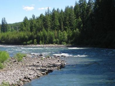
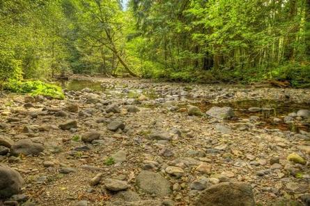
Paradise Creek sits at the confluence of Paradise Creek and the Wind River, nestled under an old-growth forest of cedars, firs, alder and maples. The sites by the river enjoy privacy from an abundance of lush undergrowth, while the other sites have a more open and spacious feel. The campground’s remote location is ideal for campers seeking a quiet and relaxed environment.
Recreation
The Wind River provides excellent fishing, with a population of steelhead and Chinook salmon. Check state regulations for open season and boundries. Wading is permitted in Paradise Creek. Fishing is not permitted in the campground.
Seasonal berry picking is a popular pastime and for visitors interested in hiking, there is access to the Lava Butte Trail 200 from the campground.
Facilities
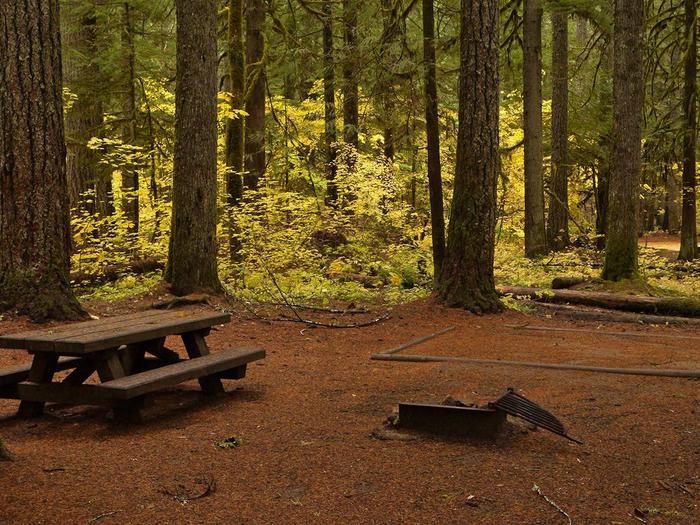
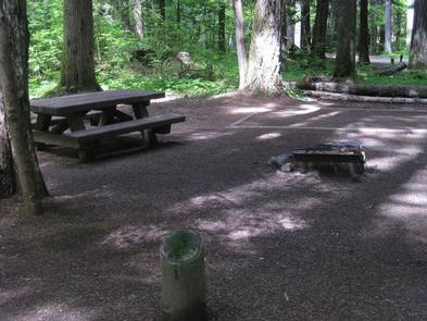
The campground consists of 42 back-in sites with paved parking spurs that vary from 20 to 40 feet in length. The Premium Sites are adjacent to the Wind River.
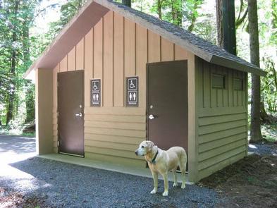
Each site has a picnic table and fire ring. An on-site hand pump offers drinking water, and vault toilets are available.
Natural Features
Located in southwest Washington State, the Gifford Pinchot National Forest encompasses 1.3 million acres and includes the 110,000-acre Mount St. Helens National Volcanic Monument established by Congress in 1982.
Paradise Creek Campground is located in the Mt. Adams Ranger District. Elevations here range between 1,200 feet at the Wind River Work Center, 12 miles north of Carson, WA and 12,276 feet at the summit of Mt. Adams.
The Mount Adams Ranger District offers a large variety of habitats and natural features, from old growth to second growth forest, wetland areas, low and high elevation meadows, glaciers, and low and high elevation lakes.
Nearby Attractions
Paradise Creek is an ideal base for exploring the different viewpoints around Mount St. Helens and Mt Adams. The nearest town is Carson, WA.