JOE GRAHAM HORSE CAMPGROUND, OR Campground Reservation, Info, Images, Map, Directions

JOE GRAHAM HORSE CAMPGROUND, Oregon Campground Images, Info & Reservations

Directions

From Sandy, travel east on Highway 26 for approximately 40 miles to Skyline Road (Road 42). Turn right onto Skyline Road and travel south for 9 miles to the campground.

Phone

503-630-5721

Activities

BOATING, HISTORIC & CULTURAL SITE, CAMPING, FISHING, HIKING, WILDLIFE VIEWING, SWIMMING SITE

Keywords

JOE1,MT. HOOD NF – FS

Related Link(s)

Rec Area Info & Images

Oregon State Tourism

Forest Service Concessionaire

Oregon State Road Conditions

Overview

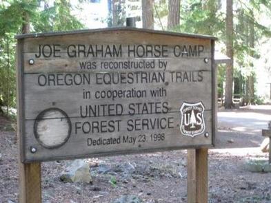
Joe Graham Horse Campground is a beautiful equestrian camp with views of majestic Mt. Hood and its surrounding forest. It provides access to a variety of hiking, mountain biking and horseback riding trails, as well as scenic historic sites.

Recreation

Clackamas Lake is a great place for fishing, swimming and non-motorized boating. Anglers can expect a catch of cutthroat, brook, rainbow and German brown trout. Nearby Timothy Lake provides opportunities for picnicking as well as water-related recreation, including the use of power boats.

The Clackamas Lake Ranger Station Historic District is less than a mile from the campground. The structures and cabins were built to house forest service workers in the early 1900s. Rustic architecture and the historic nature of the buildings and the surrounding area draws thousands of visitors each year. It is a must-see while staying at the campground.

Hiking, mountain biking and horseback riding are popular activities. The 1-mile Joe Graham Trail begins in the campground and connects to the Pacific Crest Trail, which extends more than 2,650 miles through California, Oregon and Washington as it stretches from Mexico to Canada. Trails to scenic Little Crater Lake and the Mt. Jefferson Wilderness are also nearby.

Facilities

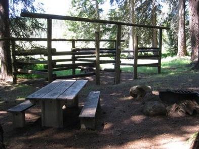
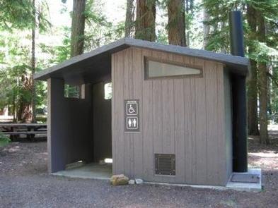
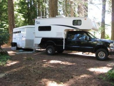
The campground offers single-family equestrian campsites. Most of the sites are equipped with horse corrals, tables and campfire rings with grills. Accessible vault toilets and drinking water are provided. Horse owners are responsible for cleaning up after their horses.

The campsites are intended for equestrians with horses only. Clackamas Lake Campground across the meadow is a good alternative site for those without horses.

Natural Features

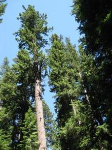
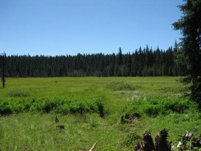
The campground is located in Mt. Hood National Forest at an elevation of about 3,350 feet. It is near Clackamas Lake and larger Timothy Lake. The campground sits among a forest of tall fir trees near a marshy meadow. A variety of wildlife makes its home in the area.

Nearby Attractions

The campground is less than 40 miles from Mt. Hood, where a historic lookout provides scenic views of the snow-capped mountain. Hiking and year-round skiing is available there.

Reservation

More from CampingHiking.net:

STATION CREEK CAMPGROUND, Wyoming Campground Images, Info & Reservations

Directions From Jackson, travel south on Highway 191/89/26 for about 13 miles, to Hoback Junction. Turn right onto Highway 26/89 and continue along the Snake River Canyon for 14 miles. The campground is on the north side of the road. Phone 541-351-1182 Activities BOATING, CAMPING, FISHING, HIKING, WATER SPORTS Keywords

BRIDGEVIEW (RATHBUN LAKE), Iowa Campground Images, Info & Reservations

Directions From Moravia, IA, travel 10 miles west on Highway J18 and follow signs into the campground. Phone FOR CAMPGROUND INQUIRIES DURING MAY-SEPTEMBER PLEASE CALL 641-724-3062. DURING CLOSED SEASON PLEASE CALL 641-647-2464 Activities BIKING, BOATING, CAMPING, FISHING, HIKING, PICNICKING, WILDLIFE VIEWING, DAY USE AREA, INFORMATION SITE, SWIMMING, KAYAKING, CANOEING, WATER

DALE HOLLOW LAKE – PRIMITIVE CAMPING, Tennessee Campground Images, Info & Reservations

Directions Camping locations are dispersed throughout Dale Hollow Lake. Reference primitive camping map or site details for information on how to get to the specific site. Mailing and contact information is for the Resource Manager’s Office. Phone DALE HOLLOW LAKE RESOURCE MANAGERS OFFICE-931-243-3136. SHERIFF’S DEPARTMENT EMERGENCY CONTACTS: CLAY COUNTY 931-243-3266

ROARING RIVER PARK, Tennessee Campground Images, Info & Reservations

Directions From I-40, take HWY 53 north through Gainesboro, TN. Turn east on HWY 135 and follow signs into recreation area. Phone (931) 268-2540 Activities FISHING, PICNICKING, WILDLIFE VIEWING, DAY USE AREA, SWIMMING SITE, PHOTOGRAPHY, SWIMMING, MOTOR BOAT, PADDLE BOATING, KAYAKING, WATER ACCESS Keywords RORN,CORDELL HULL LAKE,ROARING RIVER SHELTER,CORDELL HULL

PAULSON BAY CABIN, Alaska Campground Images, Info & Reservations

Directions To access the cabin by float plane: it is 40 minutes from Anchorage and 60 minutes from Cordova. By boat, the trip is 18 miles from Whittier. Note: the Bay is not obvious because the mouth is partially obscured by five small islands. Beware of submerged rock ledges between

SHARP CREEK, Arizona Campground Images, Info & Reservations

Directions This facility is located 23 miles northeast of Payson, Arizona, approximately 1.5 miles east of Christopher Creek. From Payson, take Highway 260 east for 23 miles. The campground is on the south side of Highway 260. Phone 928-468-7135 Activities CAMPING, FISHING, HIKING, WILDLIFE VIEWING Keywords SHAR,TONTO NF – FS