COTTONWOOD CREEK, CA Campground Reservation, Info, Images, Map, Directions

COTTONWOOD CREEK, California Campground Images, Info & Reservations

Directions

From Truckee, travel north on Highway 80 to Highway 89 approximately 20 miles to the campground. From Sierraville, travel approximately 5 miles south on Hwy 89, the campground will be on the left side of the highway.

Phone

530-994-3401

Activities

BIKING, CAMPING, HIKING, HUNTING, WILDLIFE VIEWING

Keywords

COTC,TAHOE NF – FS

Related Link(s)

Rec Area Info & Images

California State Road Conditions

California State Tourism

Overview

Cottonwood Creek Campground is located on Highway 89, four miles south of Sierraville. Its location makes it a great base camp for a variety of recreational activities, including fishing, hunting, hiking and biking. This facility is operated and maintained by the Tahoe National Forest.

Recreation

Cottonwood Creek Botanical Trail and Overlook Trail are both short, foot trails that begin in the campground. The surrounding area offers additional trails and fishing opportunities.

Facilities

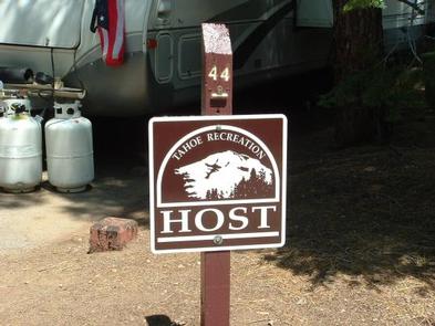
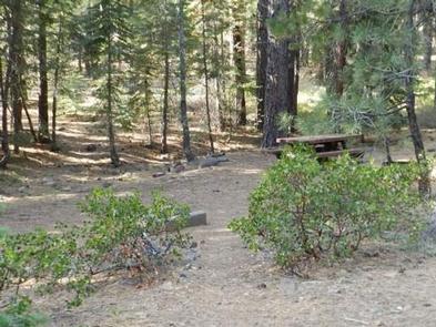
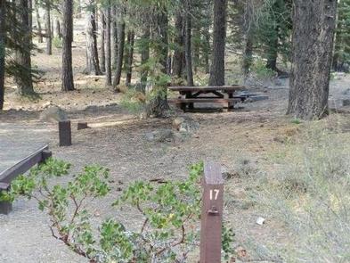
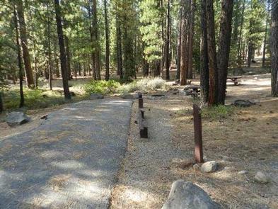
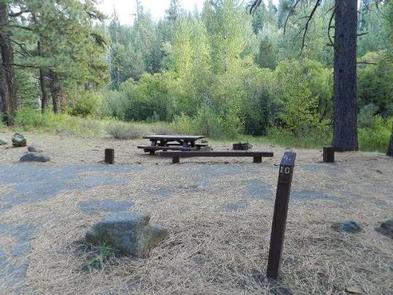
The campground offers several single-family campsites, each equipped with a picnic table and campfire ring. Vault toilets, drinking water and trash collection are provided.

Natural Features

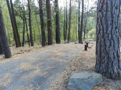
The campground sits along Cottonwood Creek, in a stand of Jeffrey pine, and red and white fir trees. The forest provides shade and privacy between sites, but noise from the highway can be heard within the campground.

Nearby Attractions

Lake Tahoe is located about 40 minutes from the campground. Scenic Tahoe offers excellent boating, kayaking, fishing, hiking and scenic driving opportunities.

Sardine Lakes, within the beautiful Lakes Basin, is a 35-minute drive northwest of the campground, via the Golden Chain/Highway 49. Stampede Reservoir is a 45-minute drive southeast.

Reservation

More from CampingHiking.net:

GREEN RIVER CAMPGROUND, Utah Campground Images, Info & Reservations

Directions Green River Campground is located approximately 12 miles north of US Highway 40. Take Utah State Route 149 from Jensen, Utah. Phone 435-781-7700 Activities BIKING, CAMPING, INTERPRETIVE PROGRAMS, FISHING, HIKING, WILDLIFE VIEWING, EVENING PROGRAMS Keywords GREEN RIVER CAMPGROUND,GREEN RIVER,DNM Related Link(s) Rec Area Info & Images Utah State Tourism

PLOTNIKOF LAKE CABIN, Alaska Campground Images, Info & Reservations

Directions Accessible early June through October. This cabin is located 45 miles southeast of Sitka, 4 miles east of Whale Bay, on the south-central part of Baranof Island. Access by floatplane is 40 minutes from Sitka. For geographic features surrounding the cabin, refer to USGS topographic map Port Alexander C-3.

MERRISACH LAKE, Arkansas Campground Images, Info & Reservations

Directions From DeWitt, Arkansas, take US-165 south for 8.1 miles to State Route 44. Turn east for 5.3 miles and continue south onto Tichnor Blacktop Rd. After 10 miles, turn right onto Merrisach Lake Lane and continue into the park. Phone 870-548-2291 Activities BOATING, CAMPING, FISHING, HUNTING, WILDLIFE VIEWING, BIRDING

Dundo Group Campground, Virginia Campground Images, Info & Reservations

Directions From Washington, D.C., metro area, travel west on Interstate 66 to exit 43A. Take US Highway 29 south approximately 55 miles to Ruckersville, Virginia, then take US Highway 33 west to Shenandoah National Park and Skyline Drive Swift Run Entrance. Follow Skyline Drive south approximately 18 miles and turn