UPPER LITTLE TRUCKEE, CA Campground Reservation, Info, Images, Map, Directions

UPPER LITTLE TRUCKEE, California Campground Images, Info & Reservations

Directions

From either east bound or west bound Interstate 80 in Truckee take exit 188, Highway 89 north to Sierraville. In aproximately 12 miles turn left into the campground.

Phone

(530) 994-3401

Activities

BIKING, CAMPING, FISHING, HIKING, HUNTING, WATER ACCESS, SCENIC DRIVE

Keywords

UPLI,TAHOE NF – FS

Related Link(s)

Rec Area Info & Images

California State Tourism

California State Road Conditions

Overview

Upper Little Truckee Campground is located on Highway 89, about 12 miles north of Truckee. Its location makes it a great base camp for a variety of recreational activities, including fishing, hunting, hiking and biking.

Recreation

Fishing for rainbow and brown trout in the Little Truckee River is a popular activity enjoyed by visitors to the area. The surrounding area offers hiking and biking trails.

Facilities

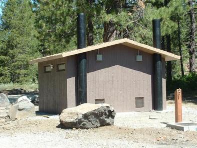
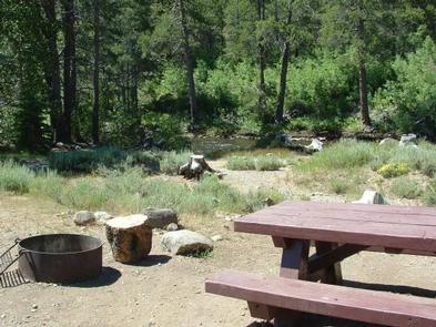
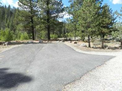
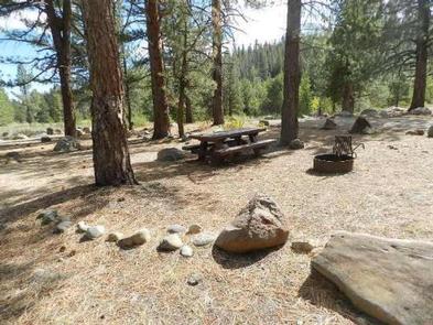
The campground offers single-family campsites, each equipped with a picnic table and campfire ring. Vault toilets and drinking water are provided.

Natural Features

The campground is situated on the banks of the Little Truckee River, at an elevation of 6,200 feet. A forest of lodgepole pine, aspen and juniper trees covers the area, offering partial shade. A few sites overlook the river.

Nearby Attractions

The town of Truckee, 10 minutes south, offers all the amenities of a year-round recreational mountain town including top notch restaraunts, resorts, hotels, grocery stores, gas stations, shopping, and historic sites. Lake Tahoe is located an additional 30 minutes south and offers excellent boating, kayaking, fishing, hiking and scenic driving opportunities as well as dining, shopping and lodging options. Stampede Reservoir and recreation area is a 35-minute drive southeast of the campground. Sardine Lakes, within beautiful Lakes Basin, is a 40-minute drive northwest, via the Golden Chain/Highway 49. Other recreational opportunities include Donner Camp Interpretive Trail, Donner Memorial State Park, Overland Emigrant Commemorative Trial, and numerous hiking, mountain biking, and OHV trails.

Reservation

More from CampingHiking.net:

FAWN LAKES CAMPGROUND, New Mexico Campground Images, Info & Reservations

Directions From Red River, drive approximately 3 miles west on NM-38. Phone 435-245-6521 Activities CAMPING, FISHING, HIKING, HOTEL/LODGE/RESORT PRIVATELY OWNED Keywords CARSON NF- FS,Carson National Forest Related Link(s) Rec Area Info & Images Forest Service Concessionaire New Mexico State Road Conditions New Mexico State Tourism Overview Fawn Lakes Campground is

HARDIN RIDGE, Indiana Campground Images, Info & Reservations

Directions From Bedford, go 7 miles east on US 50. Go north on SR 446 for 12 miles and turn west on Chapel Hill Road and travel 2 miles to the Hardin Ridge Recreation Area. From Bloomington, 46 and 446 intersection, go 14 miles south on SR 446. Turn west

LUCERNE CAMPGROUND, Utah Campground Images, Info & Reservations

Directions From Manila, Utah: Follow Highway 43 for 2.6 miles to the state line, where Highway 43 becomes Wyoming Highway 530. Follow Wyoming 530 for 1.3 miles to Lucerne Valley Road/Forest Road 146. Continue on this road approximately 4 miles to the campground. Phone 801-226-3564 Activities BOATING, CAMPING, FISHING, WATER

ROCKY BRANCH CAMPGROUND, Arkansas Campground Images, Info & Reservations

Directions From Rogers, Arkansas, take Highway 12 east for just under 10 miles. Turn left onto Highway 303 and travel 3.5 miles. Turn left onto Park Road and follow it to the campground. Phone (479) 925-2526 Activities CAMPING, FISHING, HIKING, HUNTING, VISITOR CENTER, WILDLIFE VIEWING Keywords None Related Link(s) Rec

CRANES MILL PARK, Texas Campground Images, Info & Reservations

Directions From IH 35 take Exit 191 north of New Braunfels, Texas. FM 306 is exit 191. Drive west on FM 306 for about 14 miles. Turn left on FM 2673 at the red light just after the first Guadalupe River crossing. Cranes Mill Park is located at the westernmost

WAX, Kentucky Campground Images, Info & Reservations

Directions From Louisville, take I-65 south to exit 76 and turn west onto Highway 224. After 9 miles turn left on Highway 479, then continue for another 8 miles and turn left onto Highway 88. Continue into the campground entrance. Phone 270-242-7578 Activities BOATING, CAMPING, FISHING, HIKING Keywords WAXX,NOLIN LAKE,NOLIN