LOWER FIR GROUP AREA, NM Campground Reservation, Info, Images, Map, Directions

LOWER FIR GROUP AREA, New Mexico Campground Images, Info & Reservations

Listen

Directions

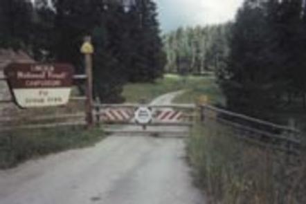
From Alamogordo take US 82 east, go 17 miles, just past Cloudcroft. Turn left (northwest) onto NM 244. Go approximately 1 mile. Turn right onto Forest Road 422. Go approximately 1/4 mile. Campground is on the left.

Phone

575-682-7570

Activities

CAMPING

Keywords

FIRL,LINCOLN NF – FS

Related Link(s)

Rec Area Info & Images

New Mexico State Tourism

Forest Service Concessionaire

New Mexico State Road Conditions

Overview

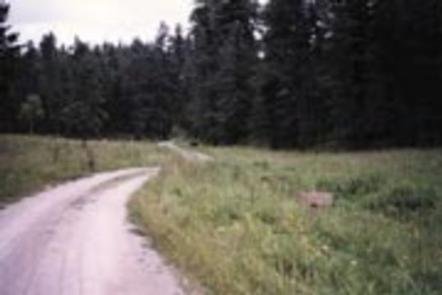
Lower Fir Group Area is a high-energy and highly popular group campground in the Sacramento Mountain area. The site is set away from public roads, so that outside noise is non-existent, leaving only the sweet sounds of rustling aspen leaves.

The campground sits within the Lincoln National Forest, which spans 1.1 million acres of undisturbed landscape. Spend your days exploring the mountain trails, or head west for a day trip to White Sands National Monument, the world’s largest dune field of pure, white gypsum sand. Bring your camera and binoculars for the chance to observe wild elk, deer, birds, and even an occasional black bear.

Recreation

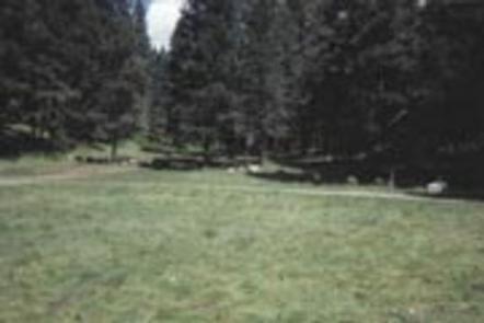
An open meadow, ideal for activities like volleyball or horseshoes, is adjacent to the campground. The Rim Trail is a short hike or drive away, offering epic views, rocky inclines, and switchbacks for adventurous mountain bikers, hikers, and horse-back riders. A few miles south, the same trail opens up to motorcyclists as well.
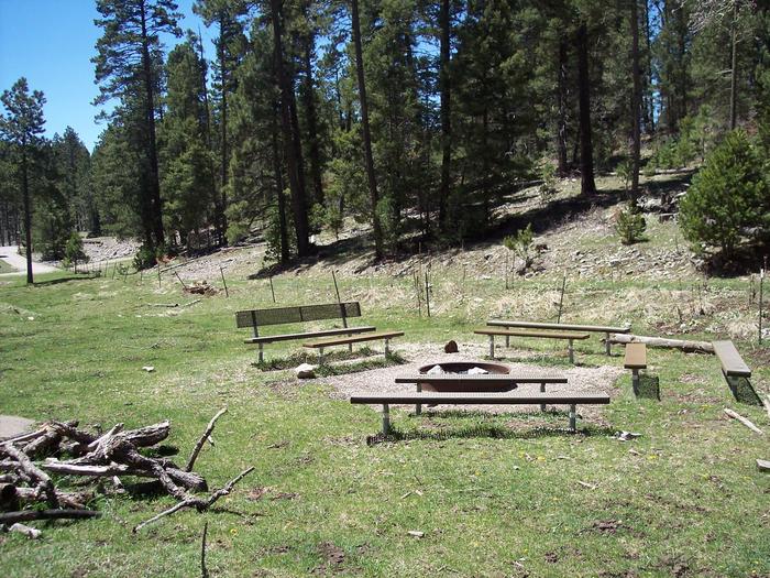
Facilities

This is one of the only group sites with water access. Lower Fir comfortably fits groups as large as 70, and it’s connected to Upper Fir Group, and even larger facility accommodating up to 120 visitors.

Natural Features

Lower Fir Group sits at a high elevation of 9,000 ft., providing visitors with dramatic views of the Tularosa Basin and lush mountain meadows surrounded by pine, fir, aspen and oak trees.

Nearby Attractions

The campground is a mile from the village of Cloudcroft, a quaint mountain town with New Mexico’s only standing railroad trestle. Trails for ATVs are near the area, too.

Reservation

More from CampingHiking.net:

LODGEPOLE (Taylor River), Colorado Campground Images, Info & Reservations

Listen Directions From Gunnison, Colo., travel north on Highway 135 for 10 miles to Almont. Turn right (northeast) onto Taylor Canyon Road and proceed 12 miles to the campground entrance, which is on the right. Phone 970-642-0566 Activities BIKING, BOATING, CAMPING, FISHING, HIKING, HORSEBACK RIDING Keywords LODG,LODGEPOLE Gunnison Grand Mesa,GUNNISON,GM,UNCOMP

FISH LAKE CAMPGROUND, California Campground Images, Info & Reservations

Listen Directions From Orleans, California, take State Route 96 south for about 8 miles. Turn north on Bluff Creek Road and continue about 4.7 miles to Forest Road. Turn right and continue almost 3 miles to the campground. Phone 530-627-3291 Activities BIKING, CAMPING, FISHING, HIKING, WILDLIFE VIEWING, SWIMMING SITE Keywords

VETERANS LAKE PAVILION, Oklahoma Campground Images, Info & Reservations

Listen Directions From I-35, take Exit #55 or #51 and drive towards the city of Davis, OK. Once in Davis, go east towards Sulphur on Highway 7 Watch for the Chickasaw National Recreation Area signs to direct you to your selected area: Campgrounds, Boat Ramps, Pavilion, and Picnic Area.- Drive

PRAIRIE CREEK (AL), Alabama Campground Images, Info & Reservations

Listen Directions From Montgomery, Alabama, follow Highway 80 west for approximately 25 miles. Turn right on County Road 29 and follow the signs into the campground. Phone 334-418-4919 Activities BIKING, BOATING, CAMPING, FISHING, HIKING, WATER SPORTS, WILDLIFE VIEWING, SWIMMING SITE Keywords PRA1,JONES BLUFF,ALABAMA RIVERS,WOODRUFF,ROBERT F. HENRY,ROBERT F HENRY,ALABAMA RIV. –

BALD MOUNTAIN CAMPGROUND, Wyoming Campground Images, Info & Reservations

Listen Directions From Lovell, Wyoming, take U.S. Highway 14A (not U.S. Highway 14) 33 miles east. The highway has a 10% grade; not recomended for RVs and motorhomes. From Dayton, Wyoming, take U.S. Highway 14/14A west 73 miles via Burgess Junction. This is the recommended route for RVs and motorhomes.