
Directions
Approximately 15 air miles and 25 water miles from Ketchikan on the south shore of Phocena Bay on the west side of Gravina Island. Accessible by floatplane or by boat. A mooring buoy is located in Phocena Bay. Refer to USGS Ketchikan A-6. Please consult local tide tables before departing for the cabin.
Phone
907-225-2148
Activities
BOATING, CAMPING, FISHING, HIKING, WILDLIFE VIEWING
Keywords
PHAY,TONGASS NF – FS
Related Link(s)
Overview
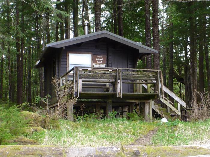
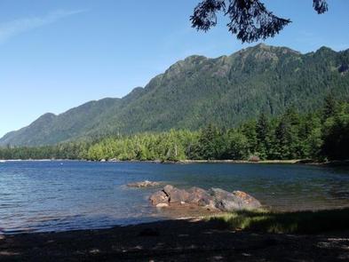
Phocena Bay Cabin sits on the south shore of Phocena Bay on the west side of Gravina Island approximately 15 miles from Ketchikan. The cabin was constructed in 1973 and moved to its current site in 1985. The cabin is available year-round and makes an excellent base for experiencing this corner of Alaska with its recreation options, beautiful scenery and abundant wildlife.
The cabin is remote and accessible only by float plane or boat, depending on conditions. This primitive cabin has no electricity, indoor plumbing or cell phone coverage. Visitors are responsible for their own travel arrangements and safety, and must bring several of their own amenities.
Recreation
The area lends itself to easy hiking to explore nearby tide pools and the surrounding forest. Exploring can also be done via kayak or boat, but local tide tables first, since there is almost no water in front of the cabin at low tide.
Saltwater fishing is possible for ling cod, red snapper, halibut and salmon outside the bay. For information about fishing permits and seasons, visit the Alaska Department of Fish and Game website.
Facilities
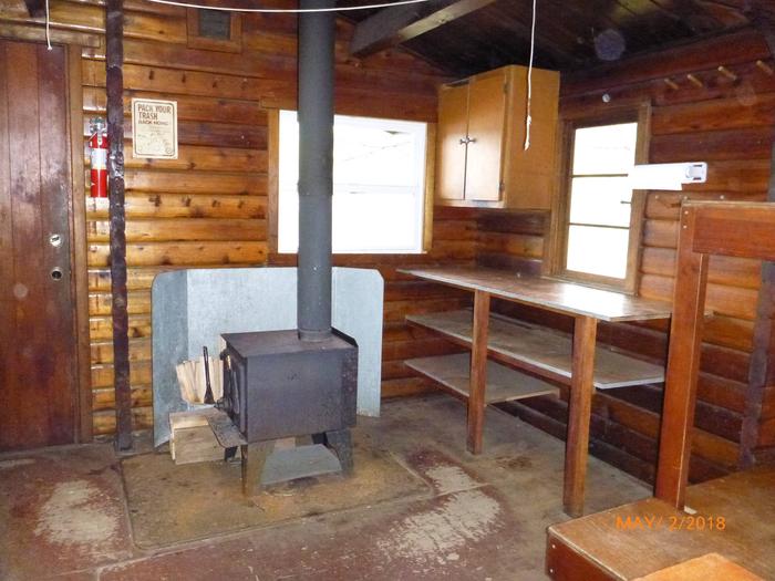
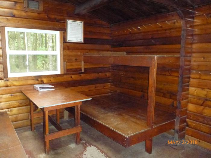
The 12×14-ft. ( pan-abode style ) log cabin accommodates 6 people with 2 single and 2 double bunks. Other amenities include a table and benches, a cooking counter, food storage, broom, splitting maul, and an outhouse. A wood stove is provided for heat. NOTE: Firewood may be available, but visitors are encouraged to contact the Ketchikan Misty Fjords Ranger District to check the status of the woodshed. A mooring buoy is located in the bay near the cabin on a first-come, first-served basis. More than one vessel is allowed if the first party there agrees. Drinking water is not available at the cabin. Visitors must bring their own water supply, but water is also available from a roof water collection system and should be treated before drinking or consuming it ( water safety ). Visitors should also bring sleeping bags, sleeping pads, cooking gear, lanterns or flashlights, food, toilet paper, garbage bags, a fire extinguisher and fire starter. Rain gear and boots are recommended. Visitors are expected to pack out their trash, gear and food and clean the cabin before leaving (additional cabin details).
Natural Features
The cabin is tucked into a sheltered cove on fairly flat terrain, and is backed by rainforest. A large tide flat appears in front of the cabin at low tide. The cabin deck offers a spectacular view of Chapin Peak and the Puppet Mountains.
Gravina Island supports populations of Sitka black-tailed deer, wolves, marten, mink, beaver and black bear (bear safety information). Bald eagles nest in the area, and there have been sightings of Queen Charlotte goshawks around Phocena Bay. Visitors may have opportunities to see humpback and killer whales in Clarence Strait.