
Directions
The cabin is 90 miles southwest of Cordova in San Juan Bay on the southwest end of Montague Island. Access to the cabin is by wheel plane at low tide only (60 minutes from Cordova, 40 minutes from Seward). Click here for local tide tables.
Phone
1 (907) 424-7661
Activities
CAMPING, FISHING, HIKING, HUNTING, WILDLIFE VIEWING
Keywords
JUAN,CHUGACH NF – FS
Related Link(s)
Overview
San Juan Bay Cabin offers recreation, relaxation and a unique lodging experience on Montague Island in the Chugach National Forest in southcentral Alaska. The remote site offers a scenic setting for fishing, wildlife viewing, hunting and beachcombing. Access to the cabin is by wheel plane at low tide from Cordova or Seward. Visitors are responsible for their own travel arrangements and safety, and must bring several of their own amenities.
Recreation
The cabin is about a mile south of San Juan Creek, so it’s a bit of a hike to get to the fishing, but the creek has good runs of coho and pink salmon and Dolly Varden from mid-July through mid-August.
Hunters can take advantage of a long hunting season on the island and in the surrounding national forest. Bear season occurs during spring and fall, while deer season begins in late summer and lasts through late fall.
The sandy landing beach, located 1/2-mile from the cabin, is a good place for beachcombers to search for glass Japanese fishing floats and other sea-borne treasures.
Facilities
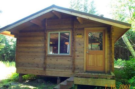
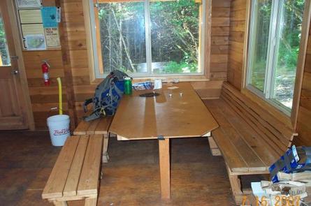
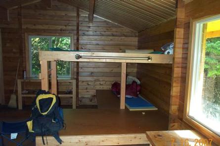
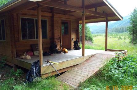
The 14×16-ft rustic cabin can sleep up to six people and is furnished with wooden bunkbeds without mattresses. The cabin is equipped with a table, wood stove, oil stove, a rainwater catchment barrel, axe, saw, splitting maul and an outdoor pit toilet. The site is also equipped with an accessible ramp.
The cabin does not have running water or electricity. Visitors must bring their own water, food, #1 stove oil, sleeping bags, sleeping pads, cook stoves, matches, cut firewood, cooking gear/utensils, lantern or flashlight, toilet paper, first aid kit and garbage bags. Click here for more cabin details.
Visitors should be aware that some of the land on Montague Island is owned by the Chugach Alaska Corporation, and access to these lands requires permission from the corporation. The area was extensively roaded and logged by the corporation from 1994 to 1998. Contact the Cordova Ranger District at 907-424-7661 for a detailed map of land ownership in this area.
Natural Features
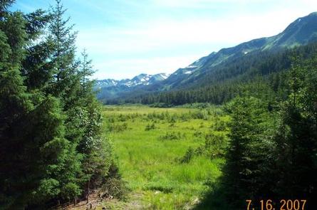
Montague Island lies in the Gulf of Alaska at the entrance to Prince William Sound. The cabin is located at the edge of a large grassy clearing near a dense spruce forest. Low forested hills rise from the surrounding area and muskeg openings dot the landscape.
This part of Montague Island uplifted about 35 feet as a result of a 1964 earthquake in the area. When the area lifted, the bay drained, and is now a meadow with the creek running through it. A new-growth Sitka spruce forest is now growing in this area.
Wildlife near the cabin abounds, including migratory waterfowl, Sitka black-tail deer and brown bear.